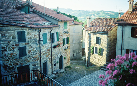
Prati di Mugnano - Badolo
Escursione circolare che parte dai Prati di Mugnano poco fuori Bologna.
Itinerario
Si lascia il parcheggio e si prende il sentiero Cai (Via degli Dei) poi si segue il Cai 122 che esce dal Parco verso Sx. Si segue una strada bianca (strada vicinale della Torricella). Alla strada asfaltata prendere a Dx e dopo poche decine di m prendere lo sterrato a Sx. Prendere poi il secondo sentiero a Dx (seguire segnavia Cai) ; il sentiero diventa di terra e dopo aver attraversato un campo entra nel bosco.
Al primo incrocio prendere a Dx e quindi si scende verso Badolo; prima un tratto in cresta poi una ripida discesa con alcuni passaggi su roccette e gradoni. Sull'asfalto prendere a Sx e alla chiesa di Badolo prendere il sentiero a Dx (Cai 110). Si scende per un sentiero nel bosco che costeggia Rio Raibano. Sull'asfalto a Dx e dopo pochi metri si prende un ripido sentiero a Dx (Cai 110). Si risale ai Prati di Mugnano, qui si svolta a Sx si passa per la Commenda e poi si fa il giro largo per ritornare al parcheggio.
https://www.trackguru.net/images/icone/hiking32.png
Da Porretta a Madognana passando da Varano
 Dal centro di Porretta Terme (Piazza della Liberta') si percorre Via Matteotti sino all'antico stabilimento termale, qui un piccolo tornante immette nell'angusta Via della Pace; la si percorre sino ad un successivo tornante nei pressi della piscina comunale.
Qui si prosegue in salita lungo il sentiero CAI 101 sino alla Borgata Varano e successivamente sino al bivio con il sentiero CAI 131 nei pressi di un rudere. Tenendo la sinistra successivamente si raggiunge un bivio nel bosco con il CAI 103. Questo, leggermente in discesa, attraversa gli abitati de La Serra e Il Poggio.
Da qui, accanto alla pieve, una cavedagna porta a Madognana e successivamente in discesa fino al nucleo storico di Porretta Terme (Via del Falcone).
La carta di cui parla l'articolo:
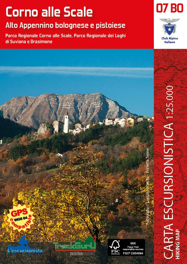 |
Alto Appennino bolognese e pistoiese
Parco Regionale Corno alle Scale, Parco Regionale dei Laghi di Suviana e Brasimone
Dal Corno alle Scale al Lago di Suviana
Porretta Terme, Lizzano in Belvedere, Granaglione, Castel di Casio
|
https://www.trackguru.net/images/icone/hiking32.png
Mulattiera di Granaglione
La mulattiera di Granaglione collega Porretta Terme a Pracchia, frazione di Pistoia, attraverso il territorio del comune di Granaglione toccandone gran parte delle borgate.
Anticamente fu, quasi certamente, calpestata dai Liguri, dagli Etruschi, dai Romani e dalle truppe di Napoleone.
https://www.trackguru.net/images/icone/hiking32.png
Da Pianaccio a Monte Grande
Da Pianaccio, nei pressi della Locanda Alpina, si incontrano le indicazioni per il sentiero CAI 115. Dopo 500 m si abbandona l'asfalto e si prosegue su un largo sentiero.
Superato a guado il fosso dei Bagnadori ci si addentra in un antico castagneto sino a raggiungere la Sboccata dei Bagnadori e in poche decine di metri si giunge al rifugio dei Bagnadori (m 1276). Proseguendo lungo la carrabile (sentiero CAI 125) si raggiunge la vetta del Monte Grande (m 1531) punto panoramico di questo itinerario.
Lasciata la vetta il sentiero CAI 125 scende in direzione nord-est sino al Passo di Bocca delle Tese (m 1172), qui sulla destra si prende il sentiero CAI 151 direzione Fiammineda.
Lasciato quest'ultimo abitato si prosegue per Pianaccio.
La carta di cui parla l'articolo:
| |
Alto Appennino bolognese e pistoiese
Parco Regionale Corno alle Scale, Parco Regionale dei Laghi di Suviana e Brasimone
Dal Corno alle Scale al Lago di Suviana
Porretta Terme, Lizzano in Belvedere, Granaglione, Castel di Casio
|
https://www.trackguru.net/images/icone/hiking32.png
Passo Osteria Bruciata - Monte Gazzaro
A poche centinaia di metri dal Passo della Futa, sulla strada che scende verso Firenzuola, si lascia la macchina in corrispondenza di un piccolo spiazzo.
Qui si prende a piedi il sentiero CAI 00 e lo si mantiene ignorando alcuni incroci con altri percorsi sino alla cima di Monte Gazzaro (m 1118).
Proseguendo si arriva al Passo dell'Osteria Bruciata (m 917), qui si prende il sentiero CAI 50 direzione Castellana, si passa un rudere nei pressi di un corso d'acqua e si incrocia un sentiero che risale verso il Monte Gazzaro e, recuperando quota, ci permette di raggiungere il sentiero CAI 00 che ci riporta al punto di partenza.
https://www.trackguru.net/images/icone/hiking32.png
Madonna dell'Acero - Lago di Pratignano
Dal Santuario di Madonna dell'Acero (fonte) si prende il sentiero CAI 331A in direzione Ovest sino all'alveo del torrente Dardagna. Lo si discende mantenendo la destra orografica (CAI 333) sino al nucleo strorico di Poggiolforato.
Qui addentrandosi tra le tipiche abitazioni in pietra si attraversa il torrente e si prende un sentiero (non piu' segnato) che in salita porta sino al Lago di Pratignano.
Questo tratto ha dei punti particolarmente scivolosi ed esposti, prestare quindi massima attenzione e si consiglia di percorrerlo solo con il bel tempo.
Dal Lago di Pratignano (m 1307), sul filo del crinale (CAI 401) si raggiunge il Passo dei Ronchi (m 1343) a seguire Le Piagge (m 1478) e infine il Passo della Riva (m 1454). Qui si tiene la sinistra (CAI 337) e si scende sino al torrente.
Il sentiero ora costeggia tutte e quattro le meravigliose Cascate del Dardagna (CAI 333), al successivo bivio tenere la destra (CAI 331) sino al punto di partenza dell'escursione.
https://www.trackguru.net/images/icone/hiking32.png
Anello di Chiapporato - Da Fossato via Monte delle Scalette
Dall'abitato di Fossato (2,5 Km a sud dal Bacino di Suviana) si prende il sentiero CAI 21A in direzione SE in salita sino al Poggio Cattarelle (m 1009). Da qui si prosegue sul crinale (sentiero CAI 00 - GEA) in direzione Nord, si passa un ricovero tra il Poggio la Zucca e quello della Croce, incrocia al termine di una discesa un'asfaltata, la si attraversa e si mantiene il sentiero fino al Monte delle Scalette (m 1185).
Da qui si scende alla Pianaccia e in discesa tra un secolare castagneto si giunge al suggestivo borgo di Chiapporato.
Da qui, mantenendo sempre il sentiero CAI 21A in direzione SW si rientra a Fossato.
Potrebbe interessarti anche: Anello Emiliano di Chiapporato
{imageshow sl=62 sc=6 /}
https://www.trackguru.net/images/icone/hiking32.png
Anello di Santa Cristina
Accanto alla chiesetta di Camaggiore si prende la pista sulla sinistra e prima del ponte una bella mulattiera a destra. Passato Canovetta ci si immette su un crinalino che porta su un pianoro e a seguire fino alla chiesetta di Santa Cristina. Qui si passa attraverso tutto il grande castagneto fino ad attraversare ad una rotabile, si prosegue, per un breve tratto paralleli a questa e successivamente per un tratto fangoso si arriva sull'orlo del Botro di Vincarolo.
Proseguendo per la traccia si sbuca sotto la chiesa di San Michele dei Monti e successivamente in discesa fino a la Rimessa sulla statale.
Si prende la prima stradina che sale a destra , si passa un secolare castagneto fino a una pista che, a mezzacosta, sbuca a Camaggiore.
https://www.trackguru.net/images/icone/hiking32.png
S. Andrea - Castiglioncello
Dal parcheggio della chiesetta di Sant'Andrea si prosegue oltre, in falsopiano, fino alle Case Fanti e sempre sulla stessa altimetrica si arriva in prossimita' del borgo abbandonato di Castiglioncello.
Qui una breve ma scivolosa variante porta all'abitato.
Si torna indietro e si risale il ripido costolone arenaceo, esposto nel primo tratto, sino nei pressi di Casetto della Razza e proseguendo per l'evidente pista si arriva alla casa di Lama dei Ronchi. Si attraversa la zona erbosa circostante fino ad imboccare una pista che successivamente costeggia il margine meridionale di un ombroso castagneto.
Si passa la piccola borgata di Poggio S. Andrea da dove una carrareccia ghiaiata scende poco a valle della chiesetta (punto di partenza).
https://www.trackguru.net/images/icone/hiking32.png
Livergnano - Anello di Monte Rosso
Nel cuore del Contrafforte Pliocenico
Questo itinerario ci farà riscoprire alcuni degli aspetti più interessanti del Contrafforte Pliocenico.
Si parte da Livergnano, nel comune di Pianoro, percorrendo con un po' di attenzione un tratto della Statale della Futa fino ad imboccare la stradina che porta a Sadurano, lungo il sentiero CAI 809 T5V (Traversata 5 Valli). L'anello è lungo circa 8 km e occorrono 3-4 ore per ritornare a Livergnano.
Poco prima della località Ca' Rossa, si abbandona il sentiero 809, che scende a destra, e si prosegue sull'809a per rientrare a Livergnano, percorrendo l'813a e poi 813.
La particolarità di questo trekking è che attraversa le formazioni rocciose del Contrafforte Pliocenico, passando dall'area di Sadurano particolarmente ricca dal punto di vista ambientale e naturalistico.
Al rientro a Livergnano, o prima di partire, merita una visita il piccolo museo "Winter Line" dove sono conservati oggetti bellici della Seconda Guerra Mondiale.
Altra particolarità di Livergnano sono le numerose case scavate nelle rocce del Contrafforte.
A cura di Stefano Lorenzi
Tratto da Valli Bolognesi, Appennino Slow, Estate 2011
La carta dei luoghi di cui parla l'articolo:
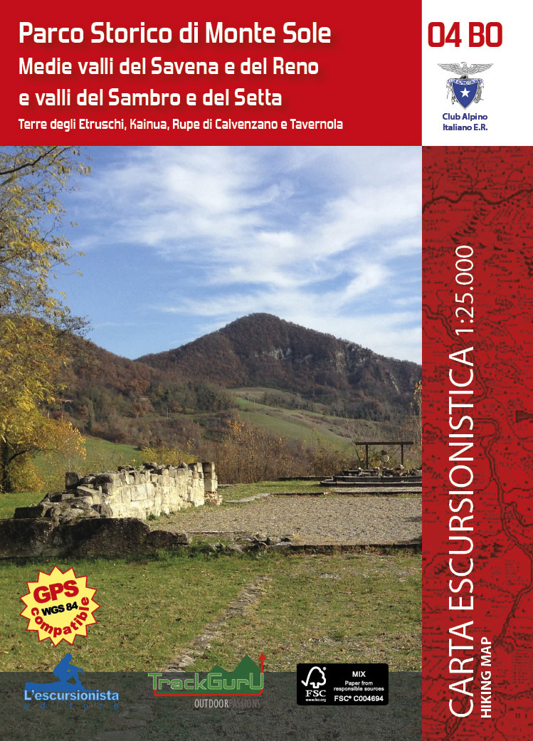 |
Medie valli del Savena e del Reno e valli del Sambro e Setta
Terre degli Etruschi, Kainua, Rupe di Calvenzano e Tavernola
|
https://www.trackguru.net/images/icone/hiking32.png
La Via del Reno - tappa 1 da Casalecchio a Sasso Marconi
Dall'ingresso del Parco della Chiusa a Casalecchio (piu' noto come Parco Talon) si procede per il viale alberato e ai successivi due bivi si tiene la destra costeggiando il fiume Reno (CAI 112A).
Questo tratto potrebbe risultare particolarmente fangoso dopo una piovviginata.
Nei pressi di una zona calanchifera termina il sentiero e ci si immette in una asfaltata che porta sulla provinciale, si tiene la destra e dopo una ripida salita si arriva ai Prati di Mugnano. Il sentiero (122) scende verso la vallata del Reno e sbuca nell'asfaltata nei pressi dei piloni in cemento dell'autostrada. Si attraversa il ponte e sulla sinistra si trova la stazione FS di Sasso Marconi.
https://www.trackguru.net/images/icone/hiking32.png
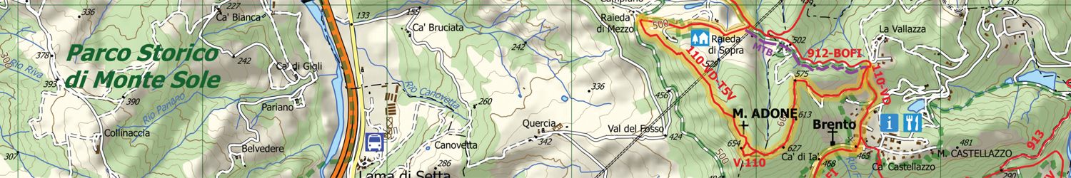
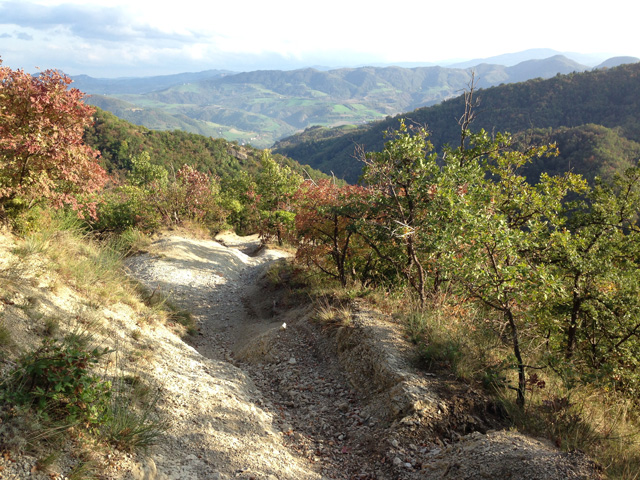
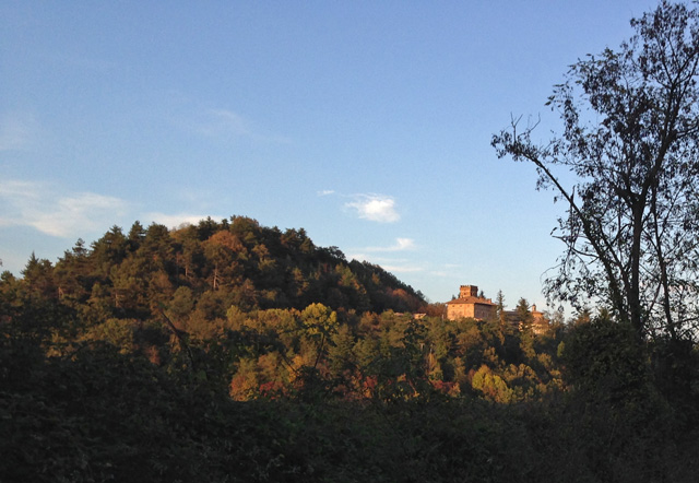
Anello di Monte Adone
Sei chilometri ad anello attorno a Brento, tra torrioni naturali, resti della Linea Gotica e animali esotici. Attenzione ai balzi.
Alla scoperta di Monte Adone
Dall'abitato di Brento, si prende per via Vallazza (sentiero CAI 110) e dopo circa 200 metri si trova sulla sinistra l’inizio del sentiero. Fatti pochi passi ci si trova in mezzo ad un “mare solidificato”, con tanto di conchiglie fossili: molluschi marini e ostriche che testimoniano come il Contrafforte Pliocenico, qualche milione di anni fa, fosse coperto dal mare. La salita non è difficile, e in poco si arriva al pianoro dove si trovano, ricordati in una bacheca, i segni della Linea Gotica.
Il panorama è molto bello, si vede una gran fetta del territorio bolognese. La particolarità del luogo sta nei numerosi tipi di piante presenti lungo l’itinerario: roverella, ginestre, ginepro, orniello e tanti altri ancora. Qui, stranamente, cresce bene il leccio, tipica pianta della macchia mediterranea, ad indicare l’unicità di questo luogo. Da lì, proseguendo con un piccolo strappo, si arriva alla cima di Monte Adone (654m slm).
Il panorama è veramente splendido e non sembra nemmeno di essere a pochi chilometri da Bologna. Non ci sono particolari pericoli, ma consigliamo di non sporgervi troppo e soprattutto di tenere controllati i bambini.
Abbandonata la croce presente sulla cima, proseguendo lungo il sentiero, si arriva ad una delle altre particolarità di Monte Adone: le torri. Si tratta di due maestosi torrioni lavorati dagli agenti atmosferici che sembrano a guardia di questo luogo. Da qui inizia la lunga discesa, in alcuni tratti anche impegnativa.
La fine del sentiero è nei pressi di un grande traliccio.
Una volta arrivati sulla strada si hanno due possibilità, o prendere la prima stradella a destra in leggera salita, più corta e che passa in località Piccola Raieda, o proseguire tra le case e, al termine della discesa, risalire a destra. Giunti sulla strada più ampia (CAI 110a) si prosegue a destra. Questa seconda ipotesi è un po’ più lunga, ma passa davanti al Centro Tutela e Ricerca Fauna Esotica e Selvatica dove trovano ricovero animali feriti o abbandonati, in prevalenza di provenienza esotica (leoni, tigri, scimmie ecc). Da qui, con circa 15 minuti di cammino, si chiude l’anello e si ritorna a Brento.
Il percorso è lungo circa 6 km con circa 190 metri di dislivello. Vi consigliamo una sosta alla Vecchia Trattoria Monte Adone dove è possibile pranzare gustando ottimi primi piatti con pasta fatta in casa.
A cura di Stefano Lorenzi
Tratto da Valli Bolognesi, Inverno 2012
La carta dei luoghi di cui parla l'articolo:
| |
Medie valli del Savena e del Reno e valli del Sambro e Setta
Terre degli Etruschi, Kainua, Rupe di Calvenzano e Tavernola
|
https://www.trackguru.net/images/icone/hiking32.png
Monte La Fine
https://www.trackguru.net/images/icone/hiking32.png
Da Porretta a Gaggio Montano
Dal centro di Porretta Terme (PIazza della Libertà), tramite la Rampata Chiesa si raggiunge la Parrocchia di Santa Maria Maddalena, accanto a questa una stradina asfaltata in salita ci conduce in Via Marconi e da questa in Via Repubblica. La percorriamo fino al termine e da qui prendiamo una ghiaiata per Pellizzano (CAI 157).
Poco prima di questo abitato, abbandoniamo la strada e prendiamo il sentiero a sx, attraversiamo gli agglomerati di Cà di Zama e Cà di Leone e raggiungiamo la dx orografica del torrente Silla. Lo guadiamo nei pressi di una briglia, risaliamo il pendio per qualche decina di metri e al bivio con il sentiero CAI 179 teniamo la dx (CAI 157) fino alla provinciale; la seguiamo in discesa per circa 500 metri, attraversiamo il borghetto di Cà dei Franchi e saliamo da una ripida asfaltata tra campi coltivati.Attraversiamo la Provinciale e tenendo la destra e in breve raggiungeremo il centro di Gaggio Montano.
La carta di cui parla l'articolo:
| |
Alto Appennino bolognese e pistoiese
Parco Regionale Corno alle Scale, Parco Regionale dei Laghi di Suviana e Brasimone
Dal Corno alle Scale al Lago di Suviana
Porretta Terme, Lizzano in Belvedere, Granaglione, Castel di Casio
|
https://www.trackguru.net/images/icone/hiking32.png
Tra il Brasimone e il Monte Gatta
Partendo da Castiglione dei Pepoli in direzione Lago del Brasimone, subito usciti dal paese trovare sulla sinistra un piccolo parcheggio, lì si può lasciare l’auto e partire per il nostro itinerario trekking. Prendiamo il sentiero CAI 001 in direzione Brasimone.
Il sentiero sale dolcemente in mezzo ai castagni e rimane quasi parallelo alla provinciale 62 che conduce al Brasimone. Giunti il località Scaliera il sentiero
ci dà la possibilità di scendere al lago con un deviazione di circa 300 metri.
Possiamo fermarci tranquillamente sulle sponde del lago costruito nel con lo sbarramento del torrente Brasimone. Qui troviamo alcuni locali pubblici dove gustare un buon caffè. Ritorniamo indietro e ripercorriamo a ritroso in salita fino a incontrare di nuovo il 001 e prendiamo a destra. Da questo punto il nostro itinerario prosegue abbastanza in piano, costeggiando da poca distanza il lago. Poco dopo però si torna a salire, direzione Pian Colore per poi incontrare il sentiero CAI 003, che prendiamo a sinistra in direzione Monte Gatta. Il percorso resta in quota (quasi sempre sopra i 1000 metri) e gira intorno alla cima. Superato il monte passiamo sotto il tubone delle condotta forzata che serve la centrale idroelettrica costruita all’inizio del secolo scorso. In un attimo arriviamo sulla strada nei pressi del borgo di Monte Baducco da dove potrete ammirare uno splendido panorama che in giornate terse arriva fino alle prealpi veronesi. Una breve sosta ristoratrice e poi si torna a seguire il sentiero CAI 003 che, finalmente in discesa, ci riporta al punto di partenza.
Durante il cammino si possono ammirare anche le grandi opere idrauliche che dal 1911 producono energia elettrica pulita. Il Lago di Brasimone è infatti un lago artificiale la cui acqua serve sia la centrale di Santa Maria che quella del lago di Suviana. A Castiglione si può visitare anche la Sala della Terra
https://www.trackguru.net/images/icone/hiking32.png
Piamaggio - Alpe di Monghidoro
L’itinerario trekking che vi proponiamo ci porta a scoprire l’Alpe di Monghidoro.
L'itinerario
Si parte da Piamaggio (Monghidoro) dove in un ampio parcheggio potrete lasciare la vostra auto.
Di fronte al parcheggio si trova il Museo della Civiltà Contadina dell’Appennino e se capitate di domenica è possibile visitarlo. Si parte percorrendo via dei Ca’ dei Grassi seguendo il sentiero CAI 907. Dopo circa un chilometro di asfalto tra belle villette il sentiero si inerpica a destra in un vecchia cavedagna. Stiamo entrando nel cuore dell’Alpe di Monghidoro, un luogo veramente bello dal punto di vista naturalistico. Dopo circa 30 minuti di cammino, seguendo rigorosamente le indicazioni del 907, si arriva alla Sorgente delle Polente dove ci si può ristorare. Poi il sentiero gira a sinistra e dopo poco si arriva al bel prato dell’Uomo Gobbo, un luogo che non nulla da invidiare al Trentino.
Il sentiero risale dopo aver passato un ponticello e poco dopo si arriva alle rovine dell’Osteria del Fantorno. La strada sale ancora verso la vetta dell’Alpe, ma qui è più dolce e in breve si arriva su un’ampia strada ghiaiata; a sinistra si scende verso il Passo della Raticosa o all’Osteria del Fantorno, noi invece procediamo a destra (CAI 917) e dopo circa 500 metri arriviamo in un ampio slargo.
Vi suggerisco di andare a destra per una piccola deviazione (200 m) arriviamo alla Croce dell’Alpe (1229 m. slm, punto più alto del nostro itinerario) dove si gode di un bellissimo panorama e dove fare una breve e meritata sosta. Ritorniamo indietro fino al piazzale e proseguiamo lungo il 917 in direzione Le Passeggere.
Poco più avanti il sentiero scende a destra in direzione Poggio Rossetti (CAI 909). Un ampio sentiero sul crinale in leggera discesa. Il sentiero continua a scendere fino a Campo di Roma e po,i poco prima di Ca’ dei Rossetti, gira secco a destra in direzione Cà di Guglielmo. Si segue sempre il CAI 909. Giunti in località Cà di Guglielmo sulla destra troviamo il vecchio mulino (datato 1776), noi giriamo a sinistra dentro al borgo. Il sentiero scende costeggiando un ruscelletto e qui incontriamo tre piccoli mulini ad acqua. Il sentiero prosegue passando le case di Ca’ di Briscandoli e in circa 10 minuti si arriva a Piamaggio.
Qui vi consigliamo di fermarvi a pranzo presso l’Osteria del Borgo dove i fratelli De Fanis vi delizieranno con piatti sfiziosi.
https://www.trackguru.net/images/icone/hiking32.png
Parco della Chiusa - San Luca - Bregoli
Questo itinerario escursionistico è tecnicamente semplice ma vario, non solo per gli ambienti attraversati ma anche dal punto di vista storico. Partenza dall'ingresso principale del Parco della Chiusa (noto anche come Parco Talon) adiacente alla chiesa di San Martino. Inizialmente si sviluppa lungo il viale alberato principale, questo incrocia una stradina asfaltata (Via Panoramica, prendere a sinistra) che si deve percorrere fino alla fine, in corrispondenza di un pianoro erboso. In questo primo tratto è da segnalare Villa Sampieri, ora oggetto di lavori di messa in sicurezza.
Proseguendo oltre ci si addentra tra la vegetazione tramite uno stretto sentiero (Sentiero delle Montagnole), che, descrivendo un arco, ci porta sulla sommità del pianoro erboso e poco dopo alla Montagnola di Sopra, sede del Parco; da qui proseguire tenendo la destra. Poco dopo si giunge all'asfaltata Via di San Luca. Da qui si domina la prospiciente vallata del Fiume Reno ed oltre si può dare uno sguardo d'insieme alle alture dell'Appennino bolognese.
Proseguendo ora a sinistra sulla strada asfaltata, in poco tempo si raggiunge il Santuario della Beata Vergine di San Luca (fontana). Da qui è possibile scendere a Bologna tramite il suggestivo porticato fino all'arco del Meloncello oppure, in alternativa, tornare al punto di partenza tramite un affascinante e noto sentiero detto de' Bregoli. Quest'ultimo lo si prende tornando indietro dall'asfaltata Via di San Luca per circa 500 metri e passato il parcheggio, sulla destra, scende l'affascinante sentiero CAI 112/A fino a raggiungere la chiesa di San Martino, punto di partenza di questo trekking.
Da segnalare, subito prima della fine del percorso, l'ingresso al rifugio antobomba; questo venne utilizzato dai casalecchiesi fino agli ultimi giorni della guerra.
Una variante di questo itinerario è descritta qui: Parco della Chiusa - Sentiero delle Montagnole.
Scarica il pdf della Guida al Territorio di Casalecchio di Reno, nella quale è descritto questo percorso e altri.
La carta dei luoghi di cui parla l'articolo:
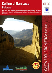 |
Bologna
Valli dell'Idice, Zena, Savena, Navile, Reno e Lavino
Da Zola Predosa a Ozzano Emilia, da Bologna a Monte Sole
Aree Protette dei Gessi Bolognesi e Calanchi dell'Abbadessa, Colline di San Luca e Contrafforte Pliocenico
|
https://www.trackguru.net/images/icone/hiking32.png
Attorno a Monte Salvaro incontrando Morandi
Questo itinerario di circa 13 km ci porta a visitare i luoghi del pittore Giorgio Morandi,nativo di queste parti.
Si parte dal centro di Grizzana Morandi, davanti al Municipio. Di fronte a noi sale il sentiero n° 100 chiamato anche Via dei Santuari, lo seguiamo fino alle ultime case. Dopo un centinaio di metri vediamo sotto i noi la provinciale che porta a Vergato e i maestosi Fienili del Campiaro, dipinti più volte dal maestro Morandi. Il sentiero continua dolcemente a salire tra fino alle case della Serra dove poco più avanti troviamo, sulla sinistra, un bel laghetto. Da qui il sentiero prosegue quasi in quota o leggera salita aggirando il Monte Pezza. Il sentiero, quasi tutto nel bosco, ogni tanto offre ampi scorci sulla valle del Reno e sale deciso sul Monte Salvaro. Con una deviazione di 100 metri si può arrivare alla croce, altrimenti si può restare un più bassi evitando la vetta. Dopo poco il sentiero scende in maniera molto decisa e sconsiglio di farlo in caso di pioggia o fango. Il tratto in forte discesa è circa cinquecento metri: vi consiglio di prenderlo con calma e con diverse soste per il bene delle vostre ginocchia. Poi si arriva sulla strada che collega San Martino di Monte Sole con Grizzana. Una volta sulla strada, prendiamo a destra in direzione Grizzana Morandi. Da qui mancano circa 5,5 chilometri per tornare al punto di partenza. La strada è asfaltata ma poco trafficata e piacevole, con leggeri sali scendi e scorci sulla valle del Setta. All’unico bivio che si incontra si deve tenere la destra, sempre in direzione Grizzana. Subito dopo il bivio si incontra il bellissimo Oratorio di Tudiano, con la parte esterna molto curata dai volontari locali. Il luogo delizioso merita una sosta di qualche minuto. Proseguendo per via Veggio e poi via Marconi, in poco tempo si arriviaal punto di partenza. Se non siete stanchi, con una piccola deviazione potete visitare il borgo medioevale di Veggio, che vedete dalla strada e che dista alcune centinaia di metri. A Grizzana Morandi merita una visita la Casa-Museo di Giorgio Morandi ed i vicini Fienili del Campiaro, spesso sede di mostre di pittura.
Il museo è aperto su prenotazione chiamando il numero 329 2108358 nei seguenti giorni e orari: martedì, giovedì e venerdì: ore 16-19, sabato: ore 10-12.
Stefano Lorenzi
https://www.trackguru.net/images/icone/hiking32.png
Sulla Via degli Dei e a Monte Cucchi nell'Alto Savena
Si parte da Madonna dei Fornelli, nel comune di San Benedetto Val di Sambro, e si prende, dal centro del paese, la via del Monte seguendo le indicazioni della Via degli Dei (VD) in direzione Pian di Balestra per circa 350 metri.
Si gira a sinistra per via Ca’ di Farini e dopo pochi metri si prende a destra il sentiero in salita che entra nel bosco. Il sentiero sale abbastanza ripido fino a giungere sulla strada asfaltata. Qui si prende a sinistra e si giunge nel borgo di Bonacca. Si prosegue sulla mulattiera, sempre in salita ma meno ripida.
Dopo circa un’oretta di cammino si arriva pressi di Monte dei Cucchi e gli si gira attorno. Siamo sul crinale, superiamo prima un anemometro e poco più avanti si arriva all’area recintata dei ripetitori di Monte dei Cucchi. Poco oltre occorre prestare attenzione perché le indicazioni del sentiero 931 sono un po’ nascoste, sulla destra, mentre il percorso da seguire, abbandonando la Via degli Dei, è a sinistra, in discesa. Inizialmente è un po’ infrascato, ma dopo qualche
centinaio di metri si apre. Purtroppo questo sentiero ha pochissima segnaletica e per di più vecchia, per cui bisogna fare
attenzione e seguire la traccia affidandosi a volte all’intuito. Il percorso non è sempre definito ed affidatevi alla cartina in quanto ci sono molte altre stradelle usate per raccogliere la legna che possono trarre in inganno. Ci sono due punti dove
bisogna prestare attenzione, quello indicato con il numero 1 dove il sentiero gira a sinistra in maniera decisa e il punto 2 dove un segnavia sbagliato ci invita ad andare dritto, ma noi dobbiamo girare a sinistra. Il sentiero è largo, e scende in forte discesa fino a Pian dei Torli. Superate le case nel mezzo alla curva a “U” trovate il sentiero 939 che conduce a Ca’ dei Cucchi.
Qui il sentiero è molto largo, carrozzabile e piacevole, non presenta dislivelli e farà riposare le vostre ginocchia impegnate nella discesa dal monte dei Cucchi. Una volta giunti al piccolo borgo contadino si prosegue lungo la strada asfaltata fino ad arrivare a Ca’ di Farini ed incontrare la strada che avete fatto all’inizio. Siamo già giunti a Madonna dei Fornelli. Il percorso è classificato “E” (escursionistico) e non è per tutti in quanto presenta dislivelli impegnativi (si passa dagli 800 m slm di Madonna dei Fornelli ai 1.138 di Monte dei Cucchi per poi scendere agli 850 di Pian dei Torli). Occorrono circa 3 ore di cammino per fare i circa 9 chilometri di questo anello.
La Via degli Dei è senza dubbio il più celebre itinerario che collega Bologna con Firenze attraverso gli Appennini ed è frequentato ogni anno da centinaia di appassionati di trekking e mountain bike.
Ti interessa la carta escursionistica Trekking/MTB della Via degli Dei? Clicca qui.
La carta + guida è un'esclusiva TrackGuru in collaborazione con Infosasso e C.A.I.
Il sentiero rappresentato in questa pagina è quello ufficiale tracciato e manutenuto dal C.A.I.
Il file gpx è liberamente scaricabile (previa registrazione al sito) e apprezzeremmo molto un vostro feedback.
https://www.trackguru.net/images/icone/hiking32.png
Brento - Monte Adone in compagnia degli amici a quattro zampe
Brento (Via Vallazza) - Monte Adone - Sentiero CAI 110
Arrivati a Brento e passata la trattoria (sulla sx) si prende Via Vallazza (sulla dx) che è una strada in salita. Alla fine della strada. Si imbocca il sentiero CAI 110 verso il Monte Adone. All'inizio del sentiero si tiene la DX e si inizia a salire verso la cima. Il sentiero è largo e ben segnalato ma il fondo è molto sconnesso, chiaramente questo non rappresenta nessun problema per i nostri amici a quattro zampe. Arrivati sulla cima del monte si può vedere splendida valle, piena di colori, tra campi coltivati, boschi e casolari e lo sguardo prosegue oltre fino a raggiungere le montagne circostanti che regalano un paesaggio di rara bellezza. Da qui si vede il Monte Cusna, il Corno alle Scale e il Monte Cimone; a sud-ovest si levano gli imponenti bastioni arenacei boscati del Parco Regionale di Monte Sole, a nord-ovest si staglia il Monte Frate e la Rocca di Badolo. Il sentiero non presenta particolari difficoltà ed in linea di massima, essendo un sentiero comunque largo, non c'è molto bisogno di guinzagliare i nostri amici che si divertiranno molto a scorrazzare qui e là scoprendo l'appennino.
https://www.trackguru.net/images/icone/hiking32.png
Via degli Dei (da Monte di Fo' a San Piero a Sieve) - Quarta tappa
La Via degli Dei è senza dubbio il più celebre itinerario che collega Bologna con Firenze attraverso gli Appennini ed è frequentato ogni anno da centinaia di appassionati di trekking e mountain bike.
Ti interessa la carta escursionistica Trekking/MTB della Via degli Dei? Clicca qui.
La carta + guida è un'esclusiva TrackGuru in collaborazione con Infosasso e C.A.I.
Il sentiero rappresentato in questa pagina è quello ufficiale tracciato e manutenuto dal C.A.I.
Il file gpx è liberamente scaricabile (previa registrazione al sito) e apprezzeremmo molto un vostro feedback.
https://www.trackguru.net/images/icone/hiking32.png
Via degli Dei (da Bologna a Badolo) - Prima tappa
La Via degli Dei è senza dubbio il più celebre itinerario che collega Bologna con Firenze attraverso gli Appennini ed è frequentato ogni anno da centinaia di appassionati di trekking e mountain bike.
Ti interessa la carta escursionistica Trekking/MTB della Via degli Dei? Clicca qui.
La carta + guida è un'esclusiva TrackGuru in collaborazione con Infosasso e C.A.I.
Il sentiero rappresentato in questa pagina è quello ufficiale tracciato e manutenuto dal C.A.I.
Il file gpx è liberamente scaricabile (previa registrazione al sito) e apprezzeremmo molto un vostro feedback.
https://www.trackguru.net/images/icone/hiking32.png
Via degli Dei (da Badolo a Madonna dei Fornelli) - Seconda tappa
La Via degli Dei è senza dubbio il più celebre itinerario che collega Bologna con Firenze attraverso gli Appennini ed è frequentato ogni anno da centinaia di appassionati di trekking e mountain bike.
Ti interessa la carta escursionistica Trekking/MTB della Via degli Dei? Clicca qui.
La carta + guida è un'esclusiva TrackGuru in collaborazione con Infosasso e C.A.I.
Il sentiero rappresentato in questa pagina è quello ufficiale tracciato e manutenuto dal C.A.I.
Il file gpx è liberamente scaricabile (previa registrazione al sito) e apprezzeremmo molto un vostro feedback.
https://www.trackguru.net/images/icone/hiking32.png
Via degli Dei (da Madonna dei Fornelli a Monte di Fo') - Terza tappa
La Via degli Dei è senza dubbio il più celebre itinerario che collega Bologna con Firenze attraverso gli Appennini ed è frequentato ogni anno da centinaia di appassionati di trekking e mountain bike.
Ti interessa la carta escursionistica Trekking/MTB della Via degli Dei? Clicca qui.
La carta + guida è un'esclusiva TrackGuru in collaborazione con Infosasso e C.A.I.
Il sentiero rappresentato in questa pagina è quello ufficiale tracciato e manutenuto dal C.A.I.
Il file gpx è liberamente scaricabile (previa registrazione al sito) e apprezzeremmo molto un vostro feedback.
https://www.trackguru.net/images/icone/hiking32.png
Via degli Dei (da San Piero a Sieve a Firenze) - Quinta tappa
La Via degli Dei è senza dubbio il più celebre itinerario che collega Bologna con Firenze attraverso gli Appennini ed è frequentato ogni anno da centinaia di appassionati di trekking e mountain bike.
Ti interessa la carta escursionistica Trekking/MTB della Via degli Dei? Clicca qui.
La carta + guida è un'esclusiva TrackGuru in collaborazione con Infosasso e C.A.I.
Il sentiero rappresentato in questa pagina è quello ufficiale tracciato e manutenuto dal C.A.I.
Il file gpx è liberamente scaricabile (previa registrazione al sito) e apprezzeremmo molto un vostro feedback.
https://www.trackguru.net/images/icone/hiking32.png
Casalecchio di Reno - Giro dei 4 ponti
L’anello tocca alcuni dei luoghi più caratteristici di Casalecchio di Reno e attraversa tutti e quattro i ponti sul Reno del Comune.
Itinerario
Si parte dalla Filanda e subito si percorre il primo ponte, al di là del quale si sviluppa il quartiere Garibaldi. Percorrendo via Tripoli e successivamente via dello Sport e via dei Mille, si incontrano il Centro Giovanile Blogos e la sede del Comune. Si imbocca quindi il Ponte della Pace, magnifica struttura strallata, fino ad arrivare a Romainville, un parco e un’area sportiva così chiamati per il gemellaggio con l’omonima cittadina francese. Si passa sotto il ponte stesso, camminando sul lungo fiume fino ad arrivare al ponte sul Reno (via Porrettana). Si percorre anche quest’ultimo e in breve si arriva alla Piazza del Monumento ai Caduti; da qui parte un comodo camminamento che arriva fino al Lido di Casalecchio.
Una strada stretta ci porta fino a via Ronzani che bisogna seguire per circa 800 metri, quando un cartello ci indica la deviazione per la passerella. Il ritorno si effettua attraverso il Parco della Chiusa fino a San Martino; poi si segue la ciclabile in direzione Bologna fino a tornare al punto di partenza.
La carta dei luoghi di cui parla l'articolo:
| |
Bologna
Valli dell'Idice, Zena, Savena, Navile, Reno e Lavino
Da Zola Predosa a Ozzano Emilia, da Bologna a Monte Sole
Aree Protette dei Gessi Bolognesi e Calanchi dell'Abbadessa, Colline di San Luca e Contrafforte Pliocenico
|
https://www.trackguru.net/images/icone/hiking32.png
Parco della Chiusa: Sentiero delle Montagnole
 E' una variante di questo percorso: Parco della Chiusa - San Luca - Bregoli.
Si parte dal Parco Talon e si percorre via Panoramica fino alla Cà Bianca, un bel prato con qualche gioco per bambini. Lì trovate anche le indicazioni per il Sentiero delle Montagnole. Comunque è sufficiente proseguire e cominciare a salire. Si arriva quindi alla Montagnola di Sopra, un edificio rurale ristrutturato da poco e oggi sede del Parco. Qui si trovano i programmi degli eventi del Comune.
Al bivio tenete la sinistra e scendete verso la Montagnola di Mezzo; da qui prendete il sentiero a destra e proseguite fino ad un incrocio, presso il quale andate dritto. Seguendo questo sentiero arriverete presto all'incrocio con i Bregoli (un collegamento di epoca medievale tra San Luca e Casalecchio; trovate delle notizie qui). Andate a sinistra e continuate a scendere anche all'incrocio successivo fino ad arrivare alla Chiesa di San Martino.
https://www.trackguru.net/images/icone/hiking32.png
Intorno a Medelana
Percorso ad anello nei pressi dell'abitato di Medelana, poco frequentato.
Caratterizzato da un certo dislivello, presenta in alcuni tratti della parte a nord un fondo sdrucciodevole perchè composto da pietrisco slegato. La parte sud è più curata e si percorre molto bene.
A causa del notevole dislivello e di alcuni tratti sdrucciodevoli, sconsiglio il percorso ai bambini e alle persone fuori allenamento.
Sentieri CAI: 140 e 180A
https://www.trackguru.net/images/icone/hiking32.png
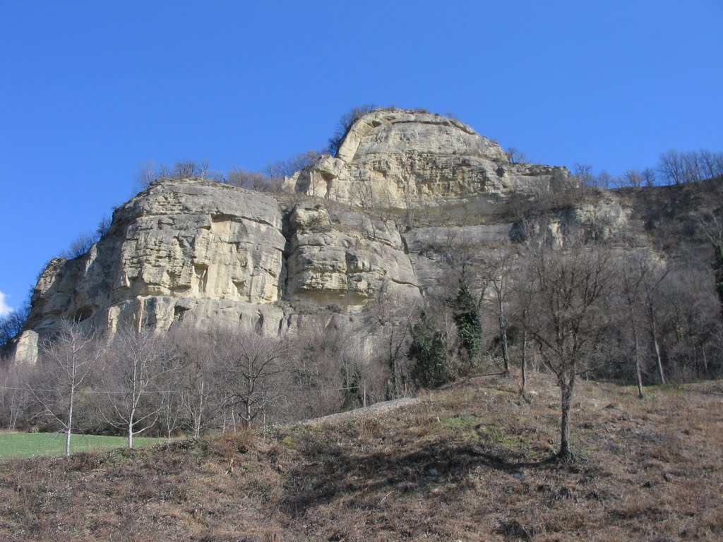
Sul Contrafforte Pliocenico: da Badolo a Monte Adone
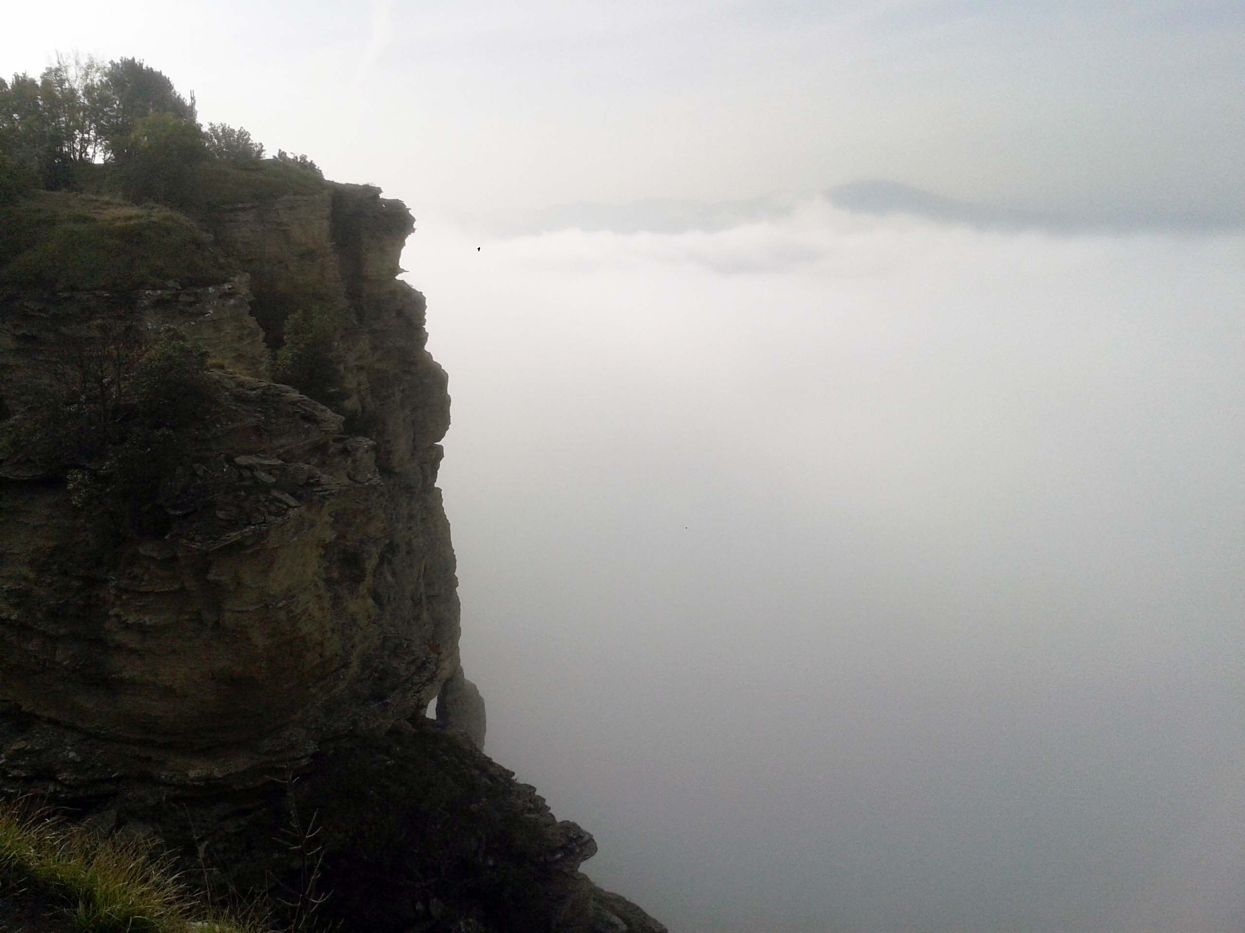 Da Badolo (Sasso Marconi) si seguono le indicazioni per Monte Adone (sentiero CAI 110-Via degli Dei), dopo poche decine di metri si lascia il sentiero a sinistra proseguendo in salita su una sterrata, si oltrepassa una presa dell'acqua e si prosegue a mezza costa sulle pendici di Monte del Frate. Il sentiero è segnato con sbiadite tracce di vernice rossa (Sentiero Nando), e tramite una lunga cengia, permette di attraversare il versante del monte per tutta la sua lunghezza. Da segnalare un paio di traversi un po' esposti su roccia, attrezzati con comode ferle. Raggiunto il termine della parete si scende su tracce di sentiero per poi risalire sul versante opposto tramite cavedagna. Nei pressi del Centro della Fauna selvatica si scende nuovamente a destra fino ad un campo coltivato per poi risalire al piccolo nucleo abitato di Campiuno. Lo si attraversa e si prende a sinistra il sentiero 110-Via degli Dei, che in salita percorre lo scenografico crinale NO di Monte Adone fino alla vetta (croce m 654). Il rientro lo si effettua percorrendo quest'ultimo sentiero in discesa, a Campiuno si prende una strada bianca in direzione est, si passa l'Agriturismo Piccola Raieda e dopo circa 100 metri si scende a sinistra per il prato che costeggia una casa isolata fino all'ingresso del Centro di Fauna selvatica. Ora teniamo la sinistra (sentiero CAI 110a), passiamo il B&B Via degli Dei e proseguiamo sul sentiero fino al bivio con il CAI 122. Qui teniamo la sinistra (indicazioni Badolo - CAI 110) e dopo pochi minuti di cammino arriviamo sul versante panoramico NO di Monte del Frate. Lo percorriamo integralmente e poi in discesa fino a Badolo.
{imageshow sl=14 sc=6 /}
https://www.trackguru.net/images/icone/hiking32.png
Trekking Gucciniano - Da Bologna a Pavana
"...e una gran voglia di andare a parlare coi boschi e con il fiume..."
Ciao Francesco,
saremo in tanti e verremo lassù fra i castagni dell' Appennino, perché quello che proviamo non si può più trattenere, sentiamo urgente il bisogno di dirtelo.
Ci troveremo sotto "quel" 43...
...verremo lentamente, e passando per le strade di "mamma" Bologna ricorderemo quel 21 giugno in Piazza, che c'eravamo tutti...
...verremo faticosamente, e ci fermeremo davanti a quel bastone su in collina, intorno a Monte Sole, a immaginare quando l'uomo potrà vivere senza ammazzare...
...verremo gioiosamente parlando con i boschi e con il fiume... cercando il segreto del Gigante Appennino.
E quando, dopo quattro giorni di cammino, saremo lì davanti alla porta verde, ognuno avrà deciso come dirtelo, quello che prova...
Tu forse ci sarai ad aspettarci, o forse no...
... ma quel "GRAZIEEE !!!" che ci hai sempre urlato in faccia a fine concerto, con quel vocione e quella "erre" un po' così, te lo rimanderemo indietro con tutta la stima e l'affetto di cui saremo capaci...
A presto
Da Bologna in Via Paolo Fabbri 43 al Mulino di Chicon a Pavana. Un viaggio di 4 giorni iniziato mercoledì 2 ottobre 2013 dalla Trattoria "Da Vito" e conclusosi a Pavana domenica 6 ottobre.
Il tracciato non presenta particolari difficoltà tecniche, però la fatica è costante per le caratteristiche classiche dei sentieri appenninici.
Non ci sono tratti pericolosi od esposti.
Bisogna prestare attenzione nei tratti di sentiero del bosco per la possibile presenza di fango, soprattutto dopo un periodo di pioggia.
L'attrezzatura da portarsi dietro dipende, ovviamente, dal mese in cui si vuole affrontare il trekking, comunque, anche in estate, l'acqua si trova facilmente ed i punti ristoro non mancano.
Sito Trekking Gucciniano
{imageshow sl=13 sc=6 /}
https://www.trackguru.net/images/icone/hiking32.png
Giro della Rocca di Badolo
 Breve e facile percorso ad anello ai piedi della Rocca di Badolo.
Sulla destra della chiesa di Badolo si prende la sterrata (CAI 110), si costeggia il cimitero e ci si addentra nel bosco. Si passano dei ruderi, si costeggia a sinistra la base della falesia di arenaria e poco dopo si raggiunge un bivio; lasciando il sentiero segnato in marcata discesa a destra si prende una traccia che devia leggermente a sinistra.
Mantenendo sempre la traccia, si passa accanto ad un piccolo stagno e successivamente si attraversano dei campi (se coltivati tenersi ai bordi). Preseguendo per un breve tratto su una mulattiera si raggiunge la provinciale asfaltata. Pochi minuti in salita ci permettono di raggiungere il punto di partenza.
https://www.trackguru.net/images/icone/hiking32.png
Passo della Raticosa - Monte Canda
Lo scorso autunno la regione Emilia Romagna ha inaugurato l’Alta Via dei Parchi, un bellissimo itinerario di quasi 500 chilometri che attraversa tutto l’Appennino Settentrionale partendo da Berceto (Parma) fino al Parco di Sasso Simone e Simoncello (Rimini). Con questa proposta ho intenzione di farvi gustare un piccolo pezzo di questo lungo itinerario: il tratto che sale su Monte Canda.
Partenza dal Passo della Raticosa
Si parte dal Passo della Raticosa (siamo già in Toscana) a 968 metri slm. Lasciata l’auto nell’ampio piazzale di fronte allo Chalet, vediamo già le frecce che ci indicano quale direzione prendere. Si parte sul lato sinistro dello chalet della Raticosa e si percorre un piccolo crinale seguendo il segnavia del CAI 801. Dopo circa 200 metri dallo chalet il sentiero prosegue ritto puntando il Monte Canda. Sulla destra invece c’è un altro sentiero che è la Bologna-Firenze che prosegue in discesa verso Pietramala, ma che noi ignoriamo. Il sentiero sale abbastanza ripido e un po’ scivoloso se lo percorrete dopo una giornata di pioggia; in alcuni tratti rovinato dal passaggio delle moto. Vi consiglio di prenderlo con calma e di fermarvi ogni tanto a riposare, tanto la vetta non è lontana. Il sentiero resta tutto nel bosco e sulla nostra destra a salire troviamo ampie distese di Abete bianco o Pini di Lawson. Dopo circa una mezzoretta di cammino si arriva in vetta dove si aprono ampie praterie, che in questo periodo offrono una moltitudine di fioriture. Il sentiero prosegue lungo questi prati a volte non sempre visibile a causa dell’erba alta, ma basta seguire sempre il crinale.
In cima al Monte Canda
Giunti sulla cima, molto ampia e con grandi prati, il panorama è veramente mozzafiato. A est vediamo tutta la valle dell’Idice fino alle porte di Bologna, e il crinale tra l’Idice ed il Diaterna. Verso nord riusciamo a intravedere Monte Adone, Loiano e Monghidoro. A ovest l’Alpe di Monghidoro, Monte Beni, e scendendo verso sud, il passo della Futa, Monte Gazzaro e Faggio all’Ombrellino, l’Osteria Bruciata e il Passo del Giogo. Verso sud, sotto di noi un burrone di circa un centinaio di metri ci fa vedere la zona del Peglio, di Poggio Tignoso, con il nuovo impianto eolico, e sullo sfondo tutta la catena del crinale denominato 00. Firenzuola non si vede perché rimane nella conca, ma sopra svetta Monte Coloreta. Nelle giornate un po’ limpide, sempre verso sud, si vede anche Monte Falco e il Falterona.
Rientro al Passo della Raticosa
Dopo esserci fermati un po’ di tempo sulla cima, piano piano si prosegue lungo il crinale fino ad arrivare ad un bivio dove si gira secco a sinistra e si inizia la discesa. Il sentiero prosegue nel bosco con alcuni ampi giri; in alcuni tratti bisogna prestare bene attenzione e guardare il segnavia bianco e rosso. Scendendo a volte è possibile incontrare mucche al pascolo. Senza correre ed agitarsi passare tranquillamente, loro ci vedono molto più grandi e sono abbastanza tranquille. In una mezzoretta dalla vetta si arriva sulla provinciale che va dal Passo della Raticosa a Piancaldoli. Noi dobbiamo prendere a sinistra e rientrare al passo della Raticosa (purtroppo facendo l’asfalto). La provinciale non è molto trafficata e ci sono ampi spazi a bordo strada. L’anello è di circa 7 chilometri e prendendosela con molta calma in due ore e mezza si fa il giro.
Nei dintorni: Monte Rocca e il Sasso di San Zanobi
Se avete voglia di fare altre due passi, da lì si può raggiungere Monte Rocca, un affioramento fatto a cono che vi vede proprio sotto la Raticosa. Ripresa l'auto, non lontano da qui (circa 4 km) lungo la provinciale verso Piancaldoli troviamo Il Sasso di San Zanobi, un ofiolite caratteristico che vi consiglio di andare a vedere. La leggenda narra che San Zanobi, Vescovo di Firenze a cavallo tra il IV e V secolo, durante la campagna di evangelizzazione di queste zone, accettasse la sfida del diavolo, su chi riuscisse a portare più lontano un enorme masso. San Zanobi vinse la sfida portando il masso nella posizione dove lo vedete attualmente e sconfisse così il demonio. Se rientrate verso Bologna vi consiglio di fermarvi a pranzo all'Hotel Kristall a Monghidoro dove potrete gustare degli ottimi piatti.
A cura di Stefano Lorenzi.
Tratto da Valli Bolognesi, Appennino Slow, estate 2013.
{imageshow sl=16 sc=6 /}
La carta dei luoghi di cui parla l'articolo:
 |
Alte valli del Savena, Setta e Limentra
Parco Regionale dei Laghi di Suviana e Brasimone, Alto Carigiola, Alta Valle del Santerno, Passo della Raticosa
Dal Lago di Suviana al Passo della Raticosa
Barberino di Mugello, Camugnano, Cantagallo, Castel di Casio, Castiglione dei Pepoli, Firenzuola, San Benedetto Val di Sambro, Vernio, Lago di Suviana, Lago Brasimone, Passo della Raticosa, Passo della Futa, Lago di Castel dell'Alpi
|
https://www.trackguru.net/images/icone/hiking32.png
Tutti i segreti di Monte Beni
 Un trekking non troppo impegnativo di otto chilometri attraverso il parco dei mufloni verso una delle cime più belle dell'Appennino Tosco-Emiliano.
In questo itinerario andremo a salire su Monte Beni (siamo in Toscana) da dove poter godere di un panorama unico.
Partenza
Si parte da Covigliaio, dove troverete un comodo parcheggio di fronte al Bar. Con il bar di fronte, prendete a destra lungo la Futa e dopo circa 200 metri trovate sulla sinistra una stradina ghiaiata con all’angolo una bella bacheca che vi illustra l’itinerario. Si segue il sentiero CAI 735 che porta su Monte Beni. La strada sale dolcemente per poco più di due chilometri fino ad arrivare il località la Serra dove ci sono dei ripetitori. Qui si prende a destra e ci si inoltra per uno stretto sentiero nel bosco. Qui inizia la salita a Monte Beni ed in circa 20-30 minuti si raggiunte la vetta.
La salita non è particolarmente impegnativa. Poco prima della vetta, se volete potete abbandonare il sentiero per meno di 100 metri ed arrivare alla Buca delle Fate, un luogo molto bello dal punto di vista naturalistico. In cima alla vetta, se sarete silenziosi ed a favore di vento, non è raro incontrate anche alcuni mufloni o avvistarli in lontananza.
Si ridiscende sui propri passi e si ritorna verso il Covigliaio.
Rientro
Superata la la Serra, dopo circa 700 metri, trovate un traliccetto dell'Enel e ora avrete due possibilità, o si rientra per la strada che avete fatto prima oppure vi consiglio di prendere a destra un sentiero con le indicazioni Fonte ai Prati - Passeggere. Superato il prato si entra subito nel bosco. Il sentiero resta in quota ma bisogna prestare attenzione al segnavia. Ad un certo punto incontriamo una carrareccia che fa un'ampia curva, noi dobbiamo andare a sinistra in discesa abbandonando il sentiero 11 SOFT.
Dopo poco si incrocia un'ampia strada sterrata con una situazione simile alla precedente ed anche qui dobbiamo prendere a sinistra in discesa. Mantenete sempre la sinistra anche ad un bivio che troverete 100 metri più avanti. Arrivati a Covigliaio è semplice tornare alla partenza.
L'anello è di 8 km, all'arrivo vi consigliamo un panino alla finocchiona al Bar da Martelli, proprio di fronte al parcheggio.
La carta dei luoghi di cui parla l'articolo:
| |
Alte valli del Savena, Setta e Limentra
Parco Regionale dei Laghi di Suviana e Brasimone, Alto Carigiola, Alta Valle del Santerno, Passo della Raticosa
Dal Lago di Suviana al Passo della Raticosa
Barberino di Mugello, Camugnano, Cantagallo, Castel di Casio, Castiglione dei Pepoli, Firenzuola, San Benedetto Val di Sambro, Vernio, Lago di Suviana, Lago Brasimone, Passo della Raticosa, Passo della Futa, Lago di Castel dell'Alpi
|
https://www.trackguru.net/images/icone/hiking32.png
Badia Moscheta e l'Alto Appennino Imolese
https://www.trackguru.net/images/icone/hiking32.png
Da Farfareta alla Giogana e Monte Lavane
https://www.trackguru.net/images/icone/hiking32.png
Da Badia del Borgo all'Eremo di Gamogna
https://www.trackguru.net/images/icone/hiking32.png
L'Eremo di Gamogna e la valle del Torrente Acerreta
https://www.trackguru.net/images/icone/hiking32.png
L'Acquacheta e il Monte Peschiena
https://www.trackguru.net/images/icone/hiking32.png
Nella valle dell'Acquacheta
https://www.trackguru.net/images/icone/hiking32.png
Transappenninica da Crespino del Lamone a Ronta per Poggio degli Allocchi
https://www.trackguru.net/images/icone/hiking32.png
L'Alpe di San Benedetto e la cascata dell'Acquacheta
Cà Lastra, Monte di Londa, Balze Trafossi, Cascata dell'Acquacheta, Il Bagnatoio, Pian Capannino, Il Crocione, Eremo (in lavorazione).
Vuoi contribuire? Leggi come inserire contenuti in TrackGuru.
{imageshow sl=23 sc=6 /}
https://www.trackguru.net/images/icone/hiking32.png
Il periplo della valle del Fosso di Fiumicello
https://www.trackguru.net/images/icone/hiking32.png
In vetta alla Romagna
https://www.trackguru.net/images/icone/hiking32.png
Da Campigna alle Cullacce e Monte Falco
https://www.trackguru.net/images/icone/hiking32.png
Dalla Calla a Pian del Varco e ritorno per la Giogana
https://www.trackguru.net/images/icone/hiking32.png
Alta Via dei Parchi - Tappa 01 - Da Berceto al Lago Santo parmense
La prima tappa dell'Alta Via è lunga e impegnativa ma offre una grande varietà ambientale, spaziando dal paesaggio agrario del medio Appennino fino alle aspre cime del crinale.
Si parte da un luogo calcato dai passi di innumerevoli pellegrini: davanti al duomo di San Moderanno di Berceto, ultimo avamposto abitato prima del Monte Bardone (l'odierno Passo della Cisa) per chi percorreva la via Francigena medievale in direzione di Roma.
Dal paese si sale fino a raggiungere il crinale un paio di chilometri a oriente della Cisa, possibile accesso alternativo al percorso; seguendo poi la cresta ondulata e panoramica si giunge al Passo del Cirone, netto confine geologico e geografico dove iniziano le dure arenarie del crinale emiliano che accompagneranno il cammino per quasi duecento chilometri.
Le aeree praterie del M. Tavola concedono un po' di respiro, poi la cresta si impenna nella ripida salita che precede la cima del M. Orsaro (1830 m), ottimo punto panoramico proteso sulla Lunigiana. Il toponimo allude chiaramente al grande animale estinto in questa zona dalla fine del '700; l'ambiente roccioso e le immense praterie sono un preludio dei paesaggi dei prossimi giorni.
Si scende prima per cresta poi fra le rocce del versante emiliano, con qualche salita per superare gli ostacoli posti da una morfologia complessa; attraverso faggete e rimboschimenti si arriva alla bella conca acquitrinosa del Lago Padre e da lì in pochi minuti alle rive del Lago Santo e allo storico rifugio Mariotti, al centro di un'area di grande interesse naturalistico.
Il limpido bacino, ricco di trote e di salmerini, è incantevole, circondato dal bosco e dominato dalle rocce stratificate della Sterpara; con i suoi 81.550 m2 di superficie è il più vasto lago naturale di tutto l'Appennino settentrionale. Qui si può arrivare anche, in poco meno di un'ora di cammino, da Lagdei, dove arriva una strada che sale da Bosco di Corniglio.
http://ambiente.regione.emilia-romagna.it/parchi-natura2000/fruizione/altavia/tappe/tappa-1/1.-berceto-lago-santo-parmense
{imageshow sl=34 sc=6 /}
Le altre tappe della Via dei Parchi
Alta Via dei Parchi - Tappa 01 - Da Berceto al Lago Santo parmense | Alta Via dei Parchi - Tappa 02 - Dal Lago Santo parmense a Prato Spilla | Alta Via dei Parchi - Tappa 03 - Da Prato Spilla al Passo del Cerreto | Alta Via dei Parchi - Tappa 04 - Dal Passo del Cerreto al Passo Pradarena | Alta Via dei Parchi - Tappa 05 - Dal Passo Pradarena a Lama Lite | Alta Via dei Parchi - Tappa 06 - Da Lama Lite a San Pellegrino in Alpe | Alta Via dei Parchi - Tappa 07 - Da San Pellegrino in Alpe al Lago Santo modenese | Alta Via dei Parchi - Tappa 08 - Dal Lago Santo modenese all'Abetone | Alta Via dei Parchi - Tappa 09 - Dall'Abetone al Lago Scaffaiolo | Alta Via dei Parchi - Tappa 10 - Dal Lago Scaffaiolo al Rifugio di Monte Cavallo | Alta Via dei Parchi - Tappa 11 - Dal Rifugio di Monte Cavallo al Poranceto | Alta Via dei Parchi - Tappa 12 - Da Poranceto a Boccadirio | Alta Via dei Parchi - Tappa 13 - Da Boccadirio all'Alpe di Monghidoro | Alta Via dei Parchi - Tappa 14 - Dall'Alpe di Monghidoro a Le Selve | Alta Via dei Parchi - Tappa 15 - Da Le Selve a Tossignano | Alta Via dei Parchi - Tappa 16 - Da Tossignano a Carnè | Alta Via dei Parchi - Tappa 17 - Da Carnè a Marradi
https://www.trackguru.net/images/icone/hiking32.png
Alta Via dei Parchi - Tappa 02 - Dal Lago Santo parmense a Prato Spilla
La lunga tappa percorre l'intero "Crinale dei laghi", un suggestivo susseguirsi di conche glaciali, creste rocciose, lastroni levigati e praterie; il severo ambiente d'alta quota è ingentilito da uno straordinario campionario di laghetti e da portentose fioriture per gran parte dell'estate.
Dalle rive del Lago Santo si sale fino al crinale alle falde del M. Marmagna dove inizia il percorso in cresta, molto panoramico ma faticoso per i continui saliscendi.
Verso la Lunigiana precipitano costole rocciose e canali ripidissimi; sul lato emiliano i versanti sono invece più dolci, scendendo con avvallamenti e gradoni glaciali separati da creste e rupi fino alle vaste foreste che ammantano la Val Parma.
Dopo aver costeggiato la boscosa valle della Riserva Statale di Guadine Pradaccio, istituita più di quarant'anni fa, si scorgono le Capanne di Badignana, vecchio alpeggio oggi adibito a bivacco che può rivelarsi utile in caso di maltempo.
Più in basso del sentiero scorrono numerosi specchi d'acqua: il minuscolo Lago Bicchiere e, più lontano, il Lago Scuro e i Lagoni, incastonati nella faggeta ai piedi della Rocca Pumacciolo.
Si raggiunge infine il M. Sillara (1859 m), la cima più alta del Parmense. I vicini laghi Sillara, appena sotto il crinale, sembrano sospesi nel cielo e nelle giornate limpide la vista spazia fino al Mar Ligure, alla Corsica e all'arco alpino; ma la veduta più impressionante è sulla sottostante valle del Bagnone, un abisso verde con le macchie chiare dei paesi situate quasi un chilometro e mezzo più in basso.
Al Passo del Giovarello si inizia a scendere sul lato emiliano toccando il modesto Lago Martini, poi un ripido valloncello pietroso porta al Bivacco Cagnin; la discesa continua nel bosco, sfiorando il Lago Verde e giungendo alla diga del Lago Ballano, accessibile in estate anche lungo la stradina che sale da Trefiumi, in Val Cedra. Da qui si raggiunge Prato Spilla con una comoda passeggiata nella faggeta.
http://ambiente.regione.emilia-romagna.it/parchi-natura2000/fruizione/altavia/tappe/tappa-2/2.-lago-santo-parmense-prato-spilla
{imageshow sl=36 sc=6 /}
Le altre tappe della Via dei Parchi
Alta Via dei Parchi - Tappa 01 - Da Berceto al Lago Santo parmense | Alta Via dei Parchi - Tappa 02 - Dal Lago Santo parmense a Prato Spilla | Alta Via dei Parchi - Tappa 03 - Da Prato Spilla al Passo del Cerreto | Alta Via dei Parchi - Tappa 04 - Dal Passo del Cerreto al Passo Pradarena | Alta Via dei Parchi - Tappa 05 - Dal Passo Pradarena a Lama Lite | Alta Via dei Parchi - Tappa 06 - Da Lama Lite a San Pellegrino in Alpe | Alta Via dei Parchi - Tappa 07 - Da San Pellegrino in Alpe al Lago Santo modenese | Alta Via dei Parchi - Tappa 08 - Dal Lago Santo modenese all'Abetone | Alta Via dei Parchi - Tappa 09 - Dall'Abetone al Lago Scaffaiolo | Alta Via dei Parchi - Tappa 10 - Dal Lago Scaffaiolo al Rifugio di Monte Cavallo | Alta Via dei Parchi - Tappa 11 - Dal Rifugio di Monte Cavallo al Poranceto | Alta Via dei Parchi - Tappa 12 - Da Poranceto a Boccadirio | Alta Via dei Parchi - Tappa 13 - Da Boccadirio all'Alpe di Monghidoro | Alta Via dei Parchi - Tappa 14 - Dall'Alpe di Monghidoro a Le Selve | Alta Via dei Parchi - Tappa 15 - Da Le Selve a Tossignano | Alta Via dei Parchi - Tappa 16 - Da Tossignano a Carnè | Alta Via dei Parchi - Tappa 17 - Da Carnè a Marradi
https://www.trackguru.net/images/icone/hiking32.png
Fra la valle del Bidente e quella del Rabbi
https://www.trackguru.net/images/icone/hiking32.png
Da Lago a Lavacchio e ritorno per Montecavallo
https://www.trackguru.net/images/icone/hiking32.png
Da Corniolo a San Paolo in Alpe
https://www.trackguru.net/images/icone/hiking32.png
Sulla Giogana fra Monte Gabrendo e Monte Falco
https://www.trackguru.net/images/icone/hiking32.png
Da Ridracoli a San Paolo in Alpe
https://www.trackguru.net/images/icone/hiking32.png
Alta Via dei Parchi - Tappa 03 - Da Prato Spilla al Passo del Cerreto
Una lunga giornata per collegare i due valichi più bassi dell'Appennino emiliano, entrambi a 1200 metri di quota e separati dal grande blocco montuoso dell'Alpe di Succiso-M. Alto-Punta Buffanaro.
Da Prato Spilla si sale fino alla conca del Lago Verdarolo, seguito dal minuscolo Lago Scuro, anch'esso circondato dalla faggeta, e poi dal Lago Squincio, più aperto e invaso dalle erbe palustri; da lì alla Diga del Lagastrello, punto di accesso alternativo all'Alta Via, è una breve discesa.
Lo sbarramento, dove nasce il fiume Enza, ha creato il Lago Paduli con la sommersione dell'ampia sella del Passo del Lagastrello, l'antico Malpasso presidiato dall'abbazia benedettina dei Linari.
La salita nel bosco alle falde del M.Acuto porta all'omonimo lago, in una conca sovrastante un gradino glaciale; nei pressi si trova il rifugio Città di Sarzana (1580 m), aperto nei mesi estivi. In breve si scende ai Ghiaccioni, bella conca ricca di praterie e di acque sorgive da cui nasce il torrente Liocca, dominata dal grande circo glaciale racchiuso dalla cresta dentata dei Groppi di Camporaghena.
La salita, fra grandi massi e praterie dominate dalla mole dell'Alpe di Succiso ermina nello stretto intaglio del Passo di Pietra Tagliata (1753 m), un ambiente severo su cui incombono le rocce del M. Alto; da lì un sentiero sassoso porta velocemente alle sorgenti del Secchia, al centro di una conca rinomata per la sua selvaggia bellezza.
Dal pianoro del Prataccio si raggiunge il non lontano Passo dell'Ospedalaccio, segnalato da un cippo che ricorda i confini della Repubblica Cisalpina; il valico prende il nome da un ospitale medievale individuato da recenti scavi. Al Passo del Cerreto si giunge con una comoda camminata fra boschetti e praterie, con ampie vedute del circo del M. La Nuda che sarà risalito nella prossima tappa.
http://ambiente.regione.emilia-romagna.it/parchi-natura2000/fruizione/altavia/tappe/3.-prato-spilla-passo-del-cerreto/3.-prato-spilla-passo-del-cerreto
{imageshow sl=41 sc=6 /}
Le altre tappe della Via dei Parchi
Alta Via dei Parchi - Tappa 01 - Da Berceto al Lago Santo parmense | Alta Via dei Parchi - Tappa 02 - Dal Lago Santo parmense a Prato Spilla | Alta Via dei Parchi - Tappa 03 - Da Prato Spilla al Passo del Cerreto | Alta Via dei Parchi - Tappa 04 - Dal Passo del Cerreto al Passo Pradarena | Alta Via dei Parchi - Tappa 05 - Dal Passo Pradarena a Lama Lite | Alta Via dei Parchi - Tappa 06 - Da Lama Lite a San Pellegrino in Alpe | Alta Via dei Parchi - Tappa 07 - Da San Pellegrino in Alpe al Lago Santo modenese | Alta Via dei Parchi - Tappa 08 - Dal Lago Santo modenese all'Abetone | Alta Via dei Parchi - Tappa 09 - Dall'Abetone al Lago Scaffaiolo | Alta Via dei Parchi - Tappa 10 - Dal Lago Scaffaiolo al Rifugio di Monte Cavallo | Alta Via dei Parchi - Tappa 11 - Dal Rifugio di Monte Cavallo al Poranceto | Alta Via dei Parchi - Tappa 12 - Da Poranceto a Boccadirio | Alta Via dei Parchi - Tappa 13 - Da Boccadirio all'Alpe di Monghidoro | Alta Via dei Parchi - Tappa 14 - Dall'Alpe di Monghidoro a Le Selve | Alta Via dei Parchi - Tappa 15 - Da Le Selve a Tossignano | Alta Via dei Parchi - Tappa 16 - Da Tossignano a Carnè | Alta Via dei Parchi - Tappa 17 - Da Carnè a Marradi
https://www.trackguru.net/images/icone/hiking32.png
Alta Via dei Parchi - Tappa 04 - Dal Passo del Cerreto al Passo Pradarena
Anche se si sale per quasi un chilometro la tappa è riposante rispetto alle precedenti.
Dalla strada per Cerreto Laghi si risale in direzione del soprastante M. La Nuda, irto di rocce e di torrioni fra cui si impone la poderosa spalla del Gendarme.
Dapprima nel bosco cosparso di blocchi morenici e poi lungo le impervie pietraie della Valle dell'Inferno - in ambiente grandioso e alpestre popolato, da una colonia di marmotte - si raggiunge il piccolo Bivacco Rosario, vicino a una sorgente.
Risalendo l'evidente circo glaciale si arriva al crinale nella sella alla base del M. La Nuda (1895 m), sormontato dagli edifici di una vecchia stazione radio.
La cresta offre ampie vedute verso la Garfagnana e le Alpi Apuane, ormai vicine, mentre sul versante padano l'inconfondibile profilo della Pietra di Bismantova si staglia oltre le foreste della valle del torrente Riarbero, dominando i mammelloni delle evaporiti trassiche, tagliati dall'erosione fluviale nelle caratteristiche scarpate biancheggianti.
Dopo le pietraie della Borra Grande il percorso diviene meno impervio, scendendo al Passo di Belfiore attraverso basse brughiere di mirtillo punteggiate di rododendri, pianta alpina presente sull'Appennino soltanto in poche località. I primi faggi contorti sono l'avamposto del bosco che in breve avvolge il sentiero; al non lontano Passo di Cavorsella si incontra una comoda pista forestale che porta al Passo Pradarena, il più alto valico carrozzabile dell'Appennino settentrionale.
http://ambiente.regione.emilia-romagna.it/parchi-natura2000/fruizione/altavia/tappe/4.-passo-del-cerreto-passo-pradarena/4.-passo-del-cerreto-passo-pradarena
{imageshow sl=42 sc=6 /}
Le altre tappe della Via dei Parchi
Alta Via dei Parchi - Tappa 01 - Da Berceto al Lago Santo parmense | Alta Via dei Parchi - Tappa 02 - Dal Lago Santo parmense a Prato Spilla | Alta Via dei Parchi - Tappa 03 - Da Prato Spilla al Passo del Cerreto | Alta Via dei Parchi - Tappa 04 - Dal Passo del Cerreto al Passo Pradarena | Alta Via dei Parchi - Tappa 05 - Dal Passo Pradarena a Lama Lite | Alta Via dei Parchi - Tappa 06 - Da Lama Lite a San Pellegrino in Alpe | Alta Via dei Parchi - Tappa 07 - Da San Pellegrino in Alpe al Lago Santo modenese | Alta Via dei Parchi - Tappa 08 - Dal Lago Santo modenese all'Abetone | Alta Via dei Parchi - Tappa 09 - Dall'Abetone al Lago Scaffaiolo | Alta Via dei Parchi - Tappa 10 - Dal Lago Scaffaiolo al Rifugio di Monte Cavallo | Alta Via dei Parchi - Tappa 11 - Dal Rifugio di Monte Cavallo al Poranceto | Alta Via dei Parchi - Tappa 12 - Da Poranceto a Boccadirio | Alta Via dei Parchi - Tappa 13 - Da Boccadirio all'Alpe di Monghidoro | Alta Via dei Parchi - Tappa 14 - Dall'Alpe di Monghidoro a Le Selve | Alta Via dei Parchi - Tappa 15 - Da Le Selve a Tossignano | Alta Via dei Parchi - Tappa 16 - Da Tossignano a Carnè | Alta Via dei Parchi - Tappa 17 - Da Carnè a Marradi
https://www.trackguru.net/images/icone/hiking32.png
Alta Via dei Parchi - Tappa 05 - Dal Passo Pradarena a Lama Lite
È la tappa più alta dell'intero cammino, mantenendosi sempre sopra i 1600 metri di quota e giungendo a sfiorare i 2000.
Dal Passo Pradarena si riprende il cammino lungo la strada forestale che tocca il Passo della Comunella e poi corre sul versante toscano fino alle falde del M. Sillano.
Un viottolo nel bosco e poi un sentierino portano in cima al M. di Soraggio, ottimo punto per abbracciare con lo sguardo la boscosa Val d'Ozola e, verso la Garfagnana, il selvaggio ventaglio di fossi franosi alla testata valliva del Serchio di Soraggio, con le pareti calcaree della Ripa che paiono sbarrare il corso del torrente.
Dopo le rocce sfasciate delle Porraie la chiesetta di San Bartolomeo annuncia il Passo di Romecchio, un tempo valico di una certa importanza. Segue la Focerella, attraversata da una strada forestale che può essere utile per raggiungere rapidamente il rifugio Bargetana in caso di maltempo.
L'Alta Via continua invece in cresta, risalendo pietraie e distese di mirtilli fino al pianoro sommitale del M. Castellino (1952 m), punto più alto dell'intero percorso; la vista abbraccia un orizzonte vastissimo, dove si impongono il profilo dentato delle Alpi Apuane e la vicina gigantesca mole del M. Cusna.
Fra i massi della dorsale quasi pianeggiante si arriva alla sella di M. Prado, dove si lascia il crinale per discendere rapidamente fino al Lago Bargetana, ai piedi dell'omonima conca glaciale, e alla strada forestale che risale la Val d'Ozola e che in breve porta all'ampia sella di Lama Lite. Il rifugio Battisti si trova a poca distanza dal valico, nascosto da una collinetta che ne impedisce la vista.
http://ambiente.regione.emilia-romagna.it/parchi-natura2000/fruizione/altavia/tappe/5.-passo-pradarena-lama-lite/5.-passo-pradarena-lama-lite
{imageshow sl=43 sc=6 /}
Le altre tappe della Via dei Parchi
Alta Via dei Parchi - Tappa 01 - Da Berceto al Lago Santo parmense | Alta Via dei Parchi - Tappa 02 - Dal Lago Santo parmense a Prato Spilla | Alta Via dei Parchi - Tappa 03 - Da Prato Spilla al Passo del Cerreto | Alta Via dei Parchi - Tappa 04 - Dal Passo del Cerreto al Passo Pradarena | Alta Via dei Parchi - Tappa 05 - Dal Passo Pradarena a Lama Lite | Alta Via dei Parchi - Tappa 06 - Da Lama Lite a San Pellegrino in Alpe | Alta Via dei Parchi - Tappa 07 - Da San Pellegrino in Alpe al Lago Santo modenese | Alta Via dei Parchi - Tappa 08 - Dal Lago Santo modenese all'Abetone | Alta Via dei Parchi - Tappa 09 - Dall'Abetone al Lago Scaffaiolo | Alta Via dei Parchi - Tappa 10 - Dal Lago Scaffaiolo al Rifugio di Monte Cavallo | Alta Via dei Parchi - Tappa 11 - Dal Rifugio di Monte Cavallo al Poranceto | Alta Via dei Parchi - Tappa 12 - Da Poranceto a Boccadirio | Alta Via dei Parchi - Tappa 13 - Da Boccadirio all'Alpe di Monghidoro | Alta Via dei Parchi - Tappa 14 - Dall'Alpe di Monghidoro a Le Selve | Alta Via dei Parchi - Tappa 15 - Da Le Selve a Tossignano | Alta Via dei Parchi - Tappa 16 - Da Tossignano a Carnè | Alta Via dei Parchi - Tappa 17 - Da Carnè a Marradi
https://www.trackguru.net/images/icone/hiking32.png
Alta Via dei Parchi - Tappa 06 - Da Lama Lite a San Pellegrino in Alpe
https://www.trackguru.net/images/icone/hiking32.png
Alta Via dei Parchi - Tappa 07 - Da San Pellegrino in Alpe al Lago Santo modenese
Bella tappa di trasferimento verso le più alte montagne modenesi e la rinomata meta turistica del Lago Santo.
Da San Pellegrino si sale subito nel bosco lungo la mulattiera che porta al Giro del Diavolo, grande cumulo di sassi deposti nei secoli dai pellegrini nei pressi del crinale; da qui si può prendere il sentiero proveniente dal Passo delle Radici che si mantiene vicino al filo di cresta con numerosi saliscendi, ma è preferibile seguire la bella strada forestale che corre quasi orizzontale sul versante toscano fino al valico della Bassa del Saltello.
Usciti dal bosco si rimonta il M. Romecchio, seguito dal Colle delle Vacche dove inizia l'aereo percorso lungo la cresta rocciosa delle Cime di Romecchio; affacciandosi sul versante modenese si notano le belle conche ricche di acquitrini che sovrastano le vaste faggete del Rio delle Fontanacce, mentre più lontano si staglia il bizzarro profilo ofiolitico del Sasso Tignoso.
La salita alla Cima dell'Omo (1858 m) è faticosa ma è ripagata dall'ampiezza delle vedute; al successivo valico, il Colle Bruciata, si lascia il crinale che si impenna nel M. Giovo raggiungendo in breve il grandioso anfiteatro glaciale delle Fontanacce, disseminato di blocchi morenici e ricco di sorgenti.
Attraverso le pietraie dei Campi di Annibale si giunge al Passo Boccaia, quindi una breve discesa nel bosco porta al Lago Santo, dominato dal largo versante settentrionale del M. Giovo articolato in una serie di cenge.
Sulle rive del lago si trovano ben quattro rifugi, molto frequentati in estate e nei fine settimana; la strada che risale la Valle delle Tagliole termina nel parcheggio a un quarto d'ora di distanza.
http://ambiente.regione.emilia-romagna.it/parchi-natura2000/fruizione/altavia/tappe/7.-san-pellegrino-in-alpe-lago-santo-modenese/7.-san-pellegrino-in-alpe-lago-santo-modenese
{imageshow sl=45 sc=6 /}
Le altre tappe della Via dei Parchi
Alta Via dei Parchi - Tappa 01 - Da Berceto al Lago Santo parmense | Alta Via dei Parchi - Tappa 02 - Dal Lago Santo parmense a Prato Spilla | Alta Via dei Parchi - Tappa 03 - Da Prato Spilla al Passo del Cerreto | Alta Via dei Parchi - Tappa 04 - Dal Passo del Cerreto al Passo Pradarena | Alta Via dei Parchi - Tappa 05 - Dal Passo Pradarena a Lama Lite | Alta Via dei Parchi - Tappa 06 - Da Lama Lite a San Pellegrino in Alpe | Alta Via dei Parchi - Tappa 07 - Da San Pellegrino in Alpe al Lago Santo modenese | Alta Via dei Parchi - Tappa 08 - Dal Lago Santo modenese all'Abetone | Alta Via dei Parchi - Tappa 09 - Dall'Abetone al Lago Scaffaiolo | Alta Via dei Parchi - Tappa 10 - Dal Lago Scaffaiolo al Rifugio di Monte Cavallo | Alta Via dei Parchi - Tappa 11 - Dal Rifugio di Monte Cavallo al Poranceto | Alta Via dei Parchi - Tappa 12 - Da Poranceto a Boccadirio | Alta Via dei Parchi - Tappa 13 - Da Boccadirio all'Alpe di Monghidoro | Alta Via dei Parchi - Tappa 14 - Dall'Alpe di Monghidoro a Le Selve | Alta Via dei Parchi - Tappa 15 - Da Le Selve a Tossignano | Alta Via dei Parchi - Tappa 16 - Da Tossignano a Carnè | Alta Via dei Parchi - Tappa 17 - Da Carnè a Marradi
https://www.trackguru.net/images/icone/hiking32.png
Alta Via dei Parchi - Tappa 08 - Dal Lago Santo modenese all'Abetone
Tappa molto affascinante dal punto di vista ambientale e paesistico, anche se un po' sciupata dagli impianti sciistici della Val di Luce; nella valle del Sestaione si attraversa la più bella foresta incontrata finora sull'Alta Via.
Dalle rive del Lago Santo si segue la comoda mulattiera che sale rapidamente al Lago Baccio, ai piedi di uno splendido vallone glaciale su cui incombono i dirupi della cresta dell'Altaretto.
L'ambiente d'alta montagna accompagna la salita al Passetto (1850 m) aereo intaglio della cresta sottostante la cima del M. Rondinaio, che si costeggia sul lato toscano con qualche passaggio esposto.
Tornati sul crinale, il sentiero raversa la estata della Valle delle Tagliole, passando sopra i minuscoli laghi Torbido e Turchino, prima di raggiungere Foce a Giovo, valico attraversato dalla via ottocentesca detta "Strada del Duca", dove una piccola cappella può servire come riparo temporaneo.
Un'altra traversata a mezza costa sul versante emiliano porta al Passo di Annibale, sormontato da un edificio diroccato; la vista si apre sulla valle del Rio delle Pozze, ribattezzata Val di Luce e notevolmente antropizzata dalle infrastrutture sciistiche che si spingono fino alla cima dell'Alpe delle Tre Potenze.
Il Lago Piatto si trova proprio sotto una seggiovia; poco dopo si incontra il Passo della Vecchia. Da qui la via più diretta si mantiene in cresta fino al M. Gomito e poi scende all'Abetone. Percorso preferibile è invece quello che dal passo scende alle rive dello splendido Lago Nero, dove si trova un rifugio con locale sempre aperto.
La discesa a mezzacosta nella valle del Sestaione attraversa ambienti forestali di rara e primordiale bellezza, con faggi e abeti giganteschi e rocce incrostate di muschi e licheni. Ormai in vista della val di Lima si incrocia una strada forestale che porta comodamente alla Consuma, località distante circa un chilometro dal centro dell'Abetone.
La rinomata meta sciistica e turistica è sede comunale e si trova sull'omonimo valico un empo detto di Boscolungo dal nome della vicina foresta; di qui passa la strada fra Modena e Lucca, erminata nel 1781 e prima rotabile moderna ad attraversare l'Appennino settentrionale.
http://ambiente.regione.emilia-romagna.it/parchi-natura2000/fruizione/altavia/tappe/8.-lago-santo-modenese-abetone/8.-lago-santo-modenese-abetone
{imageshow sl=46 sc=6 /}
Le altre tappe della Via dei Parchi
Alta Via dei Parchi - Tappa 01 - Da Berceto al Lago Santo parmense | Alta Via dei Parchi - Tappa 02 - Dal Lago Santo parmense a Prato Spilla | Alta Via dei Parchi - Tappa 03 - Da Prato Spilla al Passo del Cerreto | Alta Via dei Parchi - Tappa 04 - Dal Passo del Cerreto al Passo Pradarena | Alta Via dei Parchi - Tappa 05 - Dal Passo Pradarena a Lama Lite | Alta Via dei Parchi - Tappa 06 - Da Lama Lite a San Pellegrino in Alpe | Alta Via dei Parchi - Tappa 07 - Da San Pellegrino in Alpe al Lago Santo modenese | Alta Via dei Parchi - Tappa 08 - Dal Lago Santo modenese all'Abetone | Alta Via dei Parchi - Tappa 09 - Dall'Abetone al Lago Scaffaiolo | Alta Via dei Parchi - Tappa 10 - Dal Lago Scaffaiolo al Rifugio di Monte Cavallo | Alta Via dei Parchi - Tappa 11 - Dal Rifugio di Monte Cavallo al Poranceto | Alta Via dei Parchi - Tappa 12 - Da Poranceto a Boccadirio | Alta Via dei Parchi - Tappa 13 - Da Boccadirio all'Alpe di Monghidoro | Alta Via dei Parchi - Tappa 14 - Dall'Alpe di Monghidoro a Le Selve | Alta Via dei Parchi - Tappa 15 - Da Le Selve a Tossignano | Alta Via dei Parchi - Tappa 16 - Da Tossignano a Carnè | Alta Via dei Parchi - Tappa 17 - Da Carnè a Marradi
https://www.trackguru.net/images/icone/hiking32.png
Alta Via dei Parchi - Tappa 09 - Dall'Abetone al Lago Scaffaiolo
Classica e panoramica camminata che congiunge due delle più rinomate località dell'Appennino settentrionale.
La prima parte del cammino attraversa la magnifica foresta di Boscolungo salendo al piccolo rifugio della Verginetta, vicino a M. Maiore.
La dorsale soprastante, che in breve esce dal bosco divenendo rocciosa, conduce alla più bassa delle due cime del Libro Aperto (1936 m): dall'ottimo punto panoramico lo sguardo abbraccia l'intero valico dell'Abetone adagiato in un evidente sdoppiamento della linea del crinale.
Scesi alla cresta sottostante, il panorama del versante emiliano è invece dominato dalla vicina mole del Cimone, coronato da antenne ed edifici di una stazione meteorologica.
L'aereo percorso di crinale alterna sterminate praterie e distese di mirtilli a tratti più impervi, spesso su rocce sfasciate; come sempre il versante toscano è più ripido, mentre quello settentrionale è articolato da creste e circhi glaciali punteggiati da grandi faggi isolati.
Dopo l'ampia sella del Colle dell'Acqua Marcia si superano le rocce dei Balzoni, poi più dolci ondulazioni portano al Passo di Croce Arcana dove si incontra la strada sterrata che va da Ospitale a Cutigliano. Superati gli impianti sciistici di Doganaccia si prosegue fino a costeggiare la cima del M. Spigolino, seguito dall'intaglio del Passo della Calanca.
Da lì la cresta si sdoppia in una serie di avvallamenti, nell'ultimo dei quali si trova il Lago Scaffaiolo. Il piccolo specchio d'acqua si rova sotto il cocuzzolo erboso del M. Cupolino; alto sulle sue rive sorge il rifugio Duca degli Abruzzi, ultimo discendente della struttura originaria inaugurata nel 1878.
http://ambiente.regione.emilia-romagna.it/parchi-natura2000/fruizione/altavia/tappe/9.-abetone-lago-scaffaiolo/9.-abetone-lago-scaffaiolo
{imageshow sl=47 sc=6 /}
Le altre tappe della Via dei Parchi
Alta Via dei Parchi - Tappa 01 - Da Berceto al Lago Santo parmense | Alta Via dei Parchi - Tappa 02 - Dal Lago Santo parmense a Prato Spilla | Alta Via dei Parchi - Tappa 03 - Da Prato Spilla al Passo del Cerreto | Alta Via dei Parchi - Tappa 04 - Dal Passo del Cerreto al Passo Pradarena | Alta Via dei Parchi - Tappa 05 - Dal Passo Pradarena a Lama Lite | Alta Via dei Parchi - Tappa 06 - Da Lama Lite a San Pellegrino in Alpe | Alta Via dei Parchi - Tappa 07 - Da San Pellegrino in Alpe al Lago Santo modenese | Alta Via dei Parchi - Tappa 08 - Dal Lago Santo modenese all'Abetone | Alta Via dei Parchi - Tappa 09 - Dall'Abetone al Lago Scaffaiolo | Alta Via dei Parchi - Tappa 10 - Dal Lago Scaffaiolo al Rifugio di Monte Cavallo | Alta Via dei Parchi - Tappa 11 - Dal Rifugio di Monte Cavallo al Poranceto | Alta Via dei Parchi - Tappa 12 - Da Poranceto a Boccadirio | Alta Via dei Parchi - Tappa 13 - Da Boccadirio all'Alpe di Monghidoro | Alta Via dei Parchi - Tappa 14 - Dall'Alpe di Monghidoro a Le Selve | Alta Via dei Parchi - Tappa 15 - Da Le Selve a Tossignano | Alta Via dei Parchi - Tappa 16 - Da Tossignano a Carnè | Alta Via dei Parchi - Tappa 17 - Da Carnè a Marradi
https://www.trackguru.net/images/icone/hiking32.png
Alta Via dei Parchi - Tappa 10 - Dal Lago Scaffaiolo al Rifugio di Monte Cavallo
Ultima tappa nel paesaggio dell'alto crinale emiliano: inizia la discesa verso la valle del Reno e la media montagna bolognese.
Dal Lago Scaffaiolo si sale al vicino Passo dei Tre Termini e da lì, traversando in quota l'ultimo circo glaciale che si incontra lungo l'Alta Via, si raggiunge il Passo dello Strofinatoio (1847 m), snodo orografico dove si stacca verso nord la cresta del Corno alle Scale.
Scesi al Passo del Cancellino, si traversano le pendici settentrionali del M. Gennaio incontrando la sorgente dell'Uccelliera: qui si lascia il sentiero di crinale - lo 00, che troveremo nuovamente soltanto fra dieci giorni di cammino - costeggiando il Poggio delle Ignude; con una deviazione di pochi minuti si può andare al rifugio Porta Franca.
L'Alta Via continua lungo un comodo viottolo che dapprima traversa l'alta valle del torrente Causso, completamente ricoperta di boschi, incontrando poi le belle radure del Rombiciaio e di Pian dello Stellaio; da lì una comoda strada forestale porta all'ampia sella boscosa del Passo Tre Croci, a pochi minuti di cammino dal rifugio di Monte Cavallo.
http://ambiente.regione.emilia-romagna.it/parchi-natura2000/fruizione/altavia/tappe/10.-lago-scaffaiolo-rif.-monte-cavallo/10.-lago-scaffaiolo-rif.-monte-cavallo
{imageshow sl=48 sc=6 /}
La carta di cui parla l'articolo:
| |
Alto Appennino bolognese e pistoiese
Parco Regionale Corno alle Scale, Parco Regionale dei Laghi di Suviana e Brasimone
Dal Corno alle Scale al Lago di Suviana
Porretta Terme, Lizzano in Belvedere, Granaglione, Castel di Casio
|
Le altre tappe della Via dei Parchi
Alta Via dei Parchi - Tappa 01 - Da Berceto al Lago Santo parmense | Alta Via dei Parchi - Tappa 02 - Dal Lago Santo parmense a Prato Spilla | Alta Via dei Parchi - Tappa 03 - Da Prato Spilla al Passo del Cerreto | Alta Via dei Parchi - Tappa 04 - Dal Passo del Cerreto al Passo Pradarena | Alta Via dei Parchi - Tappa 05 - Dal Passo Pradarena a Lama Lite | Alta Via dei Parchi - Tappa 06 - Da Lama Lite a San Pellegrino in Alpe | Alta Via dei Parchi - Tappa 07 - Da San Pellegrino in Alpe al Lago Santo modenese | Alta Via dei Parchi - Tappa 08 - Dal Lago Santo modenese all'Abetone | Alta Via dei Parchi - Tappa 09 - Dall'Abetone al Lago Scaffaiolo | Alta Via dei Parchi - Tappa 10 - Dal Lago Scaffaiolo al Rifugio di Monte Cavallo | Alta Via dei Parchi - Tappa 11 - Dal Rifugio di Monte Cavallo al Poranceto | Alta Via dei Parchi - Tappa 12 - Da Poranceto a Boccadirio | Alta Via dei Parchi - Tappa 13 - Da Boccadirio all'Alpe di Monghidoro | Alta Via dei Parchi - Tappa 14 - Dall'Alpe di Monghidoro a Le Selve | Alta Via dei Parchi - Tappa 15 - Da Le Selve a Tossignano | Alta Via dei Parchi - Tappa 16 - Da Tossignano a Carnè | Alta Via dei Parchi - Tappa 17 - Da Carnè a Marradi
https://www.trackguru.net/images/icone/hiking32.png
Alta Via dei Parchi - Tappa 11 - Dal Rifugio di Monte Cavallo al Poranceto
Si perde decisamente quota per affrontare la tappa più lunga dell'Alta Via; può convenire fermarsi per la notte a Badi o sulle rive del lago di Suviana.
Al Passo Tre Croci inizia la discesa della ripida valle del Rio Maggiore, interamente ricoperta di boschi fino a dove terminano le rocce arenacee, il pendio si addolcisce e l'ambiente diventa aperto e punteggiato di edifici.
In breve si arriva a Borgo Capanne, continuando poi la discesa nel dedalo di strade e carrarecce che porta a Ponte della Venturina (395 m), popoloso paese alla confluenza fra il Fiume Reno e il Limentra di Sambuca, attraversato dalla linea ferroviaria fra Porretta e Pistoia.
Oltre il Reno si risale il costone fra le due valli verso Pavana, scendendo poi alla sottostante diga per iniziare la risalita del fianco destro della valle del Limentra toccando le case di Poggio di Badi e di Campisseri.
In breve si comincia a scendere in direzione del Lago di Suviana; giunti sulle rive si continua verso monte fino al termine del bacino, proseguendo poi nella boscosa valle del Limentra di Treppio fino al ponte del Molino dei Sassi.
Si sale quindi alla chiesa di Stagno, abbarbicata a uno sperone proteso sulla valle, e da lì alla soprastante località Belvedere, dove si continua per sentiero fino al Passo Balinello, con una breve deviazione alla panoramica cima del M. di Stagno (1213 m).
Sempre nel bosco, con rare aperture, si raggiunge la stradina che va da Baigno al Brasimone, poi costeggiando il M. di Baigno fra vecchie coltivazioni abbandonate si arriva agli edifici di Poranceto, ai margini di un castagneto secolare ricco di piante gigantesche.
http://ambiente.regione.emilia-romagna.it/parchi-natura2000/fruizione/altavia/tappe/11.-rif.-monte-cavallo-poranceto/11.-rif.-monte-cavallo-poranceto
{imageshow sl=49 sc=6 /}
La carta dei luoghi di cui parla l'articolo:
| |
Alte valli del Savena, Setta e Limentra
Parco Regionale dei Laghi di Suviana e Brasimone, Alto Carigiola, Alta Valle del Santerno, Passo della Raticosa
Dal Lago di Suviana al Passo della Raticosa
Barberino di Mugello, Camugnano, Cantagallo, Castel di Casio, Castiglione dei Pepoli, Firenzuola, San Benedetto Val di Sambro, Vernio, Lago di Suviana, Lago Brasimone, Passo della Raticosa, Passo della Futa, Lago di Castel dell'Alpi
|
Le altre tappe della Via dei Parchi
Alta Via dei Parchi - Tappa 01 - Da Berceto al Lago Santo parmense | Alta Via dei Parchi - Tappa 02 - Dal Lago Santo parmense a Prato Spilla | Alta Via dei Parchi - Tappa 03 - Da Prato Spilla al Passo del Cerreto | Alta Via dei Parchi - Tappa 04 - Dal Passo del Cerreto al Passo Pradarena | Alta Via dei Parchi - Tappa 05 - Dal Passo Pradarena a Lama Lite | Alta Via dei Parchi - Tappa 06 - Da Lama Lite a San Pellegrino in Alpe | Alta Via dei Parchi - Tappa 07 - Da San Pellegrino in Alpe al Lago Santo modenese | Alta Via dei Parchi - Tappa 08 - Dal Lago Santo modenese all'Abetone | Alta Via dei Parchi - Tappa 09 - Dall'Abetone al Lago Scaffaiolo | Alta Via dei Parchi - Tappa 10 - Dal Lago Scaffaiolo al Rifugio di Monte Cavallo | Alta Via dei Parchi - Tappa 11 - Dal Rifugio di Monte Cavallo al Poranceto | Alta Via dei Parchi - Tappa 12 - Da Poranceto a Boccadirio | Alta Via dei Parchi - Tappa 13 - Da Boccadirio all'Alpe di Monghidoro | Alta Via dei Parchi - Tappa 14 - Dall'Alpe di Monghidoro a Le Selve | Alta Via dei Parchi - Tappa 15 - Da Le Selve a Tossignano | Alta Via dei Parchi - Tappa 16 - Da Tossignano a Carnè | Alta Via dei Parchi - Tappa 17 - Da Carnè a Marradi
https://www.trackguru.net/images/icone/hiking32.png
Alta Via dei Parchi - Tappa 12 - Da Poranceto a Boccadirio
Giornata di cammino quasi interamente nel bosco, con alcuni tratti su strade secondarie.
Da Poranceto si risale brevemente e poi ci si mantiene alti sul bacino del Brasimone, ai margini dei prati che offrono belle vedute del lago, fino alla diga, che si attraversa raggiungendo il sentiero che sale da Castiglione dei Pepoli.
Dopo le strutture dell'Enea si incontra Pian Colorè, con una sorgente circondata da grandi faggi, dove il percorso si dirige a oriente scendendo nella valle del fosso di Montecucco; dopo le case di Spinareccia si prosegue fra i castagneti fino alla località Storaia e alla vicina strada per il valico di Montepiano.
Scesi al ponte sul Setta si torna a salire in direzione del M. Tavianella lungo la strada che tocca il vivaio forestale di Cottede, al centro dei vasti rimboschimenti che ricoprono la valle del Fosso delle Mesole.
All'ingresso del vivaio si prende il sentiero che sale ripidamente fino ad incontrare la strada sterrata che costeggia il M. Coroncina; si prosegue all'incrocio con la strada che sale da Baragazza a Valli, giungendo in breve a quest'ultima località.
Dalla parte più bassa dell'abitato il sentiero entra decisamente nel bosco, contornando le ripide pendici settentrionali del M. Tavianella prima di scendere nella piccola, ma impervia valle dove nasce il Rio Davena; in breve, alla confluenza di due ruscelli, appare il vasto complesso di edifici del santuario mariano di Boccadirio, sorto sul luogo di un'apparizione avvenuta nel 1480.
http://ambiente.regione.emilia-romagna.it/parchi-natura2000/fruizione/altavia/tappe/12.-poranceto-boccadirio/12.-poranceto-boccadirio
La carta dei luoghi di cui parla l'articolo:
| |
Alte valli del Savena, Setta e Limentra
Parco Regionale dei Laghi di Suviana e Brasimone, Alto Carigiola, Alta Valle del Santerno, Passo della Raticosa
Dal Lago di Suviana al Passo della Raticosa
Barberino di Mugello, Camugnano, Cantagallo, Castel di Casio, Castiglione dei Pepoli, Firenzuola, San Benedetto Val di Sambro, Vernio, Lago di Suviana, Lago Brasimone, Passo della Raticosa, Passo della Futa, Lago di Castel dell'Alpi
|
Le altre tappe della Via dei Parchi
Alta Via dei Parchi - Tappa 01 - Da Berceto al Lago Santo parmense | Alta Via dei Parchi - Tappa 02 - Dal Lago Santo parmense a Prato Spilla | Alta Via dei Parchi - Tappa 03 - Da Prato Spilla al Passo del Cerreto | Alta Via dei Parchi - Tappa 04 - Dal Passo del Cerreto al Passo Pradarena | Alta Via dei Parchi - Tappa 05 - Dal Passo Pradarena a Lama Lite | Alta Via dei Parchi - Tappa 06 - Da Lama Lite a San Pellegrino in Alpe | Alta Via dei Parchi - Tappa 07 - Da San Pellegrino in Alpe al Lago Santo modenese | Alta Via dei Parchi - Tappa 08 - Dal Lago Santo modenese all'Abetone | Alta Via dei Parchi - Tappa 09 - Dall'Abetone al Lago Scaffaiolo | Alta Via dei Parchi - Tappa 10 - Dal Lago Scaffaiolo al Rifugio di Monte Cavallo | Alta Via dei Parchi - Tappa 11 - Dal Rifugio di Monte Cavallo al Poranceto | Alta Via dei Parchi - Tappa 12 - Da Poranceto a Boccadirio | Alta Via dei Parchi - Tappa 13 - Da Boccadirio all'Alpe di Monghidoro | Alta Via dei Parchi - Tappa 14 - Dall'Alpe di Monghidoro a Le Selve | Alta Via dei Parchi - Tappa 15 - Da Le Selve a Tossignano | Alta Via dei Parchi - Tappa 16 - Da Tossignano a Carnè | Alta Via dei Parchi - Tappa 17 - Da Carnè a Marradi
https://www.trackguru.net/images/icone/hiking32.png
Alta Via dei Parchi - Tappa 13 - Da Boccadirio all'Alpe di Monghidoro
https://www.trackguru.net/images/icone/hiking32.png
Alta Via dei Parchi - Tappa 14 - Dall'Alpe di Monghidoro a Le Selve
Lunga tappa che conduce fino alle colline romagnole attraversando ambienti notevolmente diversi.
Dal posto tappa si ritorna sulla strada che collega Castel dell'Alpi alla statale della Futa. Continuando a salire nella faggeta si costeggiano le pendici del M. Oggioli per poi scendere al Passo della Raticosa, lungo l'antica strada fra Bologna e Firenze che oggi vediamo nel suo tracciato ottocentesco.
Dal valico si raggiunge il soprastante M. Canda, buon punto panoramico sull'intera conca di Firenzuola e sul suggestivo paesaggio delle argille verso cui ci stiamo dirigendo.
Il percorso ora si mantiene sulla larga dorsale fra le valli dell'Idice e del Santerno, costellata di ginepri e di blocchi rocciosi fra cui spicca, in basso, il cupo monolite ofiolitico del Sasso di San Zenobi. Si entra quindi nella valle del torrente Sillaro, dominata sul fianco sinistro dal parco eolico dei Casoni di Romagna e su quello destro dalle più ripide arenarie del M. la Fine, che si risale nel bosco fino al pilastro della cima (993 m).
Dopo un comodo tratto in cresta si scende verso la valle del Santerno al Pratolungo e da lì alla chiesetta di Montefune, dove la strada diventa rotabile; seguendola in discesa, fra i bellissimi castagneti del Rio Magnola, si arriva velocemente al bivio per il camping-ostello Le Selve.
http://ambiente.regione.emilia-romagna.it/parchi-natura2000/fruizione/altavia/tappe/14.-alpe-di-monghidoro-le-selve/14.-alpe-di-monghidoro-le-selve
{imageshow sl=53 sc=6 /}
Le altre tappe della Via dei Parchi
Alta Via dei Parchi - Tappa 01 - Da Berceto al Lago Santo parmense | Alta Via dei Parchi - Tappa 02 - Dal Lago Santo parmense a Prato Spilla | Alta Via dei Parchi - Tappa 03 - Da Prato Spilla al Passo del Cerreto | Alta Via dei Parchi - Tappa 04 - Dal Passo del Cerreto al Passo Pradarena | Alta Via dei Parchi - Tappa 05 - Dal Passo Pradarena a Lama Lite | Alta Via dei Parchi - Tappa 06 - Da Lama Lite a San Pellegrino in Alpe | Alta Via dei Parchi - Tappa 07 - Da San Pellegrino in Alpe al Lago Santo modenese | Alta Via dei Parchi - Tappa 08 - Dal Lago Santo modenese all'Abetone | Alta Via dei Parchi - Tappa 09 - Dall'Abetone al Lago Scaffaiolo | Alta Via dei Parchi - Tappa 10 - Dal Lago Scaffaiolo al Rifugio di Monte Cavallo | Alta Via dei Parchi - Tappa 11 - Dal Rifugio di Monte Cavallo al Poranceto | Alta Via dei Parchi - Tappa 12 - Da Poranceto a Boccadirio | Alta Via dei Parchi - Tappa 13 - Da Boccadirio all'Alpe di Monghidoro | Alta Via dei Parchi - Tappa 14 - Dall'Alpe di Monghidoro a Le Selve | Alta Via dei Parchi - Tappa 15 - Da Le Selve a Tossignano | Alta Via dei Parchi - Tappa 16 - Da Tossignano a Carnè | Alta Via dei Parchi - Tappa 17 - Da Carnè a Marradi
https://www.trackguru.net/images/icone/hiking32.png
Alta Via dei Parchi - Tappa 15 - Da Le Selve a Tossignano
https://www.trackguru.net/images/icone/hiking32.png
Alta Via dei Parchi - Tappa 16 - Da Tossignano a Carnè
È forse la tappa più singolare dell'intera Alta Via, percorrendo quasi per intero la cresta della Vena del Gesso.
Dai resti della rocca di Tossignano si scende alla gola di Tramosasso, scavata nel gesso dal Rio Sgarba, per poi risalire ai piedi delle falesie stratificate della Riva di San Biagio.
Alla sella successiva inizia il percorso in cresta, sullo straordinario terreno roccioso formato da cristalli traslucidi di gesso dove le assolate pareti rivolte a mezzogiorno sono in netto contrasto ambientale con gli ombrosi castagneti dei versanti che guardano la pianura.
Dopo il M. del Casino si incontra la larga sella di Cà Budrio, chiaramente impostata su una dolina, quindi si prosegue sulla cresta con modesti saliscendi fino alla chiesetta di Sasso Letroso, affacciata sulla valle del torrente Senio di fronte alla gigantesca cava di M. Tondo.
Scesi su strada a Borgo Rivola si tocca il punto più basso dell'intera Alta Via nei 98 metri della passerella sul Senio, poi si torna a salire toccando il minuscolo borgo dei Crivellari e rimontando le brulle pendici del M. della Volpe. Dalla cima si segue il filo di cresta fino alla Sella di Cà Faggia, con belle vedute sulle valle cieca del Rio Stella sbarrata da un'imponente serie di falesie.
Si continua su terreno roccioso, arrivando a incrociare la strada che sale alla panoramica cima di M. Mauro, che con i suoi 515 metri è la massima elevazione della Vena; nei pressi si trova l'antica pieve di S. Maria in Tiberici, recentemente ristrutturata.
L'ultima, ripida, discesa della giornata porta al fondovalle del torrente Sintria, quindi si risale fra frutteti, vigne e boschetti fino all'ingresso settentrionale del Parco Carnè, e da lì agli edifici dell'omonimo Centro Visite. Il Carnè è raggiungibile anche da Brisighella (stazione ferroviaria) in circa un'ora di cammino.
http://ambiente.regione.emilia-romagna.it/parchi-natura2000/fruizione/altavia/tappe/16.-tossignano-carne/16.-tossignano-carne
{imageshow sl=55 sc=6 /}
Le altre tappe della Via dei Parchi
Alta Via dei Parchi - Tappa 01 - Da Berceto al Lago Santo parmense | Alta Via dei Parchi - Tappa 02 - Dal Lago Santo parmense a Prato Spilla | Alta Via dei Parchi - Tappa 03 - Da Prato Spilla al Passo del Cerreto | Alta Via dei Parchi - Tappa 04 - Dal Passo del Cerreto al Passo Pradarena | Alta Via dei Parchi - Tappa 05 - Dal Passo Pradarena a Lama Lite | Alta Via dei Parchi - Tappa 06 - Da Lama Lite a San Pellegrino in Alpe | Alta Via dei Parchi - Tappa 07 - Da San Pellegrino in Alpe al Lago Santo modenese | Alta Via dei Parchi - Tappa 08 - Dal Lago Santo modenese all'Abetone | Alta Via dei Parchi - Tappa 09 - Dall'Abetone al Lago Scaffaiolo | Alta Via dei Parchi - Tappa 10 - Dal Lago Scaffaiolo al Rifugio di Monte Cavallo | Alta Via dei Parchi - Tappa 11 - Dal Rifugio di Monte Cavallo al Poranceto | Alta Via dei Parchi - Tappa 12 - Da Poranceto a Boccadirio | Alta Via dei Parchi - Tappa 13 - Da Boccadirio all'Alpe di Monghidoro | Alta Via dei Parchi - Tappa 14 - Dall'Alpe di Monghidoro a Le Selve | Alta Via dei Parchi - Tappa 15 - Da Le Selve a Tossignano | Alta Via dei Parchi - Tappa 16 - Da Tossignano a Carnè | Alta Via dei Parchi - Tappa 17 - Da Carnè a Marradi
https://www.trackguru.net/images/icone/hiking32.png
Alta Via dei Parchi - Tappa 17 - Da Carnè a Marradi
https://www.trackguru.net/images/icone/hiking32.png
Anello emiliano di Chiapporato
https://www.trackguru.net/images/icone/hiking32.png
Dolina di Gaibola - Farneto
Un anello alla scoperta delle meraviglie geologiche della Dolina di Gaibola.
L'anello che vi proponiamo parte dalla località Farneto, alle porte di Bologna.
Dal Centro Visita "Casa Fantini" si percorre il sentiero CAI 804, che si snoda in direzione sud-est, fino ad incrociare il sentiero CAI 806, il vero anello che circonda le doline di Gaibola e Ronzana. Giunti sull'806, prendiamo a sinistra e percorriamo il crinale che divide la Dolina dell'Inferno e la Buca di Gaibola.
Da questo crinale si può godere di una bellissima vista sulle campagne circostanti.
Proseguendo sul sentiero si arriva al Casone di Gaibola, un edificio rurale in stato di abbandono. Qui troviamo un bel cipresso, che segna anche il punto più alto dell'itinerario, e un piccolo stagno. La vista è sulla Buca di Gaibola che presenta i caratteristici affioramenti gessosi e le bolle di scollamento. Queste ultime sono dei rigonfiamenti di forma pressappoco sferoidale che si formano nelle zone di roccia scoperta; il rigonfiamento della bolla cresce, anche a causa degli agenti atmosferici, fino al crollo della parte superiore, che prelude alla demolizione di tutta la struttura.
La pareti della dolina ospitano un bosco; le acque meteoriche lo attraversano scorrendo fino all'inghiottitoio posto sul fondo della depressione e, dopo un lungo percorso sotterraneo, raggiungono il Torrente Idice, situato più ad est.
Riprendiamo la nostra passeggiata fino ad arrivare alla asfaltata (CAI 817). Alla nostra destra possiamo ammirare la Buca di Ronzana, di caratteristiche simili a quella di Gaibola. Ne facciamo il periplo fino all'Eremo e poi oltre, quando ad un bivio teniamo la destra per riprendere il sentiero CAI 806 e chiudere l'anello ripercorrendo, nell'ultimo tratto, lo stesso percorso fatto in partenza.
Presso il Centro Visita Casa Fantini potrete trovare materiale informativo sui vari aspetti dell'area protetta e avere informazioni sulle attività del parco e le visite guidate naturalistiche e speleologiche organizzate per le scuole e i gruppi di visitatori.
Infine non possiamo non ricordare che a pochi passi dalla sede del Parco si trova la Grotta del Farneto, scoperta nel 1871 dal Fantini stesso. E' stata riaperta al pubblico nel 2008; è possibile organizzare le visite presso Casa Fantini. Dedicatele un po' di tempo perché ne vale veramente la pena.
https://www.trackguru.net/images/icone/hiking32.png
Parco Regionale Storico di Monte Sole - Anello del Monte Baco
Un percorso ad anello di circa 7 Km nell'estremità settentrionale del Parco Storico di Monte Sole
Monte Baco, un balcone panoramico sulla confluenza del Torrente Setta nel Fiume Reno
Il percorso che vi proponiamo parte dalla località Sirano, sulla sponda sinistra del Torrente Setta in prossimità del complesso turistico Piccolo Paradiso. Adiacente alla piccola chiesetta di Santa Maria Assunta c'è un parcheggio nel quale potere lasciare l'auto. Da qui si prende via Belvedere, la si percorre per qualche decina di metri e sulla sinistra il sentiero con segnavia del CAI n. 100 si inerpica inizialmente tra le villette e passate queste si attraversa un bel pratone panoramico. A monte di questo, il sentiero si inoltra nel bosco, la traccia sempre in salita raggiunge un ombroso impluvio e successivamente con una serie di tornanti raggiunge il crinale. Qui, sulla destra, una traccia ci conduce, dopo essersi tenuti a sinistra ad un ulteriore bivio, alla cima del Monte Baco (m 430). Tra la fitta vegetazione, la visuale a 180 gradi ci permette di ammirare ad est il Contrafforte Pliocenico e a nord la Rupe di Sasso Marconi. Ritornati sui propri passi, si procede verso sud sul sentiero CAI 100 che in questo tratto si snoda accanto a piccole grotte scavate nella roccia utilizzate come acquartieramento durante il periodo bellico dell'ultima guerra. Oltre si attraversa l'abitato di Stanzano di Sopra, a destra poco più a valle possiamo notare l'antico insediamento di Stanzano di Sotto; mantenendo la traccia raggiungiamo successivamente San Silvestro. Il percorso prosegue lungo la sterrata che lambisce il retro del piccolo cimitero, risale dolcemente un versante boscoso e dopo vari cambi di direzione, la traccia si stringe e raggiunge i ruderi di Lichè. Proseguendo a valle, la carrareccia scende per ampi pascoli, poco prima della fondovalle si prosegue a sinistra paralleli a questa fino a raggiungere l'asfaltata che in pochi minuti ci riporterà al punto di partenza.
https://www.trackguru.net/images/icone/hiking32.png
Anello di Badolo-Monte del Frate
Un percorso ad anello di circa 8 Km nella Riserva Naturale del Contrafforte Pliocenico.
Monte del Frate e Valle del Raibano, attorno alla Rocca di Badolo.
Il percorso inizia dalla chiesetta di San Michele Arcangelo presso l'abitato di Badolo; proseguendo l'asfaltata in direzione sud, 400 metri dopo il primo tornante, si prende il sentiero CAI 110 che risale il versante Nord Ovest di Monte del Frate. Il sentiero si inerpica alternando il fondo sabbioso a gradoni arenacei fino alla cresta. Si procede ora in quota sovrastando la Valle del Torrente Setta, tra lecci, querce sempreverdi e macchie di ginepri, ginestre ed elicrisi. Ad ovest si domina la catena del Parco Storico di Monte Sole ed oltre si possono scorgere le vette del Cimone e del Corno alle Scale.
Giunti a un bivio, la tratta di destra ci porta nel punto più alto di Monte del Frate (m 547) a sinistra, invece, con le indicazioni CAI 122 VD (la Via degli Dei) e su traccia a tratti fangosa, si scende fino a un bel pianoro erboso con vista sulle colline dei Gessi e sui colli bolognesi. Proseguendo si arriva a una carrabile che sempre in discesa raggiunge la strada provinciale. Teniamo la destra e dopo circa 350 metri prendiamo la strada bianca a sinistra (Via delle Orchidee) e la si percorre quasi integralmente fino ad una sbarra che chiude la strada. Qui a destra il sentiero si inoltra in un bosco di latifoglie, al termine di questo tenendo la sinistra, raggiungiamo un pianoro erboso detto La Commenda, poi nuovamente a sinistra con segnavia CAI 110 in discesa verso la Strada Provinciale di Badolo. La prendiamo a sinistra per circa un centinaio di metri e passato il ponticello sul Rio Raibano ci si inoltra nuovamente a sinistra (CAI 110) nell'omonima valle; si passa una sorgente di acqua potabile e si sale in mezzo al bosco. Il sentiero è in principio discretamente ripido, successivamente in falsopiano e lambisce alla nostra destra la Rocca di Badolo; passiamo un rudere e poco dopo raggiungiamo il piccolo cimitero. Mantenendo la sterrata arriviamo in pochi minuti al punto di partenza.
https://www.trackguru.net/images/icone/hiking32.png
Da Lagune a Sasso Marconi
Fatto da Lagune verso Sasso Marconi, il percorso è praticamente tutto in discesa e si fa in circa un'ora. Fa parte del più ampio T5V, ossia la Traversata delle 5 Valli.
Da Lagune si gode di un bel panorama sulla bassa valle del Reno; guardando verso est sono riconoscibilissimi Monte Adone e Badolo. All'inizio si attraversano campi e pascoli con giovani vitelli curiosi. Nella sua parte centrale il percorso attraversa un bosco "comodo", pulito e senza ostacoli.
Se la stagione lo permette, è possibile individuare i punti in cui l'acqua sgorga dal terreno, per aggregarsi in piccoli rii.
Verso valle, infine, si costeggiano gli orti coltivati dagli anziani del paese, seguendo il Rio Gemese che, nel frattempo, ha preso volume grazie ai piccoli affluenti.
Quasi al termine del percorso si costeggiano pareti verticali di arenaria, propaggini del più ampio Contrafforte Pliocenico il cui confine ufficiale inizia a pochi chilometri da qui.
Alcuni tratti in forte pendenza ne sconsigliano la frequentazione con la pioggia.
{imageshow sl=61 sc=6 /}
https://www.trackguru.net/images/icone/hiking32.png
I ponti di bologna
https://www.trackguru.net/images/icone/hiking32.png
Cammino degli Sterpi - Da Riola a Montovolo
Itinerario di 11 chilometri con un dislivello di circa 800 metri - Trenotrekking
La Rupe di Montovolo - Tra antichi borghi realizzati da Maestri comacini
Dalla stazione dei treni di Riola prendiamo il ponte che attraversa il Fiume Reno, al termine di questo, sulla destra, svettano il campanile e la bianca facciata della Chiesa di Santa Maria Assunta, progettata dall'architetto finlandese Alvar Aalto. Proseguiamo in salita sull'asfaltata e dopo circa 100 metri, ad un bivio, voltiamo a sinistra (segnavia CAI 039), attraversiamo su un ponticello il Torrente Limentra e proseguiamo in salita. Alla nostra destra lo sguardo non può che posarsi sulla Rocchetta Mattei, una eclettica costruzione posta su un rialzo roccioso voluta dal Conte Cesare Mattei, fondatore della medicina elettromeopatica nella metà dell'800. Nei pressi dell'abitato di Fornace, si prende il sentiero segnalato che si inerpica per il versante fino a La Scola: un'incantevole paesino, eccezionale esempio di architettura medievale appenninica ad opera dei Maestri comacini. Dopo una breve visita proseguiamo il nostro itinerario su una carrareccia, passiamo Cà Dorè, Predolo e Sterpi (segnavia CAI 039) fino all'asfaltata a monte dell'abitato di Campolo. Siamo arrivati ai piedi della rupe di Montovolo la cui pietra arenacea venne utilizzata fin dal XI secolo come materiale lapideo e da costruzione. Proseguiamo per pochi a metri a destra sull'asfaltata e subito prendiamo il sentiero a sinistra in mezzo a due fabbricati, successivamente incrociamo nuovamente la strada e proseguendo per il sentiero arriviamo al bivio con il CAI 039c che porta alle Balze di Santa Caterina, teniamo la destra e arriviamo dopo pochi minuti alla chiesa della Beata Vergine della Consolazione dalla sobria facciata in conci di arenaria locale. A poca distanza da questa si trova l'Oratorio di Santa Caterina d'Alessandria un autentico gioiello del romanico montano. Ridiscendiamo la rupe per il medesimo itinerario di salita, lasciandoci alla nostra destra il bivio con il 039c e poco oltre l'abitato di La Costa prendiamo il sentiero a destra 039a che attraversa il paesino di Campolo. Percorriamo un breve tratto di strada asfaltata fino ad un piccolo cimitero e proseguiamo sul sentiero fino a La Scola. Da qui scendiamo a Riola sul percorso che abbiamo praticato all'andata.
Lo trovate anche su 
https://www.trackguru.net/images/icone/hiking32.png
Anello di Trasasso
Il percorso inizia appena a sud del centro di Monzuno; si seguono le indicazioni per i campi sportivi (stadio) e si può lasciare l'auto nell'ampio parcheggio di fianco al campo da calcio.
Ci troviamo già sulla Via degli Dei (CAI 019); il panorama, già poco dopo la partenza, è molto suggestivo, con ampie visuali sulla sottostante valle del Savena. Il percorso è molto ben segnalato e non presenta difficoltà. Superato l'agriturismo Il Rifugio del Viandante (bell'esempio di architettura della montagna che utilizza il sasso per le costruzioni) comincia il sentiero di sottobosco. In breve si giunge ad un prato dove troviamo diversi alberi secolari e qualche ceppaia; proseguendo e lasciata sulla destra la Collina (ampio pascolo con un paio di pale eoliche sullo sfondo) si giunge in breve alla località Sasso Rosso.
Da qui si procede su una strada bianca piuttosto larga fino al bivio con il CAI 14; imbocchiamo questo sentiero sul quale non è infrequente avvistare animali del bosco. Il tracciato, in questa parte, presenta alcuni tratti accidentati ma è comunque percorribile facilmente data la sua modestissima pendenza. Seguiamo il 14 fino al piccolo abitato di Trasasso: una volta giunti sull'asfaltata, la seguiamo fino ad una curva stretta sulla sinistra. Da qui bisogna scendere sulla stradina secondaria e seguirla fino in fondo, oltre il cantiere.
Qui, non molto visibile, possiamo imboccare un percorso, non CAI ma segnato sulle carte, che ci permette di arrivare sul CAI 921 a monte della recente frana che lo interrompe più a sud.
Proseguiamo verso nord, seguendo il 921, fino alla località Zardino; da qui chiudiamo l'anello in breve tornando al parcheggio.
Lo trovate anche su
https://www.trackguru.net/images/icone/hiking32.png
Il Rio Rovigo da Casette di Tiara
Quattordici chilometri per 1200 metri di dislivello nell'Appennino toscano nei pressi di Firenzuola
Circa a 10 km a sud-est da Firenzuola c'è Casette di Tiara, una piccola frazione di Palazzuolo sul Senio dove nel 1916 Dino Campana e Sibilla Aleramo bruciarono le loro settimane d'amore e dove si parla una lingua unica al mondo, il casettino, un idioma che deriva dal greco parlato nei territori italiani dell' Impero bizantino.
Lasciata l'auto si prende il sentiero CAI 607/a che in pochi minuti ci permette di raggiungere l'alveo del Rio Rovigo; da qui il sentiero 711 lo risale attraversandolo un paio di volte fino a raggiungere l'intersezione con il percorso 741 alla nostra sinistra. Proseguendo oltre, in pochi minuti raggiungiamo le suggestive ed imperdibili cascatelle del Rio Rovigo dove possiamo comodamente fermarci per una breve sosta. Torniamo indietro fino al precedente bivio con il sentiero 741 e imbocchiamo la diramazione a destra in salita fino al bivio con il 739 che prendiamo mantenendo la sinistra. Passiamo accanto ai ruderi del vecchio podere Pallareto (m 889) e successivamente a quelli di Cà di Vestro e proseguiamo fino al Monte della Colonna (bivio CAI 741). Voltiamo a sinistra e dopo pochi minuti arriviamo a Cà di Cicci , un piccolo edificio posto su uno sperone roccioso ed adibito a ricovero. Proseguiamo percorrendo il panoramico crinale in direzione nord fino all'antico abitato di Pian dell'Aiara (m 871), qui pieghiamo in direzione sud-ovest mantenendo sempre lo stesso segnavia fino a raccordarsi con il sentiero 711. Da qui torniamo indietro con lo stesso itinerario che abbiamo percorso all'andata fino a Casette di Tiara.
Lo trovate anche su
{imageshow sl=64 sc=3 /}
https://www.trackguru.net/images/icone/hiking32.png
Orrido di Gea
Mulini abbandonati nei boschi di Villa d’Aiano
Il percorso è descritto in senso antiorario e vi porta alla scoperta di antichi mulini, ora ruderi, che sottolineano l’importanza che rivestiva la forza dei corsi d’acqua in passato.
Dal parcheggio di Villa d’Aiano potete seguire il V.400/3, su asfalto, oppure inoltrarvi da subito nei boschi andando ad intercettare il 160 dirigendovi a NE; il 160 poi vi porta in breve sul 400/3, che seguirete in direzione SO. Alla fine, i due sentieri V.400/3 e 400/3 confluiscono sull’asfaltata, che seguirete fino alla località Cà d’Angiolino.
Poco dopo prendete il sentiero 456: il percorso ora entra nel vivo, costeggiando il Rio Poiarolo. E’ molto suggestiva l’interazione tra il corso d’acqua, le rocce e la vegetazione: le rocce sembrano essere state scolpite (ed in effetti è proprio così) dall’acqua e poi rivestite di strati di muschio. In questi boschi potrebbe sembrare quasi normale avvistare un folletto!
In breve si arriva al Mulino di Gea; oggi è in rovina ma si può ancora percepire l’importanza che questi manufatti rivestivano in passato per le popolazioni del luogo, capaci come erano di sfruttare la forza inesauribile dell’acqua.
Una comoda passerella permette di oltrepassare agevolmente il corso d’acqua; da qui in poi il percorso si inerpica sul versante sud di Sasso Baldino prima e Monte Grande d’Aiano poi, con tratti in forte pendenza fino alla località Marsili.
Dai Marsili, infine, si chiude l’anello tornando in paese con moderati dislivelli. Viste le pendenza in gioco, soprattutto dopo l’attraversamento del Rio, è un percorso sconsigliato con la neve a dopo piogge abbondanti.
La carta dei luoghi di cui parla l'articolo:
 |
Piccola Cassia nell’Appennino bolognese
Parco dell’Abbazia di Monteveglio, Parco regionale dei Sassi di Roccamalatina, Riserva di Sassoguidano, Via dei Brentatori
Da Vignola a Gaggio Montano
Vignola, Monteveglio, Parco dell'Abbazia di Monteveglio, Castelletto, Guiglia, Savigno, Zocca, Montese, Castel D'Aiano, Gaggio Montano
|
Lo trovate anche su
https://www.trackguru.net/images/icone/hiking32.png
La Via degli Etruschi
https://www.trackguru.net/images/icone/hiking32.png
Anello di Monte Gatta da Castiglione dei Pepoli
Dieci chilometri per 600 metri di dislivello nelle foreste tra Castiglione dei Pepoli e il Lago del Brasimone
Dal centro di Castiglione dei Pepoli (m 691), accanto alla facciata della Chiesa di San Lorenzo, saliamo per Via Saliciata e successivamente Via Manfredi; al termine di questa, sulla destra, prendiamo una carrareccia in salita con segnavia CAI 035. Passati alcuni edifici ci inoltriamo in un giovane castagneto, dopo avere aggirato una casina in sassi incrociamo un'asfaltata che attraversiamo e proseguiamo in salita fino ad incrociare una strada bianca. Questa ci permette di raggiungere il Rifugio Ranuzzi Segni all'ombra dell'omonima abetaia rimboschita nel 1899 con abete rosso e bianco. Proseguiamo poche decine di metri e al bivio con il sentiero 037 prendiamo quello a destra (035) in salita nella foresta fino alla cima del Monte Bagucci (m 1104). Manteniamo il sentiero in falsa pendenza in direzione ovest fino ad un quadrivio nei pressi di una sella, qui prendiamo il sentiero a destra in direzione nord-ovest (segnavia CAI 033) in salita tra una splendida faggeta. Raggiunto il pianoro sommitale pieghiamo a sinistra attraversando un piccolo rio e in breve arriviamo alla deviazione, a destra, per la cima di Monte Gatta (m 1160). Su questa, nel 1882, venne inaugurato l'Osservatorio meteorologico voluto dal Capitano del Genio militare Domenico Giannitrapani assieme al presidente dell'Associazione Meteorologica Italiana, Padre Francesco Denza, ormai ridotto a un cumulo di sassi. Ritorniamo sui nostri passi e proseguiamo oltre, poco dopo l'inizio della discesa il sentiero 033 si innesta nello 003 fino all'abitato di Monte Baducco. Passiamo in mezzo agli edifici seguendo sempre i segnavia bianco-rossi e ci inoltriamo nuovamente nel bosco. Il sentiero termina sulla Provinciale alle porte di Castiglione dei Pepoli e la percorriamo fino al punto di partenza dell'itinerario.
{imageshow sl=71 sc=6 /}
https://www.trackguru.net/images/icone/hiking32.png
Pian D'Ivo - La Nuda - Circo del Corno (trekking o ciaspole)
Nove chilometri per 750 metri di dislivello con le ciaspole nel Parco regionale del Corno alle Scale
La Nuda da Madonna dell'Acero con le racchette da neve
Lasciamo l'auto presso il piazzale antistante il Santuario della Madonna dell'Acero, edificio risalente al XVI secolo. Questo ospita numerosissimi ex voto tra cui il gruppo di statue lignee policrome fatto realizzare dalla famiglia di Brunetto Brunori per ricordare come egli scampasse miracolosamente alla morte nella battaglia di Gavinana nel 1530. Ci incamminiamo sull'asfaltata in direzione nord per circa 250 metri, dove prenderemo la strada bianca sulla destra (segnavia CAI 323-327) che ci permette di accedere a Pian d'Ivo (m 1193). Qui sorge il Centro Visita del Parco Regionale del Corno alle Scale all'interno del quale, un interessante allestimento strutturato su due piani e realizzato con pannelli interattivi e teche espositive, illustra gli aspetti geologici ed idrografici di questa magnifica area protetta. Proseguiamo per una larga strada forestale attraverso un rimboschimento a conifere e dopo alcune curve prendiamo il sentiero CAI 327 che si stacca a destra, salendo ripido tra faggi e macchie di abeti fino ad uscire dal bosco e proseguire fino in cima a La Nuda (m 1828). Affascinati dal panorama proseguiamo sul crinale in direzione sud-ovest (segnavia CAI 129) fino al Passo del Vallone, da dove prenderemo a destra in discesa il sentiero 337 all'interno del Circo del Cavone, circo glaciale wurmiano risalente a circa 10.000 anni fa, fino a raggiungere il laghetto del Cavone. Prendiamo ora la asfaltata in direzione ovest per circa 200 metri dove imboccheremo a destra il sentiero in discesa (segnavia CAI 337) fino ad intersecare il V.331 a monte delle cascate del Torrente Dardagna. Lo percorriamo integralmente fino a raggiungere il punto di partenza di questo itinerario.
Nine kilometers to 750 meters in altitude with snowshoes in the Regional Park of Corno alle Scale
We leave the car at the square in front of the Shrine of Madonna dell'Acero, building dating back to the sixteenth century. This is home to numerous votive including the group of polychrome wooden statues commissioned by the family of Brunetto Brunori to remember how he miraculously escape to death in the battle of Gavinana asphalted in 1530. We walk north for about 250 meters, where we will take the road on the right (CAI 323-327) that allows us access to Pian d'Ivo (1193 m). Here stands the Visitor Center of the Regional Park of Corno alle Scale in which, an interesting exhibition on two floors and built with interactive panels and display cases, illustrates the geological and hydrographic of this magnificent protected area.
We continue along a wide forest road through a reforestation with conifers and after some curves take the path CAI 327 which goes off to the right, climbing steeply through beech and fir trees until stains out of the woods and go up on top of La Nuda (1828 m ). Fascinated by the panorama we continue along the ridge to the south-west (CAI 129) to Passo del Vallone, from where we will take right downhill path 337 inside the Circus of Cavone, cirque Wurmian dating back to about 10,000 years ago, until you reach the pond Cavone. Now take the paved westbound for about 200 meters before continuing on to the right where the downhill path (CAI 337) until it intersects the V.331 upstream of waterfalls Torrente Dardagna. We walk in full up to the starting point of this hiking.
https://www.trackguru.net/images/icone/hiking32.png
Anello di Monte delle Scalette
Il percorso che vi proponiamo inizia da una località chiamata Cà Fontana del Boia che si trova circa ad un chilometro e mezzo dall’estremità ovest del Lago Brasimone, sulla sponda sinistra del torrente omonimo. Qui potete lasciare l’auto e costeggiare il Rio delle Fontanelle (direzione est) fino ad incrociare il sentiero CAI 001; seguite le indicazioni per il vicino Sasso Bibbio. Da qui, al bivio, procedete in direzione sud ovest, continuando in pratica sul sentiero 001. Dopo circa un chilometro giungerete sul sentiero 00 GEA. Poco dopo, una biforcazione vi obbliga a scegliere se continuare sul sentiero 001 o sulla GEA: noi abbiamo preferito seguire quest’ultima poiché, anche se per un breve tratto, coincide con il confine regionale ed è il sentiero di crinale. Volgendo lo sguardo a sud apprezzerete senz’altro gli ampi panorami sulle sottostanti vallate pratesi. Continuate fino ad incontrare il sentiero CAI 21a, imboccatelo e procedete verso nord. Deviando un po’ dal percorso, potete fare una sosta all’Eremo del Viandante, una graziosa casetta in legno posta al centro di un ampio prato; con un po’ di buona volontà si riesce anche a cucinare qualcosa ed è possibile sostare per la notte. Il rifugio è autogestito. Ritorniamo sul sentiero 001 e ci dirigiamo decisamente verso nord per quasi due chilometri fino all’incrocio con il CAI 155; al bivio prendiamo a destra, verso est, per chiudere l’anello.
The path that we propose starts from a place called Cà Fontana del Boia located about a mile from the end west of Lake Brasimone, on the left bank of the river of the same name. Here you can leave your car and drive along the Rio delle Fontanelle (east) until you cross the path CAI 001; follow the signs for the near Sasso Bibbio. From here, at the junction, continue heading southwest, continuing into practice on the path 001. After about a mile you will come to the path 00 GEA. Shortly after, a bifurcation forces you to choose whether to continue on the path 001 or GEA: we preferred to follow the latter because, even if for a short distance, coincides with the regional border and is the ridge trail. Looking back to the south will appreciate the wide views of the valleys below Prato. Continue until you reach the path CAI 21a, take it and go north. Deviating a bit 'from the path, you can make a stop to the Eremo del Viandante, a charming wooden house in the center of a large lawn; with a bit 'of good will you can also cook something and you can stop for the night. The refuge is self-managed. We return to the path 001 and head north for much more than a mile to the intersection with the CAI 155; at the junction turn right, towards the east, to close the loop.
https://www.trackguru.net/images/icone/hiking32.png
Pale eoliche Casoni di Romagna
Giro turistico panoramico tra le grandi pale eoliche di Casoni di Romagna tra Monterenzio e Piancaldoli
https://www.trackguru.net/images/icone/hiking32.png
Alpe di Monghidoro - Monte Oggioli
https://www.trackguru.net/images/icone/hiking32.png
Anello Ponte del Molinacci - Val d'Inferno - Badia di Moscheta - Monte Acuto
Giro E da ponte vicino a Casetta di Tiara si raggiunge Badia di Moscheta per poi salire verso Serra e Monte Acuto, nella fase finale prestate attenzione alle indicazioni che non sono chiare.
Nella mia traccia fuori sentiero nel Bosco con forte pendenza: pericoloso!
https://www.trackguru.net/images/icone/hiking32.png
Anello Rio Rovigo, Cascata, Val d'Inferno fino a Casetta di Tiara
Giro lungo con forte dislivello e bellissimi panorami.
https://www.trackguru.net/images/icone/hiking32.png
Anello di Poggio Santa Cristina - Val del Diaterna
Giro bello e panoramico sopra il Santerno, partendo da Camaggiore si segue a destra.
Arrivati a Moraduccio si sale lungo la strada per Monti e si arriva in un piano panoramico su tutto il Val del Diaterna, si vedono i monti di Firenzuola e la Raticosa, Monte la Fine sulla destra, Sasso di S.Zanobi di fronte e le pale eoliche di Monte Carpinaccio.
L'ultima parte è molto ripida in discesa e rocciosa
https://www.trackguru.net/images/icone/hiking32.png
Alpeligella e la gola del Torrente Brasimone
Per escursionisti esperti dal passo sicuro e assenza di vertigini, otto chilometri per 600 metri di dislivello tra il Lago del Brasimone e Castiglione dei Pepoli
Alpegella, un balcone naturale sulla gola del Torrente Brasimone
Dalla località La Guardata, affacciata sulla sponda nord-orientale del Lago Brasimone, prendiamo il sentiero CAI 043a che raggiunge la sommità del Poggio Sassigolaia e ridiscende sulla Strada Provinciale 62; la si attraversa e raggiungiamo il piccolo abitato di Casalino. Proseguiamo in direzione nord sulla dorsale dell'Alpegella il cui dirupato versante orientale si affaccia sulla gola che il Torrente Brasimone ha scavato a valle della diga. Su questo massiccio nidificano varie specie di uccelli, non è raro l'avvistamento del Falco Pellegrino e sulla sommità si sviluppa la Tana delle Fate, cavità tettonica a sviluppo orizzontale di circa 60 m che ospita rari chirotteri ed anfibi tra cui il geotritone. Raggiunta la chiesetta della Madonna del Cigno manteniamo il sentiero, scendiamo fino al Rio Randonara, lo attraversiamo e prendiamo il sentiero CAI 043 a destra fino all'abitato di Mogne (antico centro medievale fortificato di cui non rimangono che i resti murari delle fondamenta celati sottoterra). Qui voltiamo nuovamente a destra, attraversiamo Cà di Beppe e raggiungiamo il Molino. Attraversiamo il Torrente Brasimone e lo risaliamo fino a Il Piano, attraversiamo nuovamente il torrente raggiungendo la sponda sinistra; ora il sentiero risale il versante orientale dell'Alpegella, il percorso si fa stretto e sempre più ripido con qualche passaggio esposto e scivoloso, pertanto consigliato solo ad escursionisti esperti. Questo ultimo tratto ci permette di guadagnare la cima dell'Alpegella e rientrare al punto di partenza percorrendo a ritroso la prima parte dell'itinerario.
https://www.trackguru.net/images/icone/hiking32.png
Sasso Marconi - Monte Mario
Un anello nell'estrema propaggine occidentale del Contrafforte Pliocenico; percorso descritto in senso orario.
Appena fuori dal paese di Sasso Marconi, sulla strada che porta a Pianoro, lasciate la macchina in località Cà Orto e imboccate il sentiero CAI 122. Il percorso interseca alcuni dei sentieri più importanti di questa parte di Appennino, come la Via degli Dei e la Traversata delle Cinque Valli. I luoghi attraversati sono tipici, questo davvero potrebbe essere il percorso-tipo dell'Appennino bolognese. In questo primo tratto di percorso troverete numerosi punti pic-nic, con tavoli e possibilità di accendere fuochi per delle belle grigliate estive. Qualcuno viene quassù addirittura con i gazebo per trascorrere i pomeriggi domenicali, in alternativa alle spiagge romagnole.
Seguite il 122 fino alla località Commenda, dove imboccherete il sentiero CAI 110.
Sulla strada del ritorno, in località Sella di Monte Mario, imboccate il CAI 118. Nella sua parte finale, al momento in cui scrivo, cioè luglio 2015, è ancora un po' "sporco", in seguito alle nevicate dello scorso inverno; è comunque percorribile.
Il percorso è adatto a tutti; segnalo solo possibili difficoltà nella salita a Monte Mario, soprattutto dopo una pioggia o in assenza di scarponcini adeguati. Fortunatamente, si può optare per una variante nei pressi (CAI 118a). Una curiosità: in cima a Monte Mario c'è un piccolo presepe alla base di un grosso albero.
La carta dei luoghi di cui parla l'articolo:
| |
Bologna
Valli dell'Idice, Zena, Savena, Navile, Reno e Lavino
Da Zola Predosa a Ozzano Emilia, da Bologna a Monte Sole
Aree Protette dei Gessi Bolognesi e Calanchi dell'Abbadessa, Colline di San Luca e Contrafforte Pliocenico
|
https://www.trackguru.net/images/icone/hiking32.png
Anello Moraduccio - Monte Faggiola
https://www.trackguru.net/images/icone/hiking32.png
Anello di Monte Belvedere
Dieci chilometri per 450 metri di dislivello su uno storico baluardo difensivo
Anello di Monte Belvedere tra le Provincie di Bologna e Modena
Dalla località Castelluccio (Montese-MO), lasciata l'auto, ci incamminiamo sulla carrozzabile Querciola/Maserno in direzione sud (segnavia CAI 400/4). Passato il confine amministrativo tra le Provincie di Bologna e Modena, lasciamo la strada per salire a sinistra su mulattiera nel bordo di un campo. Successivamente prendiamo a destra un sentiero che risale il versante nord-ovest del Monte Belvedere, attraversiamo un bel castagneto e raggiungiamo la sommità del crinale. Una ripida strada ghiaiata a sinistra ci conduce alla cima del panoramico Monte Belvedere (m 1140) dal quale si domina l'alto crinale appenninico, dall'Orsigna al Cimone. Per la sua posizione strategica, qui nel 1200 venne edificato un castello; ora di tale manufatto sono rimasti solo pochi ruderi. Durante la Seconda Guerra Mondiale, questa cima rappresentò uno dei principali baluardi difensivi tedeschi della Linea Gotica, resistette per tutto l'autunno e parte dell'inverno del 1944-45 ai ripetuti attacchi degli americani e dei Partigiani. Venne liberata dai “mountaineers” americani della 10° Divisione da Montagna la mattina del 20 Febbraio 1945.
Torniamo all'ultimo bivio e prendiamo a destra (CAI 157-345-400/4), incrociamo sempre a destra e in successione i sentieri che salgono rispettivamente da Querciola (CAI 345) e Gaggio Montano (CAI 157); dopo quest'ultimo, a circa 1,5 chilometri in direzione nord-est, arriviamo al passo di Ronchidoso dove sorge il santuario dedicato alla Madonna degli Emigranti. Dal passo seguiamo verso ovest la sterrata in moderata pendenza, passiamo la fontana di Ronchidoso ed oltre tocchiamo l'abitato di Cà di Orlando. Qui la strada diventa asfaltata e poco dopo la abbandoniamo per scendere su sentiero a destra che in circa 30 minuti ci permette di raggiungere Castelluccio, il nostro punto di partenza.
La carta dei luoghi di cui parla l'articolo:
| |
Piccola Cassia nell’Appennino bolognese
Parco dell’Abbazia di Monteveglio, Parco regionale dei Sassi di Roccamalatina, Riserva di Sassoguidano, Via dei Brentatori
Da Vignola a Gaggio Montano
Vignola, Monteveglio, Parco dell'Abbazia di Monteveglio, Castelletto, Guiglia, Savigno, Zocca, Montese, Castel D'Aiano, Gaggio Montano
|
{imageshow sl=74 sc=6 /}
https://www.trackguru.net/images/icone/hiking32.png
Rovine Brento Sanico
Anello tra San Pellegrino, Camaggiore e Scheggianico.
Si sale subito dalla chiesa di San Pellegrino fino ad arrivare dopo un paio di KM alle rovine di Brento in questo piccolo villaggio fantasma, con la chiesa e le poche case ricoperte di vegetazione.
Successivamente si risale fino alla cava di pietra serena, da qui possibilità di proseguire fino al monte Coloreta, purtroppo a causa del maltempo sono sceso sul sentiero fino alla galleria della TAV di Brentone.
{imageshow sl=76 sc=6 /}
https://www.trackguru.net/images/icone/hiking32.png
Monte Coloreta e Col Caprile
Breve percorso tra bosco, radure e cava della pietra serena di Firenzuola, davvero bello per i panorami su Val Santerno Firenzuola/Imola, Val Diaterna e Vallata Sillaro.
Si sale in macchina per 3 km dislivello 400 metri e si parcheggia all'ingresso della cava, da qui si sale a sinistra nel sentiero Cai per Monte Coloreta, dopo 1 km c'è una zona di alberi abbattuti dove il sentiero si perde tenete la destra e risalite il crinale. Avanti ancora il percorso si fa stretto e scivoloso, ma ben attrezzato con cavi in acciaio e passerelle con tronchi di legno.
https://www.trackguru.net/images/icone/hiking32.png
Da Capanno Tassoni al Lago Scaffaiolo (trekking e racchette da neve)
Un percorso di 12 chilometri e 700 metri di dislivello, con le racchette da neve sui crinali dell'Alto Appennino modenese e bolognese.
Da Capanno Tassoni al Lago Scaffaiolo
Nella Valle dell'Ospitale, anticamente chiamata Val di Lamola, nel cuore dell'Appennino modenese, è ubicato il Rifugio Capanno Tassoni (m 1317); comodamente raggiungibile da Fanano, sarà il punto di partenza di questo itinerario che si sviluppa in buona parte sul crinale dell'Alto Appennino modenese e bolognese fino al Lago Scaffaiolo.
Lasciato il rifugio e calzate le racchette da neve se l'innevamento lo consente, ci incamminiamo in direzione sud su una strada forestale (segnavia CAI 415) che percorriamo per circa 1 chilometro fino ad incrociare a destra il sentiero che, in marcata salita, permette di addentrarci nel bosco. Il sentiero intersecherà svariate volte la strada forestale, nell'ultimo tratto sarà parallelo a questa fino ad arrivare al Passo della Croce Arcana (m 1675): valico assai frequentato fin dal basso Medioevo per transitare dalla Toscana alla Pianura Padana. Da qui ci manteniamo sul largo crinale e in direzione est (segnavia 00) raggiungiamo la cima del Monte Spigolino (m 1827). Da questa cima si può godere di un panorama stupefacente, non solo sulle valli circostanti del Dardagna, dell'Ospitale e della Lima ma anche sull'intero crinale che si sviluppa in direzione NO e collega la vicina Cima Tauffi, il Libro Aperto e il Monte Lagoni al Cimone. In condizioni di buona visibilità, in direzione SW, appare anche l'intera catena delle Alpi Apuane e dietro, il riflesso baluginante del Mare Tirreno. Scendiamo ora in direzione SE e passato il Passo della Calanca (m 1732) arriviamo al Lago Scaffaiolo inserito nel fondo di una conca di origine tettonica. Diverse leggende su questo lago sono giunte fino a noi a cominciare da quella del Boccaccio che nel 1598 lo cita nel "De montibus, silvis, fontibus et fluminibus"; e narra che muovendo le sue acque gettandovi una pietra, subitamente si scatena una furiosa tempesta...
Adiacente al lago, in posizione dominante, il Rifugio Duca degli Abruzzi (m 1787) rappresenta un ottimo punto di sosta per rinfrancarsi prima di imboccare la strada di ritorno, il cui itinerario è lo stesso che abbiamo effettuato per giungere fin qui.
https://www.trackguru.net/images/icone/hiking32.png
Anello di Loiano
Il percorso è descritto in senso antiorario.
L'inizio di queso anello si trova nelle immediate vicinanze dell'edificio Consorzio Agrario di Bologna, a Loiano, a nord del paese, verso Bologna. I cartelli sono girati verso il bosco e possono sfuggire alla vista.
Il primo tratto (CAI 925), appena partiti, è piuttosto "sporco": vegetazione poco curata e qualche ramo a sbarrarci la strada. Potrebbe scoraggiare, a prima vista. Forse sono ancora i resti delle nevicate del febbraio 2015, che fecero davvero tanti danni. Ben presto si arriva ad una fontanella che porta il curioso nome di Fonte Nonna Bice. Il sentiero adesso è già molto migliorato e fino alla fine dell'anello si manterrà così. Si costeggiano campi coltivati e aie curate, spiazzi per cavalli e stalle, aziende agricole e allevamenti che vendono i loro prodotti in loco; il territorio attorno a Loiano è ricco di questi elementi.
A Bibulano di Sopra passiamo in mezzo alle case e raggiungiamo l'asfaltata. Percorriamo circa 50 metri in direzione NO e incontriamo sulla nostra sinistra l'indicazione CAI 925 che ci porta fino all'abitato di Bibulano. La chiesa di Bibulano è pressochè sempre visibile lungo tutto l'anello.
Proseguendo, si arriva di nuovo alla statale, che dobbiamo seguire per un po'. Il 925 prosegue oltre il Savena e ci sarebbe piaciuto descrivere questo percorso: purtroppo alcuni smottamenti del terreno impediscono un passaggio sicuro in questo tratto quindi, finchè il CAI non darà disposizioni in merito, è meglio evitare di avventurarsi. Vi consigliamo, quindi, di imboccare una strada bianca, appena prima dell'incrocio suddetto. Questa strada diventa presto un tratturo che vi porterà fino a Cà di Taddeo e poi Roncobertolo, tipici borghetti delle colline bolognesi con alcuni edifici in sasso. A Roncobertolo incrocerete il CAI 901 e lo potrete seguire fino a Loiano, per chiudere l'anello. A dire il vero, in questo ultimo tratto, le indicazioni sono meno chiare ma è impossibile perdersi con il profilo loianese ormai in vista.
Con la variante di Cà di Taddeo, il percorso è fattibile da chiunque, non presentando alcuna difficoltà nè pericoli (bisogna stare attenti solo le auto sull'asfaltata). In particolare la seconda metà dell'anello è molto aperta e soleggiata, rendendolo fruibile agevolmente anche nei mesi invernali.
******
The route is described in a counterclockwise direction.
The beginning of this ring is in the immediate neighborhood of the Agricultural Consortium of Bologna, Loiano, to the north of the country, towards Bologna. The cartels have turned to the woods and can escape the sight.
The first section (CAI 925), just started, is rather "dirty" vegetation careless and some branch to bar the way. It could discourage, at first sight. Perhaps they are still remnants of snow in February 2015, which did so much damage really. Soon you reach a fountain bearing the curious name of Source Grandma Bice. The path now is already much improved and until the end of the ring will remain so. You along fields and farmyards cured, open spaces for horses and stables, farms and farms that sell their products on site; the territory around Loiano is rich in these elements.
A Bibulano di Sopra we pass through the houses and reach the tarmac. We walk about 50 meters to the NW and we meet on our left the sign CAI 925 that leads to the village of Bibulano. The church Bibulano is almost always visible along the entire ring.
Continuing on, you come back to the state, we must follow for a while. The 925 continues over the Savena and would have loved to describe this route: unfortunately some landslides impede safe passage along this stretch then, until the CAI does not give provisions on the matter, it is better not to venture out. We suggest, therefore, to take a dirt road, just before the aforesaid. This road soon became a cattle track that will take you to Ca' di Taddeo and then Roncobertolo, typical hamlets of the Bologna hills with some buildings in stone. A Roncobertolo will cross the CAI 901 and can follow up in Loiano, to close the ring. Actually, in this last stretch, the signs are less clear but it is impossible to get lost with terms Loiano within sight.
With the variation of Ca' di Taddeo, the path is doable by anyone, since there is no difficulty nor danger (to be careful only cars asphalted). In particular the second half of the ring is very open and sunny, making it easily accessible even in winter.
https://www.trackguru.net/images/icone/hiking32.png
Sasso di Castro - Monte Beni
Panorami stupendi
La carta dei luoghi di cui parla l'articolo:
| |
Alte valli del Savena, Setta e Limentra
Parco Regionale dei Laghi di Suviana e Brasimone, Alto Carigiola, Alta Valle del Santerno, Passo della Raticosa
Dal Lago di Suviana al Passo della Raticosa
Barberino di Mugello, Camugnano, Cantagallo, Castel di Casio, Castiglione dei Pepoli, Firenzuola, San Benedetto Val di Sambro, Vernio, Lago di Suviana, Lago Brasimone, Passo della Raticosa, Passo della Futa, Lago di Castel dell'Alpi
|
https://www.trackguru.net/images/icone/hiking32.png
Anello di Parco Carnè_CAI 511a/b
Percorso agevole attorno al Centro visite del Parco, con bella varietà di panorami e contesti.
https://www.trackguru.net/images/icone/hiking32.png
Anello di Monte Salvaro
Un percorso di 8 chilometri e 650 metri di dislivello nel Parco Storico di Monte Sole
Anello di Monte Salvaro
L'abitato di Salvaro, nostro punto di partenza, è situato a circa km 1,5 a sud di Pioppe di Salvaro sulla destra del Fiume Reno. Lasciamo l'auto nei pressi della chiesa e proseguiamo a piedi per l'asfaltata che sale di fronte al cimitero; costeggiamo diversi edifici fino a raggiungere il limite del bosco. Qui il sentiero CAI 172 si inerpica sul versante occidentale del Monte Salvaro e dopo circa un'ora dalla partenza arriviamo ad un isolato edificio colonico (m 566); lo aggiriamo sulla destra e proseguiamo fino al bivio con il sentiero CAI 100. Qui, sempre sulla destra, il sentiero ci permette di raggiungere la cima del Monte Salvaro (m 826) dalla quale svetta la croce posata dal Gruppo Alpini di Vergato nel 1985. Lungo il fianco occidentale della montagna, a poca distanza dalla cima si apre la Buca del Diavolo: una grotta articolata lungo un sistema di fratture che raggiunge una profondità di 47 metri.
Torniamo indietro fino al bivio e prendiamo a destra, in discesa su larga carrareccia (CAI 100) raggiungiamo la località Casone (m 570). Qui lasciamo il sentiero a destra per intercettare a sinistra il Percorso del Memoriale, questo itinerario è l'essenza stessa del Parco Storico di Monte Sole e in esso si ripercorrono alcuni dei luoghi dell'eccidio nazifascista che portò all'uccisione di 770 persone inermi tra il 29 Settembre e il 5 Ottobre 1944, che però percorreremo solo in minima parte. Da qui scendiamo su comoda strada bianca fino ad intercettare l'asfaltata, giriamo a sinistra e proseguiamo sempre in discesa. Dopo pochi metri sulla destra, una strada bianca conduce all'abitato di Creda, qui sulla facciata di un edificio agricolo, una lapide ricorda la strage del 29 Settembre '44 perpetrata dai nazifascisti nella quale perirono 80 persone.
Proseguendo per l'asfaltata per circa 1 km , al bivio prendiamo a sinistra e raggiungiamo dopo pochi minuti il punto di partenza.
La carta dei luoghi di cui parla l'articolo:
| |
Medie valli del Savena e del Reno e valli del Sambro e Setta
Terre degli Etruschi, Kainua, Rupe di Calvenzano e Tavernola
|
https://www.trackguru.net/images/icone/hiking32.png
Attorno a Monte Bastione e Monte Luario
Avventura semiseria di un martedì mattina
Decido proprio all'ultimo momento di fare questo giro, ho una mattina libera e c’è il sole. Non mi preoccupo neanche di consultare i vari siti di meteo, tanto il percorso l’ho già individuato qualche giorno fa, un bell’anello intorno a Monte Luario, in parte sulla Via degli Dei.
Parto da Bologna intorno alle 8:30 e verso le 9:00 sono a Pian del Voglio. Qui la prima sorpresa, il cielo si è annuvolato e c’è una leggera pioviggine. Poco male, penso. In tre ore dovrei riuscire a chiudere l’anello, per mezzogiorno sono di nuovo alla macchina. A volte il mio ottimismo mi mette nei guai e questa è una di quelle volte.
Lascio la macchina a Valle Serena, un piccolo centro abitato sopra Pian del Voglio. “Abitato” si fa per dire. Le ville ci sono, e anche belle, ma evidentemente sono perlopiù di villeggiatura, oggi non c’è nessuno in giro.
Mi metto in spalla lo zaino e mi incammino. Mi viene in mente che non ho caricato la mappa sul GPS e neanche la traccia con il percorso; dovrò affidarmi solo alla carta.
La nebbia si intensifica, avrò sì e no una visibilità di 15-20 metri. Proseguo lo stesso, immaginando che tra un’ora al massimo ci sarà una schiarita. Capisco subito che non sarà facile perché nella nebbia i segnali CAI, essendo più distanti del mio raggio visivo, non si scorgono proprio. Inoltre la nebbia rende tutto grigio, i colori svaniscono e il bel rosso fuoco dei segnavia CAI diventa, nella migliore delle ipotesi, un grigio scuro. Un grigio scuro in mezzo a tante altre sfumature di grigio, per citare il famoso libro.
Ho ancora il borgo alle spalle quando sbaglio la prima volta. Non vedo nulla. Mi inerpico costeggiando un piccolo corso d’acqua ma presto capisco che non può essere questa la strada giusta. Torno indietro, decido di attraversare il fosso e, poco dopo, intercetto il segnavia.
Dunque la mattina trascorrerà così, immagino. Dovrò stare molto attento ad ogni incrocio per non perdere il sentiero. Le ultime parole famose.
Dopo altri dieci minuti sono già di nuovo disorientato. Sono sicuro di non essere uscito dal sentiero, solo che tutto ad un tratto è come…svanito. Torno indietro e decido di scendere un po’. Il terreno è scivoloso e infatti scivolo e mi faccio una decina di metri sul sedere mentre in mano stringo la cartina che, mi rendo conto, devo salvaguardare al massimo. Torno al punto in cui ero prima di cadere ed eccolo lì, il segnavia che cercavo. Lo vedo ora solo perché, rispetto a prima, mi sono spostato un paio di metri, non di più. Un’altra lezione, quindi: in caso di nebbia o aspetti che passi o scandagli il territorio a tratti di due metri per due. Proseguo con ottimismo.
Non so descrivere molto bene il panorama intorno a me perché non lo vedo. Dovrei avere Monte Bastione alla mia sinistra mentre procedo verso sud-ovest ma cercare di vederlo è un’utopia. Non vedo neanche il sole: la sua luminosità è talmente diffusa dalla nebbia che non riesco a localizzarlo con sicurezza. Il bosco poi rumoreggia: la pioggia crea bizzarri effetti sonori che, spesso, sembra che io abbia un “qualcosa” che mi cammina dietro, e questa cosa è piuttosto inquietante. Mi viene in mente il film Blair Witch Project, quando i protagonisti si rendono conto di aver camminato in circolo. Mi sento un po’ come loro, solo che io, in più, non vedo una cippa.
Intercetto una strada, dovrei essere sul sentiero giusto. Mi trovo su un crinale; se sono dove credo, sotto di me c’è l’agriturismo Confienti ma, sempre a causa della visibilità, non riesco ad avere conferma di ciò. Proseguo.
Poco dopo il segnavia CAI scompare di nuovo. Vorrei brevettare un segnale CAI luminoso, intermittente. Oppure convincere gli addetti a fare un segnale ogni 5 passi, porca miseria. Comincio a sentire un po’ la stanchezza e sono, forse, a neanche un quarto del percorso.
Devo prendere una decisione. O torno verso la macchina oppure provo a terminare l’anello. La prima ipotesi mi stuzzica, ho già una discreta fame, potrei fermarmi in una bella osteria montanara e sfasciarmi di insaccati e tigelle. Rifletto un po’ e si fa sentire l’orgoglio: se ci riuscivano i Romani ad aprire delle strade in mezzo alle colline senza alcun ausilio, perché non posso riuscirci io? Decido quindi di proseguire. Sì, ma dove? Non so esattamente dove sono e quindi è difficile stabilire una direzione. Consulto scoraggiato il GPS e…colpo di fortuna! E’ vero che non avevo caricato la mappa offline ma, apparentemente a circa 1 km dalla mia posizione, il GPS ha caricato una vecchia mappa che avevo usato mesi prima! Bene, finalmente un segnale positivo. Devo solo andare verso sud fino a che non entrerò nella zona mappata.
Per andare verso sud devo costeggiare una recinzione in filo spinato. I cartelli su di essa dicono “Zona esercitazione cani da sparo”. La cosa mi inquieta un po’. Non vorrei essere scambiato per un labrador da un cacciatore mezzo accecato. Anche per via della nebbia, che, contro le mie previsioni, non si è ancora alzata. Adesso poi c’è anche un “WHOOOOO”, forte e costante. Deve essere il vento: ancora non lo sento ma probabilmente crea questo effetto sonoro tra i fusti degli alberi. Se non è il vento, non voglio sapere cos’è.
Attraverso un’altra macchia di alberi sotto la quale piove più che all’aperto. L’acqua sta entrando nella scarpa destra. Credo sia giunta l’ora di sostituirle. Ho in mente solo di andare verso sud, come cantano i Negrita, “Rotolando verso sud, looooong waaaaaay”.
Scavalco il filo spinato della recinzione e mi trovo sul sentiero giusto! Ho le gambe già molli, mi fermo a bere ma vorrei mangiare qualcosa. Lo stomaco inizia a brontolare. Ma sono sul sentiero giusto! Sicuramente troverò un’osteria, una trattoria, una baracca che vende qualcosa di commestibile. Do un’occhiata alla carta e ho la conferma di ciò che, dentro di me, già sapevo: non c’è nulla di tutto questo sul percorso. Il massimo che posso trovare è l’agriturismo Il Passeggere, nel punto più a sud dell’anello. Deciderò quando sarò là.
Il vento aumenta dopo Capannone e ogni tanto mi spruzza acqua in faccia. E’ febbraio, non è freddissimo ma neanche questo gran caldo, starei bene anche senza le secchiate trasversali, grazie. In questo momento mi trovo sulla Via degli Dei; cerco di distrarmi pensando a quale opera grandiosa fecero i Romani. Questa via permetteva alle truppe militari di attraversare gli Appennini piuttosto agilmente. Venne lastricata ed utilizzata anche in epoche successive, fino a che se ne persero le tracce. Fu poi riscoperta da due ricercatori bolognesi negli anni ’70. Subito prima del Passeggere sul sentiero si sono formate delle pozze piuttosto profonde che, con la pioggia, si sono riempite d’acqua. Se ci cado dentro adesso, mi ritroveranno a maggio, con la primavera. Le costeggio con cautela e arrivo finalmente all’incrocio con il Passeggere.
La mia fame adesso è preoccupante: lo stomaco produce rumori che non avevo mai sentito. Ora, il cartello dice che l’agriturismo si trova a 500 mt. Guardo la strada indicata: è una pietraia in discesa che mi spaccherà definitivamente le gambe. Inoltre non è più tanto presto: avevo pronosticato tre ore per fare tutto e invece, dopo tre ore, sono a metà dell’anello, forse neanche!
A malincuore decido di proseguire e imbocco il CAI 917. Lo stomaco decide di parlarmi: “Cosa fai? Là potevi farti un piatto gigante di tagliatelle al ragù e un buon mezzo litro di vino rosso! Ripensaci! Torna indietro!”. Improvvisamente la nebbia si alza e la visibilità diventa normale. Ormai non ci speravo più. Vedo i segnali CAI anche da lontano, sono quasi commosso.
Con rinnovato spirito (non posso dire vigore, visto le ormai pessime condizioni fisiche), mi dirigo verso nord. Se non altro, non ho più il problema di considerare l’eventualità di tornare indietro: adesso conviene senz’altro terminare il giro. Devo solo stare attento ad imboccare il 919, più avanti.
Il 917 è uno spettacolo. Ci sono corsi d’acqua dappertutto che si incrociano e danno vita a micro torrenti che scrosciano allegramente. Attraverso il Savena che qui è già irruente. Lo guado pensando che, se scivolo ora, mi trovano di sicuro in piazza a San Lazzaro. Senza la nebbia a rendere tutto grigio il panorama è fantastico, il bosco è sufficientemente aperto per scorgere l’intera valle in cui mi trovo. Anche gli uccelli hanno cominciato a cantare e tutto sembra andare per il meglio. E’ spuntato anche il sole, sulla mia destra, che rende tutto più…. Un momento. Cosa ci fa il sole alla mia destra? Dovrei averlo alle spalle, io sto andando verso nord! Uno sguardo alla bussola e alla carta e capisco che devo aver mancato il bivio con il 919. Maledizione, e dire che ero stato attento! Altro tempo perso, altre energie che se ne vanno. Le gambe cominciano ad insultarmi mentre torno su miei passi.
Arrivo a quello che sospetto essere il bivio mancato e leggo meglio i cartelli. L’indicazione per il 919 non c’è. Allora mi viene in mente ciò che avevo provato qualche ora prima e comincio a spostarmi di lato di qualche metro, guardandomi intorno, e…eccolo là! Avanti 50 metri, seminascosto da un cespuglio, c’è il segnavia CAI che cercavo.
Proprio in prossimità del segnale, c’è un fosso piuttosto largo da guadare. E’ gonfio d’acqua e le pietre sistemate per il guado sono abbondantemente sotto il pelo dell’acqua. Se guado qui, vado giù fino alla caviglia. E comunque la corrente è forte, anche per un fosso, e potrebbe sbilanciarmi sul più bello. La gamba sinistra mi parla e mi fa: “Guarda, fossi in te cercherei un guado più a monte perché io comincio a non farcela più”. Seguo il consiglio, trovo un altro passaggio poco più su. Andrò dentro con il piede ma almeno la corrente è meno forte. Traggo un respiro, mi puntello col bastone e mi lancio sul guado. Decisamente devo decidermi a cambiare le scarpe: in un secondo hanno imbarcato più acqua che il Titanic. Per tornare sul sentiero devo arrampicarmi con le mani nella sterpaglia. Quando torno sul sentiero i capelli mi ricadono ormai fradici sul viso; li sposto con le mani infangate e li sistemo come se usassi il gel per capelli. Neanche un Cheyenne è conciato così.
Mi rimetto faticosamente in cammino. Non so più bene che ore sono ma so che, adesso, mi mangerei qualsiasi cosa. Il mio pensiero è fisso su questa cosa, penso solo al cibo. Sarei pronto a pagare 50 euro per un panino al salame. Al pensiero comincio a salivare pericolosamente. Un mio amico che era a dieta mi diceva che, quando si ha fame, bisogna bere. Attingo alla borraccia e riparto. La stanchezza adesso è tanta. Non è certo la prima volta che faccio trekking ma, tra la nebbia della mattina e la mancanza di carboidrati, ho le gambe che mi sostengono a stento. Allo stesso tempo ho quasi paura a fermarmi: penso che tra non molto comincerà a fare più buio (in mezzo ai boschi la sera arriva prima che altrove) ma soprattutto ho paura che le mie gambe vadano in sciopero a causa dell’acido lattico. Accorcio il passo e mi costringo ad inspirare dal naso, per ridurre l’affanno. Dopo un po’ va meglio e arrivo a Cà dei Borelli.
Qui sembra tutto molto semplice. Il segnavia c’è. Lo seguo.
Sì, il segnavia c’è ma non c’è la via. Sono stanco, abbattuto e costernato: dov’è il sentiero? Questa volta non mi sono perso, la località è giusta, solo che non capisco come proseguire. Perdo almeno 45 minuti cercando di capire dove si trova il sentiero. Faccio diversi tentativi, giro intorno alle case cercando indizi che non arrivano.
Alla fine capisco: sul lato destro della casa più ad ovest del paese c’è un cancello chiuso. Forse si passava da qui, una volta? Mah. Proprio di fianco a questo, poco visibile, ce n’è un altro molto più piccolo ma aperto. Si passa da qui e si costeggia la casa a monte. Questo adesso voi lo sapete ma io l’ho capito dopo. Per trovare la strada invento una variante che mi fa salire per un versante con un dislivello improponibile, viste le mie condizioni in quel momento. Quando, dopo un’altra mezz’ora, intercetto di nuovo il CAI 919 sono distrutto. Talmente distrutto che invece che girare a destra giro a sinistra e praticamente torno a Cà dei Borelli. Quando me ne rendo conto, le mie imprecazioni si sentono in tutta la valle.
Bevo le ultime gocce dalla borraccia. Non ho ancora visto anima viva da quando sono partito. Stamattina la cosa mi piaceva, adesso mica tanto. Nella scarpa ci saranno i girini, ormai. Ha ricominciato a piovigginare ma non manca più molto alla macchina. Nei pressi di un rudere, in località Fontanabura, vedo San Nicola che vende hot-dog da una bicicletta. Le mascelle si muovono da sole, immaginando di masticare qualcosa, qualsiasi cosa.
La mia avventura termina verso le 17 di quel giorno. Quando raggiungo la macchina sono davvero provato. Questo giro mi ha insegnato diverse cose: consultare sempre il meteo prima di partire anche per un semplice giro sugli Appennini. Ricordarsi di avere il GPS con la mappa della zona caricata. Avere sempre con sé anche strumenti analogici, quali la bussola e la cartina. E cibo, perdiana, cibo!
La carta dei luoghi di cui parla l'articolo:
| |
Alte valli del Savena, Setta e Limentra
Parco Regionale dei Laghi di Suviana e Brasimone, Alto Carigiola, Alta Valle del Santerno, Passo della Raticosa
Dal Lago di Suviana al Passo della Raticosa
Barberino di Mugello, Camugnano, Cantagallo, Castel di Casio, Castiglione dei Pepoli, Firenzuola, San Benedetto Val di Sambro, Vernio, Lago di Suviana, Lago Brasimone, Passo della Raticosa, Passo della Futa, Lago di Castel dell'Alpi
|
https://www.trackguru.net/images/icone/hiking32.png
Anello Cavone-Scaffaiolo
https://www.trackguru.net/images/icone/hiking32.png
Giretto rapido a Monteveglio
Avete un paio d'ore e volete fare una sgambata veloce? Oppure un giro poco impegnativo con dei bambini?
Questo è uno dei numerosi anelli che è poossibile costruire attorno al massiccio di Monteveglio. L'Ente Parco ha realizzato questi brevi percorsi, dotandoli di interessanti cartelli esplicativi. Sono itinerari poco impegnativi che possono tornare utili se avete poco tempo a disposizione o volete organizzare un picnic domenicale senza fermarvi alla prima area attrezzata di fianco ad una strada trafficata.
Dal Centro Visita San Teodoro prendete l'itinerario 4, in direzione SE. Arrivati ad una asfaltata, girate subito a destra per imboccare l'itinerario 6, in direzione SO, senza farvi ingannare da un altro cartello che invita a seguire la strada. Dopo una salita a tratti anche impegnativa, vedrete, alla vostra destra, il primo calanco.
Dopodichè l'anello è piuttosto facile e ben segnalato. Nonostante si svolga anche su strade asfaltate, queste sono scarsamente frequentate e quindi è un percorso adatto anche ai bambini. Inoltre, la presenza dei calanchi offre spunti didattici di rilievo.
Immancabile la visita al vecchio borgo!
La carta dei luoghi di cui parla l'articolo:
| |
Piccola Cassia nell’Appennino bolognese
Parco dell’Abbazia di Monteveglio, Parco regionale dei Sassi di Roccamalatina, Riserva di Sassoguidano, Via dei Brentatori
Da Vignola a Gaggio Montano
Vignola, Monteveglio, Parco dell'Abbazia di Monteveglio, Castelletto, Guiglia, Savigno, Zocca, Montese, Castel D'Aiano, Gaggio Montano
|
https://www.trackguru.net/images/icone/hiking32.png
Piccola Cassia - tratto 1 (ovest)

La Piccola Cassia, recentemente riscoperta e resa percorribile, ripercorre quel tratto d'Appennino che già i Romani utilizzavano per raggiungere la Pianura Padana centrale salendo da Pistoia in direzione di Modena e Bologna. Nell'Alto medioevo diventò una strada longobarda quindi uno dei tanti itinerari che portavano a Roma congiungendosi con la Via Francigena. Percorrendola in direzione sud (verso Roma) è un cammino suggestivo, ricco di tante testimonianze storico-religiose ( Abbazia di Nonantola, Rocca di Bazzano, Abbazia di Monteveglio e S. Apollinare, Badia, Santa Lucia e Pieve di Roffeno, Bombiana, Rocca Corneta, Fanano e tanti altri centri e borghi storici) e caratterizzato da un paesaggio rurale e naturale particolarmente interessante ( dalla fertile pianura centuriata, alle colline dei calanchi e vigneti, ai boschi severi e alle grandi praterie del crinale appenninico). Percorrendo lentamente questo cammino si può fare un'importante esperienza culturale, un'intima esperienza spirituale e, non meno importante, una gustosa esperienza gastronomica: siamo infatti nelle terre del Parmigiano Reggiano, dei salumi tipici modenesi e bolognesi, del vino pignoletto e di tante specialità montanare ancora poco conosciute.
(Luigi Vezzalini)
Dal piano ai monti
Il cammino giunge nei pressi di Monteveglio con due rami principali, uno ad ovest proveniente da Nonantola, l'altro ad est, che ha origine a San Giovanni in Persiceto.
Da Monteveglio la strada si biforca di nuovo seguendo i crinali dei torrenti Ghiaie e Samoggia, in vallate ricche di calanchi, riunificandosi oltre Savigno.
Il percorso escursionistico attualmente predisposto ha uno sviluppo complessivo di circa 94 chilometri, inizia a Monteveglio e conduce fino a Rocca Corneta, snodandosi prevalentemente lungo suggestivi crinali panoramici.
Il tracciato qui descritto è relativo alla biforcazione ovest, ovvero: Monteveglio - Castello di Serravalle - Sant'Apollinare - San Prospero - Cà Bortolani - Tolè - Santa Lucia - Rocca di Roffeno - Castel d'Aiano - Sasso Molare - Bombiana - Gaggio Montano - Rocca Corneta.
vedi altro itinerario: Piccola Cassia - tratto 2 (est)
La carta dei luoghi di cui parla l'articolo:
| |
Piccola Cassia nell’Appennino bolognese
Parco dell’Abbazia di Monteveglio, Parco regionale dei Sassi di Roccamalatina, Riserva di Sassoguidano, Via dei Brentatori
Da Vignola a Gaggio Montano
Vignola, Monteveglio, Parco dell'Abbazia di Monteveglio, Castelletto, Guiglia, Savigno, Zocca, Montese, Castel D'Aiano, Gaggio Montano
|
https://www.trackguru.net/images/icone/hiking32.png
Piccola Cassia - tratto 2 (est)
La Piccola Cassia, recentemente riscoperta e resa percorribile, ripercorre quel tratto d'Appennino che già i Romani utilizzavano per raggiungere la Pianura Padana centrale salendo da Pistoia in direzione di Modena e Bologna. Nell'Alto medioevo diventò una strada longobarda quindi uno dei tanti itinerari che portavano a Roma congiungendosi con la Via Francigena. Percorrendola in direzione sud (verso Roma) è un cammino suggestivo, ricco di tante testimonianze storico-religiose ( Abbazia di Nonantola, Rocca di Bazzano, Abbazia di Monteveglio e S. Apollinare, Badia, Santa Lucia e Pieve di Roffeno, Bombiana, Rocca Corneta, Fanano e tanti altri centri e borghi storici) e caratterizzato da un paesaggio rurale e naturale particolarmente interessante ( dalla fertile pianura centuriata, alle colline dei calanchi e vigneti, ai boschi severi e alle grandi praterie del crinale appenninico). Percorrendo lentamente questo cammino si può fare un'importante esperienza culturale, un'intima esperienza spirituale e, non meno importante, una gustosa esperienza gastronomica: siamo infatti nelle terre del Parmigiano Reggiano, dei salumi tipici modenesi e bolognesi, del vino pignoletto e di tante specialità montanare ancora poco conosciute.
(Luigi Vezzalini)
Dal piano ai monti
Il cammino giunge nei pressi di Monteveglio con due rami principali, uno ad ovest proveniente da Nonantola, l'altro ad est, che ha origine a San Giovanni in Persiceto.
Da Monteveglio la strada si biforca di nuovo seguendo i crinali dei torrenti Ghiaie e Samoggia, in vallate ricche di calanchi, riunificandosi oltre Savigno.
Il percorso escursionistico attualmente predisposto ha uno sviluppo complessivo di circa 94 chilometri, inizia a Monteveglio e conduce fino a Rocca Corneta, snodandosi prevalentemente lungo suggestivi crinali panoramici.
Il tracciato qui descritto è relativo alla biforcazione est, ovvero:
Monteveglio - Fagnano - Badia - Cà Bortolani - Tolè - Santa Lucia - Rocca di Roffeno - Castel d'Aiano - Sasso Molare - Bombiana - Gaggio Montano - Rocca Corneta
vedi altro itinerario: Piccola Cassia - tratto 1 (ovest)
La carta dei luoghi di cui parla l'articolo:
| |
Piccola Cassia nell’Appennino bolognese
Parco dell’Abbazia di Monteveglio, Parco regionale dei Sassi di Roccamalatina, Riserva di Sassoguidano, Via dei Brentatori
Da Vignola a Gaggio Montano
Vignola, Monteveglio, Parco dell'Abbazia di Monteveglio, Castelletto, Guiglia, Savigno, Zocca, Montese, Castel D'Aiano, Gaggio Montano
|
https://www.trackguru.net/images/icone/hiking32.png
Corno alle scale: Cavone - Scaffaiolo, giro lungo.
La carta di cui parla l'articolo:
| |
Alto Appennino bolognese e pistoiese
Parco Regionale Corno alle Scale, Parco Regionale dei Laghi di Suviana e Brasimone
Dal Corno alle Scale al Lago di Suviana
Porretta Terme, Lizzano in Belvedere, Granaglione, Castel di Casio
|
https://www.trackguru.net/images/icone/hiking32.png
Giro delle malghe
https://www.trackguru.net/images/icone/hiking32.png
Monte delle Formiche e Contrafforte Pliocenico
L'itinerario che vi proponiamo inizia da Tazzola, un piccolo borgo della Val di Zena. Ci si dirige a sud, verso il Monte delle Formiche, percorrendo il sentiero CAI 815. Il panorama dal Santuario è veramente superbo. Il fatto è noto ma, per chi non lo sapesse, il Monte delle Formiche è chiamato così perchè tutti gli anni, in settembre, arrivano sciami di formiche alate fino dal centro dell'Europa. Il motivo è ancora sconosciuto ma, nei dintorni dell'edificio, è facile notare la presenza di questi insetti, anche se non è settembre.
Dal Santuario si scende sull' 809b, passando davanti al piccolo cimitero dove riposa il Fantini, lo speleologo (tra le altre cose) che tanto studiò questi luoghi.
Questo breve collegamento è costellato di attrezzi per lavorare la terra messi a bella posta sul ciglio del sentiero. Curiosamente ci sono anche un'ancora Ammiragliato e un cannone leggero.
Il sentiero 809-T5V dà l'occasione di riposare un po' le gambe, essendo il declivio regolare, fino alla località Bigallo, quando si entra nella Riserva Naturale del Contrafforte Pliocenico e si torna a salire.
Questa parte dell'anello è davvero unica poichè si cammina sulle arenarie emerse dal mare circa 5 mlioni di anni fa e non è affatto raro trovare delle conchiglie incastonate nella friabile roccia. Al bivio si prende l'813a in direzione Zenarella, poi si percorre un breve tratto di asfaltata fino all'incrocio con una strada bianca. Questa strada ogni tanto scompare, per poi riapparire all'improvviso ma è abbastanza intuitivo ritrovare la rotta. Infine si imbocca nuovamente l'815 per concludere l'anello. Quest'ultimo tratto è da considerare un mero collegamento, il sentiero è un po' dissestato ed evidentemente poco frequentato.
Tornati a Tazzola si può visitare il Museo dei Botroidi, arenarie antropomorfe scoperte dal Fantini in queste zone.
La carta dei luoghi di cui parla l'articolo:
 |
Terre dei Celti
Contrafforte Pliocenico, Monte delle Formiche, Monte Bibele, Parco La Martina, Passo della Raticosa
|
https://www.trackguru.net/images/icone/hiking32.png
[training] Rovereto-Bosco della Città-Volano-Zaffoni-Monghello
https://www.trackguru.net/images/icone/hiking32.png
Via dei Brentatori
Sulle colline tra Monteveglio e Zola Predosa si sviluppa la Via dei Brentatori, una strada del vino dalla antica storia che trae origine dalla necessità di trasportare vino e mosto dai terreni del contado alla città di Bologna. Le truppe modenesi, a metà del 1200 con le loro scorrerie, rendevano poco sicure le strade della pianura, quindi il Comune di Bologna avviò la costruzione di un nuovo percorso attraverso le colline, per consentire ai Brentatori, che avevano il compito di trasportare mosto e vino nella brenta caricandosela in spalla, di raggiungere la città in sicurezza.
Il percorso, nel corso dei secoli, è diventato una parte importante della viabilità locale, è però ancora possibile ripercorrere le stesse colline attraversate dai Brentatori, con l'itinerario qui proposto che è anche un ideale filo conduttore attraverso cui riscoprire la locale tradizione della viticoltura.
Il punto di partenza è il castello di Monteveglio che racchiude il borgo medievale e l'antica abbazia di Santa Maria Assunta, da qui il sentiero CAI 205 scende verso il moderno abitato, lo attraversa e in corrispondenza della Via Cà Agostini piega decisamente a sud-est sempre su asfalto. Dopo circa 800 m giriamo a sinistra per Via dei Ciliegi in direzione Stiore, dopo avere attraversato il ponte sul Torrente Samoggia, si volta a sinistra e si costeggia per un breve tratto la strada provinciale. Giunti a Stiore si inizia a risalire la collina ove sorge Oliveto; inizialmente lungo la strada asfaltata (Via San'Egidio) poi percorrendo l'antico sentiero (11.12009,44.47299) che sale alla chiesa di San Paolo; attenzione a quest'ultimo tratto in corso di valorizzazione pertanto non ancora corredato dei necessari segnavia, per di più, potrebbe risultare difficoltoso l'orientamento a causa dell'infrascamento. Dopo avere attraversato le vie del piccolo paese si arriva alla casa tradizionalmente detta La Bronzina di fronte alla quale si trova un pozzo -citato in un documento del 1250 come Fontana Fuscoli-, qui imbocchiamo Via Cà Foscolo fino ad incontrare nuovamente il sentiero CAI 205. Da qui si può ammirare il calanco di Montemaggiore che anno dopo anno erode lo stretto sentiero che lo attraversa.
Riprendendo il cammino, raggiungiamo le pendici del Monte Avezzano e in località Cà Bianca proseguiamo sempre sul dolce crinale (CAI 209) fino a San Lorenzo in Collina. Dalla pieve – di origini romaniche e in seguito ricostruita fino ad assumere le forme attuali – si prende lo stretto sentiero che ci riporta sul sentiero CAI 209 e lo si percorre fino al bivio con Via Francesco Raibolini e Via Predosa. Manteniamo la destra e percorso circa 1 km, in località Monticino, scendiamo a destra mantenendo il sentiero che attraversa i campi fino a fiancheggiare il Torrente Lavino. Qui, il percorso vita si mantiene sulla destra del torrente fino a raggiungere l'abitato di Zola Predosa
Per approfondire l'itinerario qui proposto, si rimanda al testo di Carmen Santi contenuto nella cartoguida Valli del Lavino, Samoggia e Panaro – Piccola Cassia nell'Appennino bolognese - TrackGuru (L'Escursionista Editore).
La carta dei luoghi di cui parla l'articolo:
| |
Piccola Cassia nell’Appennino bolognese
Parco dell’Abbazia di Monteveglio, Parco regionale dei Sassi di Roccamalatina, Riserva di Sassoguidano, Via dei Brentatori
Da Vignola a Gaggio Montano
Vignola, Monteveglio, Parco dell'Abbazia di Monteveglio, Castelletto, Guiglia, Savigno, Zocca, Montese, Castel D'Aiano, Gaggio Montano
|
https://www.trackguru.net/images/icone/hiking32.png
Nei boschi di Morandi
Si può lasciare l'auto in località Torre Lame - Campoluzzo e partire seguendo i segnavia CAI e le indicazioni "Percorso Naturalistico" affisse dall'Ente Parco. La particolarità di questo anello sono i piccoli borghi che attraversa, di fondazione medievale e conservati meravigliosamente. Questi borghi nascevano per esigenze civili e militari; in tempi più recenti, furono teatro degli scontri sulla Linea Gotica tra tedeschi e alleati. A Cà Benassi prestare attenzione e seguire le indicazioni dell'Ente Parco. Una signora ci dà indicazioni sui borghi limitrofi: Tudiano, Castelvecchio, ecc. Purtroppo non abbiamno tempo per visitarli tutti ma ci ripromettiamo di tornare appositamente. Il CAI 61 ci porta su un tratto asfaltato dove incontriamo una sorgente solforosa. L'odore non si sente ma il sapore...eccome! Un signore che sta riempendo diverse bottiglie ci dice che la beve regolarmente per dolori nella zona renale e che, da quando ha cominciato, si sente molto meglio. Poco dopo una scaletta ci introduce ad un nuovo aspetto del percorso: il periplo - o quasi - di Monte Pezza. Questo è il tratto più impegnativo dei 10 km in quanto la pendenza si fa sentire. Dal punto di vista naturalistico è stupendo: si sale, il panorama si apre sui borghi che abbiamo lasciato poco fa e il continuo zigzagare ci mostra la pietra calcarea che emerge dal terreno in conformazioni particolarissime. Il fondo è un po' sconnesso, fare attenzione in caso di pioggia.
La terza parte del percorso inizia nel "valico" di Monte Pezza: una morbida e costante discesa attraversa un sottobosco tipico dei nostri Appennini e ci porta al punto di partenza, concludendo l'anello.
Percorso adatto anche ai bambini in quanto i tratti sull'asfaltata sono davvero ridotti e gli edifici in sasso sono un'occasione per mostrare loro i metodi costruttivi dei nostri avi. E se sono golosi di more, portate con voi un cestino in cui raccoglierle poichè questa zona ne è ricca!
La carta dei luoghi di cui parla l'articolo:
| |
Medie valli del Savena e del Reno e valli del Sambro e Setta
Terre degli Etruschi, Kainua, Rupe di Calvenzano e Tavernola
|
https://www.trackguru.net/images/icone/hiking32.png
Boschi, antichi abitati e molini nel versante occidentale del Monte Poggio Santa Croce
Un percorso di 9 chilometri e 550 metri di dislivello nel versante occidentale di Monte Venere
Sui rilievi tra Monzuno e Rioveggio, l'abitato di Gabbiano a 617 metri sul livello del mare, rappresenta il punto di partenza del nostro itinerario. Tra antichi edifici dalla caratteristica architettura della montagna bolognese e risalenti al XVI Secolo, svetta l'insolita facciata in stile gotico-francese della chiesa dedicata a San Giacomo, rimaneggiata nel 1923 dall'Architetto Idelbrando Tabarroni.
Lasciata l'auto nel piccolo parcheggio antistante l'edificio religioso, seguiamo l'asfaltata tra gli edifici per qualche decina di metri in direzione sud, svoltando a sinistra su un'evidente mulattiera che costeggia l'antico lavatoio recentemente restaurato. Seguendo il segnavia CAI 059, raggiungiamo un ampio e panoramico terreno prativo, qui a sinistra e leggermente infrascato tra la vegetazione il sentiero prosegue nel bosco; la segnaletica non è abbondante pertanto bisogna prestare la massima attenzione nell'individuarla. Attraversiamo vari corsi d'acqua senza particolari problemi che scendono dal versante occidentale della dorsale di Monte Venere – Monte Poggio Santa Croce, fino ad uscire dal bosco in località Valle di Sopra. Prendiamo l'asfaltata a destra in leggera discesa fino a Pradole, qui voltiamo a sinistra su strada bianca in direzione Molinello. Dopo circa 15 minuti raggiungiamo il bivio con il sentiero CAI 059a, che lasciamo a sinistra, per proseguire fino all'abitato abbandonato di Molinello. Tra la fitta vegetazione possiamo osservare l'antico molino che sfruttava la corrente d'acqua del sottostante Rio Paiè. Ripercorriamo la strada fino al bivio, qui prendiamo la mulattiera grossolanamente pavimentata che sale a destra tra il bosco (CAI 059a). L'ultimo tratto panoramico si innesta sulla carrabile che prendiamo girando a sinistra. La percorriamo per circa 2 Km in direzione nord fino ad arrivare a una stretta curva adiacente a un rimboschimento a conifere, qui prendiamo una strada bianca a sinistra in marcata discesa che successivamente si collega al sentiero CAI 059 poco prima di arrivare alla chiesa di Gabbiano.
La carta dei luoghi di cui parla l'articolo:
| |
Medie valli del Savena e del Reno e valli del Sambro e Setta
Terre degli Etruschi, Kainua, Rupe di Calvenzano e Tavernola
|
https://www.trackguru.net/images/icone/hiking32.png
Il "Memoriale" di Monte Sole
Può un sentiero sulle colline bolognesi essere definito struggente? Se sì, è senz'altro quello che vi propongo qui. Esso si snoda sulle colline del Parco Storico di Monte Sole, il più vasto dei parchi bolognesi.
Si parte dal centro visite Il Poggiolo, in località San Martino. Il centro è anche ristorante, bar e locanda. Qui potete trovare materiale illustrativo, mappe e informazioni varie sul Parco. Intercettate poco più a monte il CAI 100 e dirigetevi verso sud-ovest. Il CAI 100 coincide, in questa zona, con l'"Itinerario del Memoriale" e mai nome fu più azzeccato. Lungo il percorso si trovano cippi, lapidi, croci, targhe e anche opere d'arte che ricordano il massacro ad opera dei nazifascisti tra la fine di settembre o i primi di ottobre 1944. Si cammina, per così dire, tra i resti delle abitazioni e delle chiese che furono date alle fiamme in quei giorni. Ogni "tappa" è descritta molto precisamente da cartelli informativi e in alcuni di questi vengono riportate le parole dei pochissimi sopravissuti al massacro. Accanto a questi, si trovano poi dei cartelli che riportano gli articoli della Costituzione, al fine di far ricordare ai visitatori che gli sforzi di coloro che si opposero al regime fascista e nazista portarono alla stesura delle nostre leggi fondamentali. In località Le Scope, poco dopo il campeggio, c'è il bivio per il CAI 51; questa è la parte dell'anello meno battuta. Sul fondo fangoso ci sono solo orme di animali. A Rivabella si torna brevemente sull'asfalto fino a La Quercia che, nonostante la vicinanza dell'autostrada, ha mantenuto il carattere dei borghi collinari. Da qui, imboccando il CAI 52,inizia la salita in direzione NNE; nei pressi dell'incrocio con il CAI 55 (che ignoriamo proseguendo dritto) ci ritroviamo di nuovo sul "Memoriale". Poco più avanti troviamo il cimitero e la chiesa di Casaglia. I pannelli descrivono anche troppo bene ciò che avvenne nel '44; gli edifici distrutti e le croci ne sono eloquenti testimoni.
Il percorso non presenta particolari difficoltà ma la salita da La Quercia potrebbe mettere alla prova la resistenza dei soggetti meno allenati o dei bambini. Qualche area attrezzata da pic-nic vi dà occasione di riposarvi e ripristinare le energie.
La carta dei luoghi di cui parla l'articolo:
| |
Medie valli del Savena e del Reno e valli del Sambro e Setta
Terre degli Etruschi, Kainua, Rupe di Calvenzano e Tavernola
|
https://www.trackguru.net/images/icone/hiking32.png
Anello Borgo Tossignano attraverso San Ruffillo e Monte Battaglia
Percorso panoramico adatto a tutti, in pare su sentiero battuto ed in parte su asfalto
Si parte dal cimitero di Borgo Tossignano e tramite i sentieri si arriva a Tossignano, passato il paese si percorre la via Monte Battaglia che è in parte asfaltata ed in parte in terra o sabbia battuta (ci possono essere problemi in caso di pioggie) andando verso l'agriturismo La Taverna ed arrivando sulla SP33, la via Casolana, si percorre fino al Passo del Prugno, da li si prende la via Monte Battaglia e la si percorre fino alla Rocca che consiglio di andare a vedere anche perchè di lassù si gode di un panorama bellissimo. Si riprende la via Monte Battaglia, dopo circa 600 mt, si incontra un bivio e la via Monte Battaglia prosegue a sinistra, si passa attraverso un bellissimo casatagneto, e si arriva all'incrocio con la via Chesuola e la Via San Ruffillo, io consiglio di andare a vedere il piccolissimo borgo di San Ruffillo con la sua chiesa perchè e molto vicino all'incrocio in cui si arriva.Visto il borgo si ptorna indietro e si percorre la via Chiesuola fino al Passo del Prugno, da lì si rifà il cammino fatto all'andata fino a ritornare a Borgo Tossignano. il tempo si percorrernza è di circa 6,30 ore e sono circa 26 km.
https://www.trackguru.net/images/icone/hiking32.png
Via degli Etruschi - traccia sommaria
https://www.trackguru.net/images/icone/hiking32.png
Le valli nascoste del Contrafforte Pliocenico
10 km per 500 metri di dislivello attorno a Monte del Frate
Dalla chiesetta di Badolo, dedicata a San Michele, ci incamminiamo lungo l’asfaltata in direzione sud-est, lasciamo a destra la deviazione per Brento proseguendo lungo la strada provinciale fortunatamente poco trafficata.
Dopo circa 1,5 km prendiamo Via delle Valli, una strada bianca a destra in salita. Alla nostra sinistra degrada un pendio coltivato ad ulivi e alla destra, man mano che saliamo, possiamo scorgere l’inconfondibile cima della Rocca di Badolo.
Arrivati al termine della salita prendiamo la seconda strada ghiaiata a destra con un cartello all’imbocco che ci indica l’inizio del percorso ambientale.
Proseguendo e mantenendo la destra al successivo bivio ci addentriamo nella valle del Rio Favale, uno stretto corso d’acqua che nasce dalla dorsale di Monte del Frate – Monte Adone per immettersi nel Torrente Savena nei pressi di Pianoro.
La strada ora è in discesa e costeggia un’ombrosa pineta, passiamo accanto ad un imponente edificio colonico detto Valle Bianca e dopo avere attraversato il bosco, proseguendo sempre sul tracciato principale, sbuchiamo sull’asfaltata nei pressi dell’abitato di Cà di Cò.
Avvicinandoci di qualche decina di metri al nucleo di case, a destra prendiamo il sentiero (CAI 912) inizialmente in marcata salita; dopo circa 400 m al bivio manteniamo la sinistra e ci inerpichiamo su basse e rotondeggianti formazioni arenacee. Ci troviamo ora su una stretta dorsale tra le vallecole del Rio Favale, a destra, e quella del Rio Campestrino a sinistra.
L’ultimo strappo in salita ci permette di raggiungere Via Valverde, la carrabile che porta a Brento.
Qui teniamo la destra (segnavia CAI 110), dopo circa 350 metri raggiungiamo l’ingresso carrabile del Centro Tutela e Ricerca di Fauna Esotica e Selvatica – Monte Adone; in questo tratto il terreno è particolarmente sabbioso e il nostro tracciato prosegue in parte sulla Via degli Dei: un percorso storico che collega Bologna a Firenze attraverso l’Appennino.
Lasciamo a sinistra il B&B Sulla Via degli Dei, poco dopo raggiungiamo un panoramico declivio prativo dove possiamo riposarci prima di effettuare la discesa.
Rinfrancati, proseguiamo fino al successivo bivio dove prendiamo il sentiero di sinistra (segnavia CAI 110) che ci conduce, dopo un tratto boscoso, sul ciglio del fronte roccioso che offre superbi affacci panoramici sulla Valle del Setta dominando la dorsale di Monte Sole. Oltre, all’orizzonte, si scorgono le alte cime del Corno alle Scale e del Monte Cimone.
Il sentiero prosegue sulla sommità, dopo la prima discesa incontriamo un bel punto panoramico dal quale si domina l’abitato di Badolo e con l’ultimo tratto, in parte gradonato tra gli affioramenti arenacei, raggiungiamo l’asfaltata.
La prendiamo a sinistra e dopo pochi minuti torniamo alla chiesetta di Badolo concludendo qui il nostro percorso.
La carta dei luoghi di cui parla l'articolo:
| |
Medie valli del Savena e del Reno e valli del Sambro e Setta
Terre degli Etruschi, Kainua, Rupe di Calvenzano e Tavernola
|
https://www.trackguru.net/images/icone/hiking32.png
Val Samoggia
Da Bortolani al Molino del Dottore, poi da Madonna di Rodiano sul crinale appenninico (sentieri 134b e 134) fino a Vedegheto e ritorno a Bortolani
La carta dei luoghi di cui parla l'articolo:
| |
Piccola Cassia nell’Appennino bolognese
Parco dell’Abbazia di Monteveglio, Parco regionale dei Sassi di Roccamalatina, Riserva di Sassoguidano, Via dei Brentatori
Da Vignola a Gaggio Montano
Vignola, Monteveglio, Parco dell'Abbazia di Monteveglio, Castelletto, Guiglia, Savigno, Zocca, Montese, Castel D'Aiano, Gaggio Montano
|
https://www.trackguru.net/images/icone/hiking32.png
il "Naturalistico" di Monte Sole
Il sentiero di questo mese inizia in località Caprara di Sotto, alle pendici di Monte Sole. L'Ente Gestione Parchi Emilia Orientale ha preso in carico, già da qualche anno, anche il Parco Storico di Monte Sole. Sono stati individuati alcuni percorsi significativi, tra cui quello del Memoriale (dedicato agli strazianti eventi bellici), quello Etrusco, quello Naturalistico.
Abbiamo quindi testato proprio parte di quest'ultimo in un anello intorno a Monte Sole.
Potete lasciare l'auto a Caprara di Sotto e imboccare il CAI 100; il sentiero è ben segnalato e, fino a Nuvoleto, il Parco mostra "i muscoli": un bel sottobosco con punti panoramici sulla valle del Reno e versanti scoscesi sulla sinistra, stretti tra Monte Sole e Monte Abelle. Come sempre, in questi luoghi, stupisce la quiete che sembra essere parte stessa del paesaggio.
A Nuvoleto abbandoniamo il sentiero CAI per seguire l'indicazione Sentiero Naturalistico. Dopo essere scesi di quota si arriva a Poggioletto, una piccolissima e incantevole località formata da un edificio e alcuni ruderi. A San Mamante prendiamo il CAI 053; seminascosti dalla vegetazione, sorgono due ruderi affascinanti, integrati come sono alla natura circostante.
Tra ginestre in fiore, ciliegi carichi di frutti e onnipresenti cespugli di more, si arriva fino a Casaglia dove, a pochissima distanza uno dall'altro, troviamo il cimitero e la chiesetta, distrutta dai tedeschi in ritirata. In breve si chiude l'anello.
Se siete appassionati di botanica, è senz'altro un giro da non perdere.
La carta dei luoghi di cui parla l'articolo:
| |
Medie valli del Savena e del Reno e valli del Sambro e Setta
Terre degli Etruschi, Kainua, Rupe di Calvenzano e Tavernola
|
https://www.trackguru.net/images/icone/hiking32.png
2017.08.19 Brescia - Calvisano
https://www.trackguru.net/images/icone/hiking32.png
la via degli dei "bologna - madonna dei fornelli"
La Via degli Dei è senza dubbio il più celebre itinerario che collega Bologna con Firenze attraverso gli Appennini ed è frequentato ogni anno da centinaia di appassionati di trekking e mountain bike.
Ti interessa la carta escursionistica Trekking/MTB della Via degli Dei? Clicca qui.
La carta + guida è un'esclusiva TrackGuru in collaborazione con Infosasso e C.A.I.
Il sentiero rappresentato in questa pagina è quello ufficiale tracciato e manutenuto dal C.A.I.
Il file gpx è liberamente scaricabile (previa registrazione al sito) e apprezzeremmo molto un vostro feedback.
https://www.trackguru.net/images/icone/hiking32.png
la via degli dei "madonna dei fornelli - san piero a sieve"
seconda traccia con tutti i waypoint fotografici dei punti di interesse.
La Via degli Dei è senza dubbio il più celebre itinerario che collega Bologna con Firenze attraverso gli Appennini ed è frequentato ogni anno da centinaia di appassionati di trekking e mountain bike.
Ti interessa la carta escursionistica Trekking/MTB della Via degli Dei? Clicca qui.
La carta + guida è un'esclusiva TrackGuru in collaborazione con Infosasso e C.A.I.
Il sentiero rappresentato in questa pagina è quello ufficiale tracciato e manutenuto dal C.A.I.
Il file gpx è liberamente scaricabile (previa registrazione al sito) e apprezzeremmo molto un vostro feedback.
https://www.trackguru.net/images/icone/hiking32.png
la via degli dei " san piero a sieve - firenze p.zza signoria"
3 traccia completa di foto per ogni waipoint...
La Via degli Dei è senza dubbio il più celebre itinerario che collega Bologna con Firenze attraverso gli Appennini ed è frequentato ogni anno da centinaia di appassionati di trekking e mountain bike.
Ti interessa la carta escursionistica Trekking/MTB della Via degli Dei? Clicca qui.
La carta + guida è un'esclusiva TrackGuru in collaborazione con Infosasso e C.A.I.
Il sentiero rappresentato in questa pagina è quello ufficiale tracciato e manutenuto dal C.A.I.
Il file gpx è liberamente scaricabile (previa registrazione al sito) e apprezzeremmo molto un vostro feedback.
https://www.trackguru.net/images/icone/hiking32.png
Anello intorno a Monte Vignola e Monte Castellaccio
Un po' fuori dalle zone più frequentate, la caratteristica di questo anello diventa uno dei suoi aspetti più forti: la quiete. Si parte dal piccolo abitato di Montasico (chiesa) e si prende il CAI 138, di fianco al piccolo cimitero.
Fin da subito colpisce la presenza di numerosi edifici abbandonati ma ancora splendidi che, con la loro struttura prevalemntemente in sasso, rendono il paesaggio molto suggestivo. Il tratto ovest dell'anello fornisce scorci memorabili sulla valle adiacente ed è sempre al sole. E' facile avvistare anche i rapaci che nidificano nel prospiciente SIC di Monte Radicchio e Rupe di Calvenzano. Giunti aull'asfaltata, percorretela per circa un chilometro fino ad incontrare il CAI 142. Questo è l'esatto complemento della prima parte: sempre nel sottobosco, all'ombra dei monti Vignola e Castellaccio e senza la presenza (o quasi) di opere dell'uomo.
Le recenti nevicate hanno probabilmente fatto sparire qualche segnale bianco/rosso e in un paio di occasioni può sorgere il dubbio di essere fuori strada. I più allenati potrebbero anche prendere in considerazione di percorrerlo con le ciaspole ai piedi.
La carta dei luoghi di cui parla l'articolo:
| |
Medie valli del Savena e del Reno e valli del Sambro e Setta
Terre degli Etruschi, Kainua, Rupe di Calvenzano e Tavernola
|
https://www.trackguru.net/images/icone/hiking32.png
Dorsale del Monte Pezza - Parco Storico di Monte Sole
Avvicinamento in auto
Autostrada A1 (Panoramica) uscita Rioveggio, girare a sinistra sulla Provinciale 325; dopo circa 700 m voltare a destra in discesa e proseguire per Poggiolino e Puzzola. Qui voltare a destra in salita e dopo circa 1,5 km si raggiunge Veggio all'interno del Parco Storico di Monte Sole.
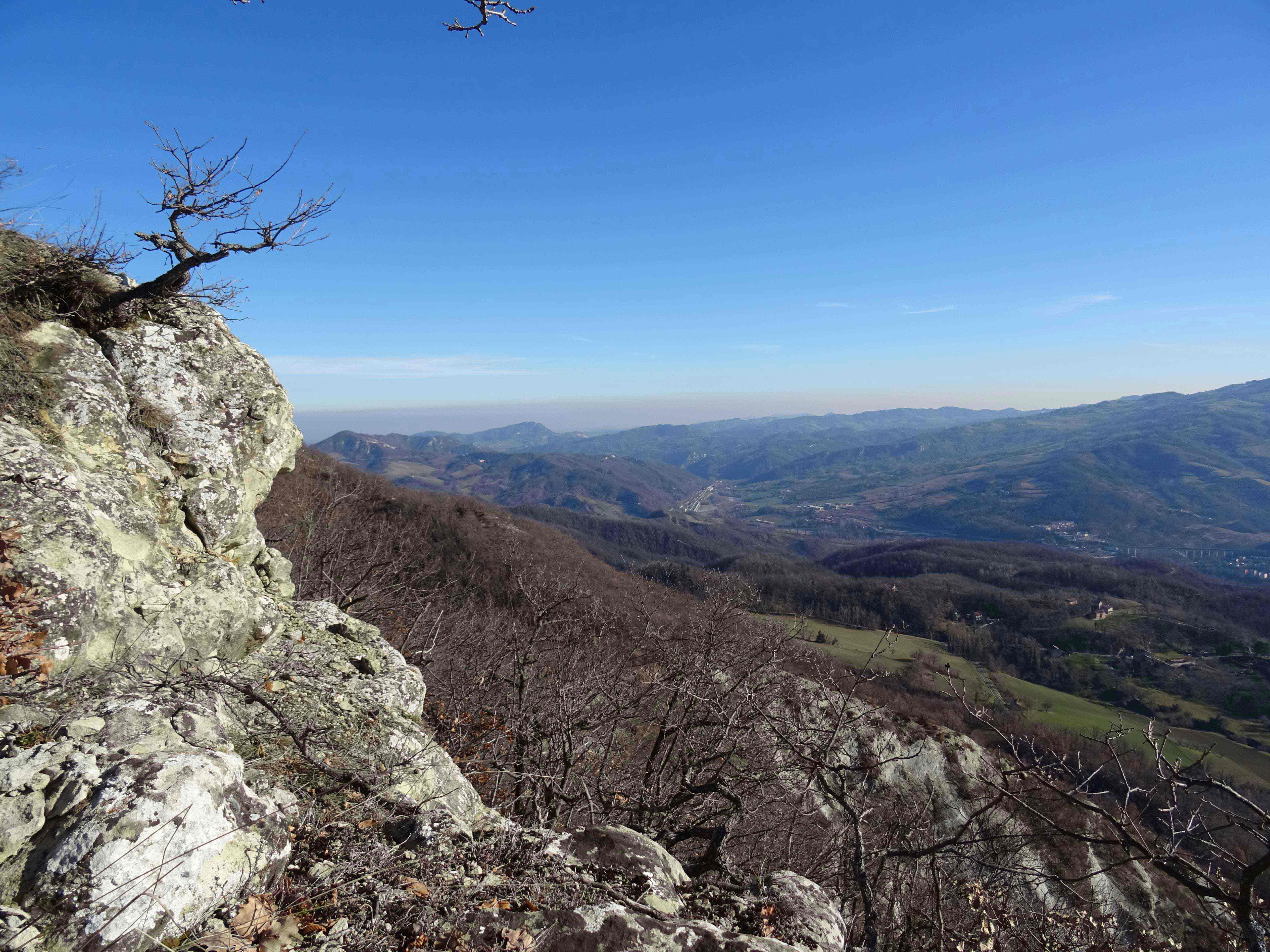 Lasciata l'auto nei pressi della chiesa di San Giovanni Battista di Veggio, dalla quale si domina la Valle del Setta, a destra del cimitero si prende il sentiero CAI 061. Attraversato un terreno prativo in forte pendenza si raggiunge il piccolo abitato di Nadia con una casa torre del Quattrocento e poco dopo l'asfaltata. Qui giriamo a sinistra e la percorriamo per circa 200 metri, un cartello indica la presenza di una sorgente di acqua solforosa che rimane a pochi metri rispetto alla strada. Poco oltre si prende a destra il sentiero CAI 061 che si inerpica nel bosco risalendo il versante orientale del Monte Pezza. Alcuni tratti potrebbero risultare esposti e scivolosi pertanto bisogna prestare la massima attenzione.
Raggiunta una sella a quota 676 m lasciamo il sentiero segnato CAI 061 e prendiamo una traccia a sinistra, contrassegnata da pennellate di vernice rossa sui fusti degli alberi, che permette di raggiungere la cima di Monte Pezza a 752 m. Qui il panorama è grandioso si domina parte della vallata del Setta e verso est possiamo scorgere la dorsale di Monte Venere con il suo parco eolico. Proseguiamo sempre sulla sommità della dorsale e una breve discesa ci permette di raggiungere il sentiero CAI 100 nei pressi dell'abitato di Serra.
Si prosegue in discesa su strada bianca fino al bivio con il 061a che prendiamo a sinistra costeggiando Cà Mascagni e successivamente entriamo nel bel borgo di Cà Benassi la cui origine medievale di borgo fortificato è testimoniata dalla presenza di elementi costruttivi tra cui una trecentesca casa torre e un sottoportico. Da segnalare la presenza di una feritoia, forse unica nella montagna bolognese.
Mantenendo sempre il sentiero in discesa, si raggiunge velocemente il punto di partenza.
La carta dei luoghi di cui parla l'articolo:
| |
Medie valli del Savena e del Reno e valli del Sambro e Setta
Terre degli Etruschi, Kainua, Rupe di Calvenzano e Tavernola
|
https://www.trackguru.net/images/icone/hiking32.png
Anello nel SIC-ZPS di Monte Radicchio - Rupe di Calvenzano
Un percorso di 10 chilometri e 630 metri di dislivello nel SIC (Sito di Importanza Comunitaria) di Monte Radicchio – Rupe di Calvenzano
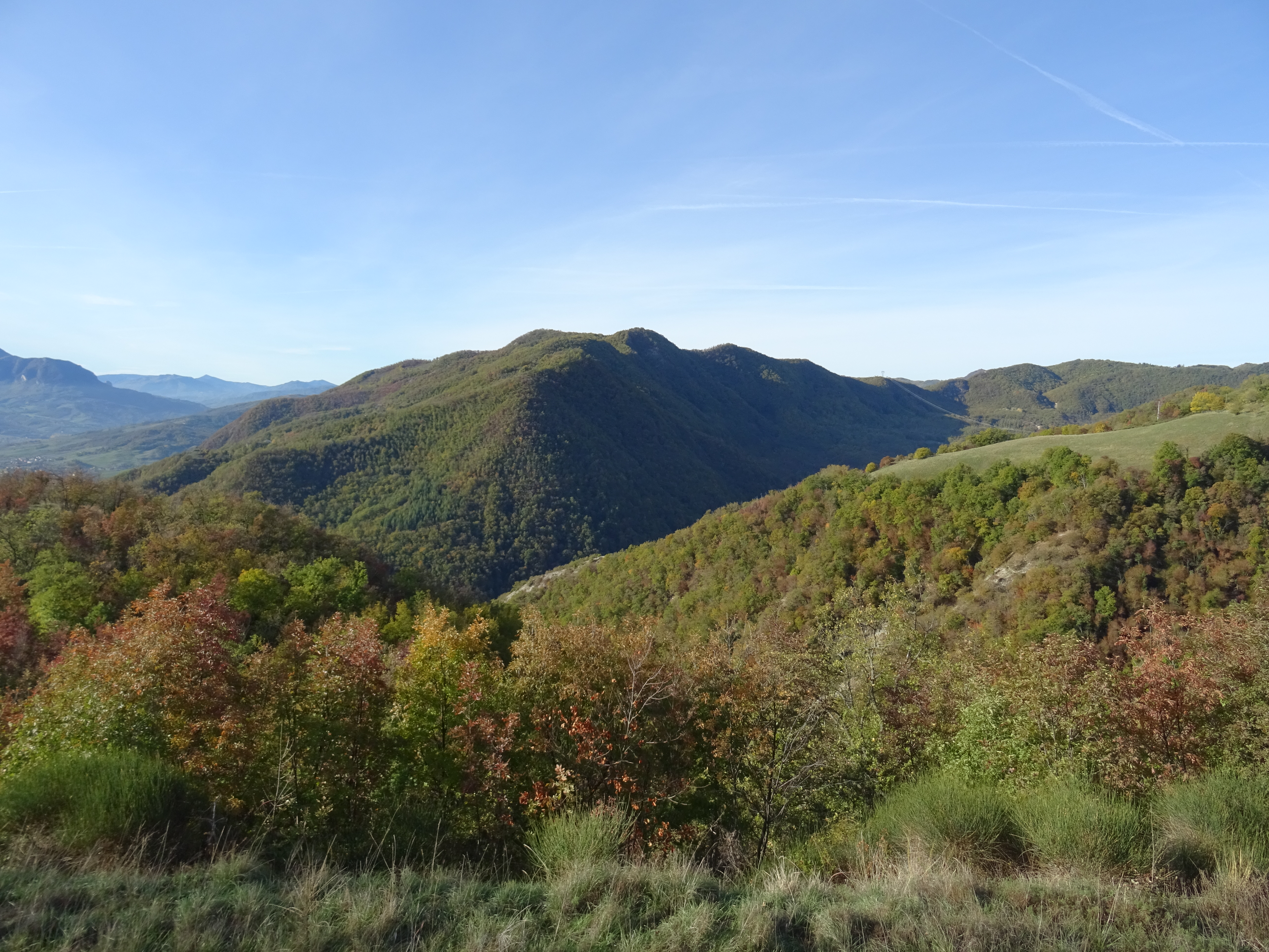 Seguendo la SS 64 Porrettana da Sasso Marconi in direzione sud, superato Pioppe di Salvaro, si giunge a Calvenzano. Poco oltre, nei pressi dell’Osteria della Tabina, a destra si incontra Via Campioncino Prunarolo che imbocchiamo. Dopo circa 400 metri al bivio si tiene la destra e passati due tornanti, possiamo lasciare l’auto in un piccolo spiazzo sulla destra.
Siamo all’interno del SIC (Sito di Importanza Comunitaria) di Monte Radicchio e della Rupe di Calvenzano sulla sinistra del Fiume Reno e di fronte a Monte Sole. Questo sito è prevalentemente ricoperto da boschi ed inframezzato da aspre rupi arenacee nelle quali vi nidifica regolarmente il Falco pellegrino.
Da qui seguiamo il segnavia CAI 134 incamminandoci in salita per l’asfaltata. Al successivo tornante teniamo la destra e poco dopo si apre la visuale verso la rupe arenacea di Calvenzano oltre la stretta valle del Rio Cane.
Costeggiamo il piccolo abitato di Le Lastre e proseguiamo mantenendoci sulla carrareccia che ora è ghiaiata. Tralasciamo sulla destra delle deviazioni, raggiungiamo l’abitato colonico di Rede lo oltrepassiamo e dopo circa un chilometro raggiungiamo un bivio sulla sinistra che porta a Buda di Sotto. Noi proseguiamo diritti, ignorando il bivio, e dopo 300 metri passiamo sotto i semidiroccati edifici di Buda di Sopra nei pressi di un ampio tornante che scavalla la stretta valle del Rio di Buda e poco dopo raggiungiamo un quadrivio a quota 808 metri.
Qui il sentiero prosegue sulla dorsale in direzione nord, noi invece scendiamo a destra sulla carrareccia in discesa sotto il bosco. Al successivo tornante sulla destra si trova una sorgente e poco oltre si raggiunge l’abitato rurale di Riolo. Qui ci inoltriamo tra le pregevoli costruzioni in sasso e una vecchia cavedagna ci permette di raggiungere la strada asfaltata poco più a valle.
Teniamo la sinistra e la percorriamo in discesa; fortunatamente è poco trafficata e nella parte alta ci regala appaganti panorami sulla vallata del Fiume Reno e sul crinale di Monte Sole.
Manteniamo sempre l’asfaltata ignorando le deviazioni che incontriamo fino a raggiungere il punto di partenza.
https://www.trackguru.net/images/icone/hiking32.png
Da Vado a Montovolo
https://www.trackguru.net/images/icone/hiking32.png
Anello tra i calanchi sulla Flaminia Militare
L'anello percorre in parte l'antica strada nota come Flaminia Militare, usata dai romani per muoversi rapidamente tra Rimini ed Arezzo.
Lasciata l'auto a Cà del Vento, imboccate il sentiero 801-FM-5TV (in loco segnalato solo come 801). Fin da subito vengono proposti alla vista suggestivi scorci sui calanchi di cui la zona abbonda. Tra il bivio per l'Oratorio di Sant'Anna e quello in prossimità di Migliarina, si cammina letteralmente sui calanchi, con solo pochi tratti non proprio pericolosi ma in cui è bene fare attenzione alla tenuta del terreno. Arrivati sull'801c (strada asfaltata) dirigetevi a sinistra anche se, in questo tratto, sono assenti le indicazioni CAI. Proseguite fino a che non vedete il cartello di "via Malpasso"***, qui prendete a sinistra e inoltratevi nel bosco. Il primo tratto del sentiero è un po' dissestato ma migliora in fretta. Questa parte dell'anello è tutto in salita e potete fermarvi a recuperare le forze sul prato antistante la chiesa dei SS.Michele Arcangelo e Cristoforo. In breve si conclude l'anello, passando per il piccolo borgo di Sassuno.
*** Attenzione: sulla carta 03BO di TrackGuru c'è un errore di rappresentazione di questo sentiero. E' in corso di revisione.
La carta dei luoghi di cui parla l'articolo:
| |
Terre dei Celti
Contrafforte Pliocenico, Monte delle Formiche, Monte Bibele, Parco La Martina, Passo della Raticosa
|
https://www.trackguru.net/images/icone/hiking32.png
Anello Laghi Glaciali (Lago Santo, Baccio, Torbido e Turchino)
L'itinerario ad anello porta a scoprire tutti e 4 i laghi glaciali della zona Pievepelago. Si può percorrere ovviamente in entrambe le direzioni: nella direzione contraria a quella registrata si può fare una variante più "verticale" con una piccola scalata.
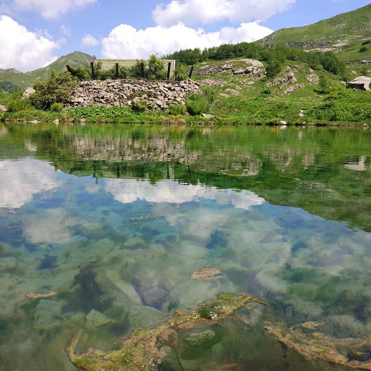
https://www.trackguru.net/images/icone/hiking32.png
ANELLO DI MONTE BIBELE
https://www.trackguru.net/images/icone/hiking32.png
assisi-foligno
https://www.trackguru.net/images/icone/hiking32.png
Tre giorni in Appennino a passo lento dall’emiliana Val di Setta alla toscana Val Bisenzio, con i bambini.
Tra i numerosi cammini che collegano l’Emilia Romagna con la Toscana ne abbiamo scelto uno, che dalla Valle del Setta sale sulla dorsale del Parco Storico di Monte Sole fino a raggiungere il Lago del Brasimone e poi ancora in su fino alla testata del torrente che lo alimenta svalicando poi in territorio toscano e degradando poco per volta fino all’alta valle del Bisenzio.
Primo giorno: Pian di Setta - Montovolo (km 16,7 - dislivello salita m 1060 - dislivello discesa m 423)
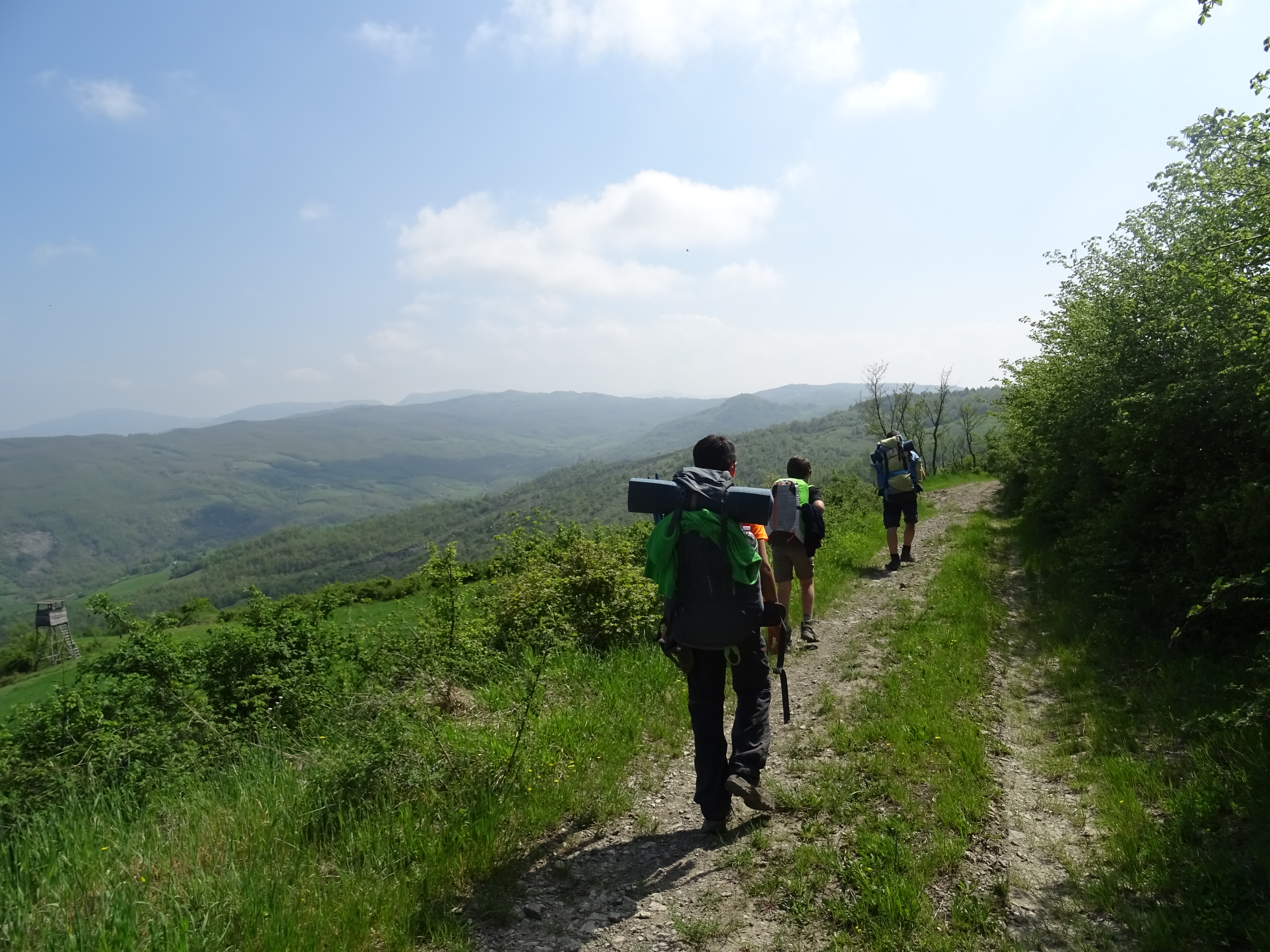 Ci incamminiamo sull’asfaltata partendo dalla stazione dei treni di Grizzana Morandi a Pian di Setta nella vallata del torrente omonimo, mantenendo alla sinistra i binari del treno. Raggiunto il cavalcavia della ferrovia prendiamo il sentiero CAI 061 che si inerpica verso il crinale di Monte Sole. In breve arriviamo sotto la chiesa di Veggio e da qui su asfaltata (segnavia CAI 061a), arriviamo a Cà Benassi. La sua origine medievale di borgo fortificato è testimoniata dalla presenza di elementi costruttivi tra cui una trecentesca casa torre e un sottoportico; da segnalare la presenza di una feritoia, forse unica nella montagna bolognese.
Lasciamo Cà Benassi, ci manteniamo sull’asfaltata e arriviamo a Grizzana Morandi, l’unica località presente sulla prima tappa del percorso dove poter acquistare qualcosa da mangiare.
Manteniamo l’asfaltata in direzione sud (CAI 100) e dopo circa 2,5 km, in località S. Abramo, prendiamo il sentiero a destra che si inoltra nel bosco. Altri 2 km circa e arriviamo a Collina, attraversiamo la strada provinciale e riprendiamo il sentiero CAI 100 che ci regala superbi panorami verso la Valle del Brasimone e i crinali di Monte Venere e Monte Bastione.
Proseguiamo verso Montovolo, la cui sagoma dominante, assieme a quella di Monte Vigese, si staglia a ovest. In località I Torlai, piccolo rudere alla nostra sinistra, proseguiamo dritti (CAI 039), raggiungiamo l’asfaltata e proseguiamo in ripida salita fino all’antico Santuario della Beata Vergine della Consolazione dove a fianco si trova la foresteria. In prossimità della cima è presente l’Oratorio di Santa Caterina di Alessandria e poco oltre si raggiungono i Balzi di Santa Caterina dai quali si apre un suggestivo panorama della Valle del Reno.
Secondo giorno: Montovolo - Lago del Brasimone (km 14,7 - dislivello salita m 590 - dislivello discesa m 641)
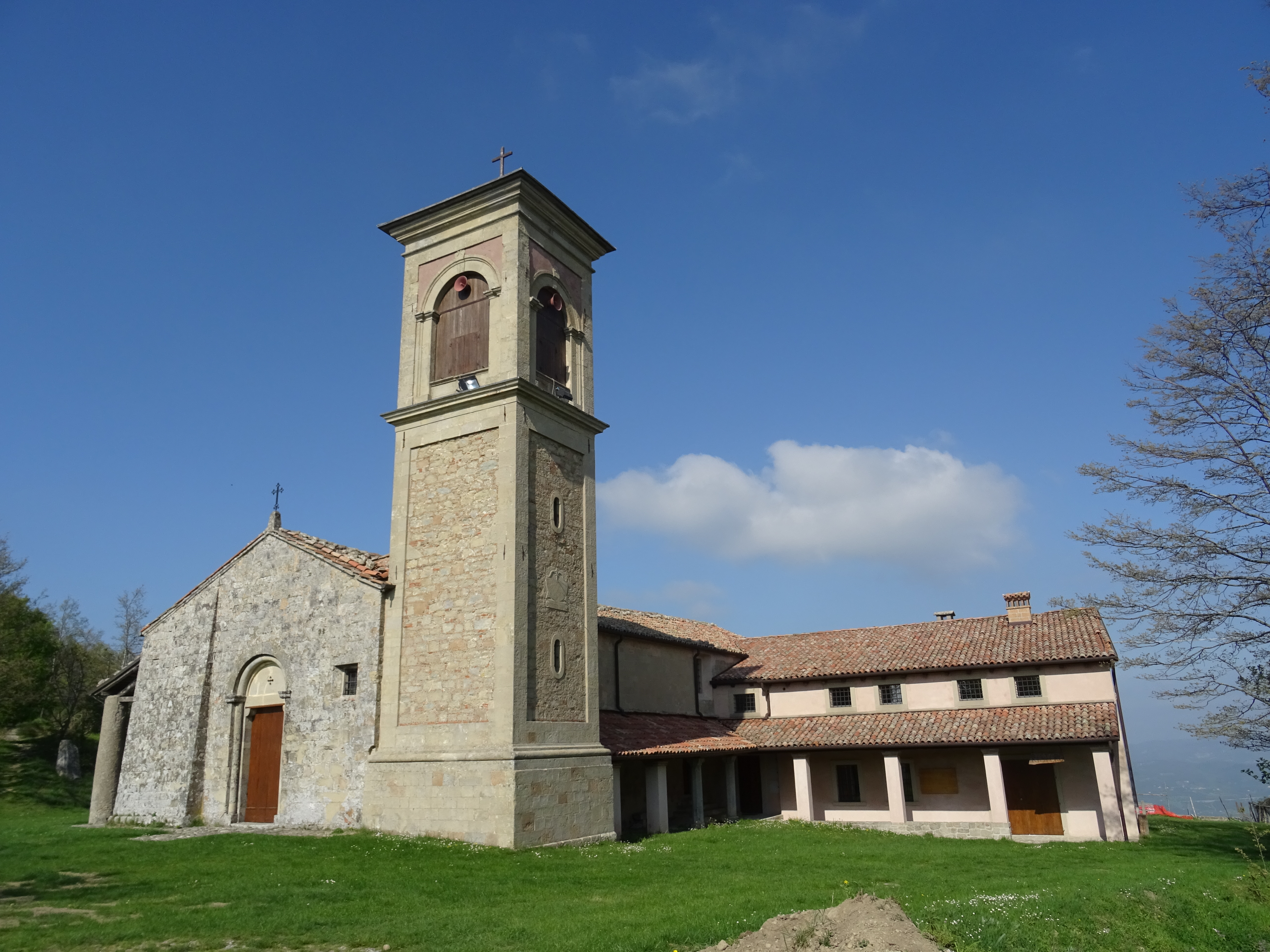 Scendiamo per l’asfaltata che abbiamo percorso il giorno precedente e riprendiamo il sentiero CAI 039 fino a I Torlai. Qui prendiamo a destra la traccia che taglia trasversalmente il pendio sulla cui sommità è posto Monte Vigese.
Proseguendo, intersechiamo l’asfaltata, teniamo la sinistra in direzione Burzanella e al primo gruppo di case giriamo a destra su strada bianca.
Arrivati a Il Luogo giriamo a sinistra e prendiamo il sentiero CAI 039 che si inoltra nel bosco. Tra vari saliscendi, tratti fangosi e ripide salite in mezzo alla foresta, arriviamo sulla sommità di Monte Fontanavidola.
Una breve sosta per riprendere fiato e proseguiamo in direzione sud-ovest su un bel sentiero con alcuni tratti panoramici fino alle pale eoliche di Serra dello Zanchetto.
Qui abbiamo pensato di tagliare l’ultima parte del percorso e ci siamo mantenuti sulla monotona asfaltata fino a La Guardata, sulla sponda occidentale del Lago di Brasimone (bar, ristoranti ed alberghi).
Terzo giorno: Lago del Brasimone - Vernio (km 18,00 - dislivello salita m 876 - dislivello discesa m 1486)
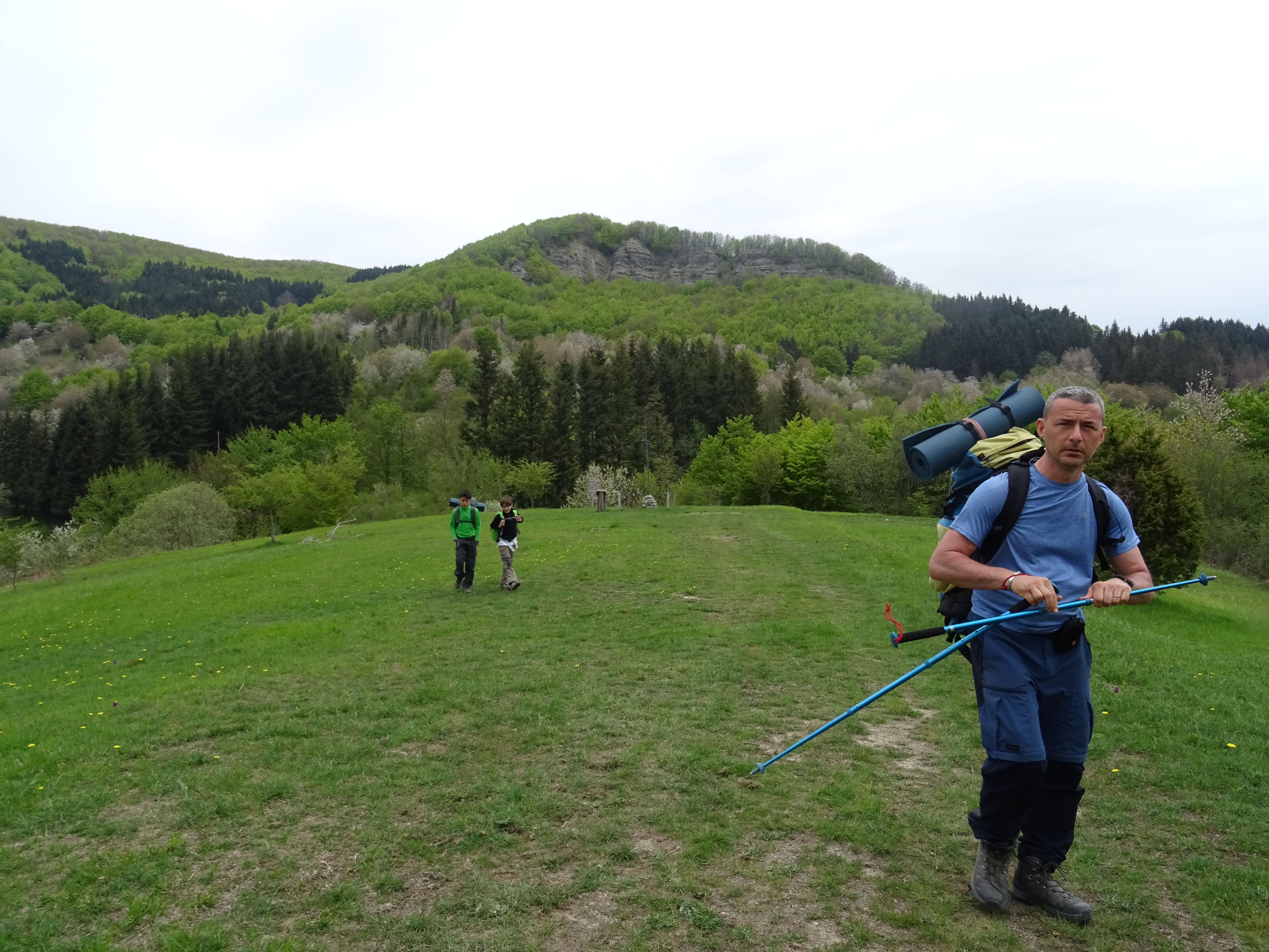 Attraversiamo la suggestiva diga del lago e a destra prendiamo il sentiero CAI V.901 che, adiacente ad una fonte, si inerpica nel bosco su un pendio fino ad intersecare il CAI 001-AVP che a tratti ci offre splendidi panorami sul lago. Entriamo in una fitta foresta fino al Passo di San Giuseppe sullo spartiacque tra l’Emilia e la Toscana.
Prendiamo la strada bianca in salita a destra che ci permette di raggiungere il Passo dell’Alpe di Cavarzano. Proseguimo sul sentiero 00 e prendiamo una deviazione che ci conduce sul Poggio di Petto e successivamente all’accogliente rifugio.
Ora tutto in discesa fino a Vernio; inizialmente percorriamo la strada bianca fino a Cavarzano, qui accanto alla chiesa prendiamo una strada bianca a sinistra che ci condurrà a Vernio dove prenderemo il treno per tornare al punto di partenza.
La carta dei luoghi di cui parla l'articolo:
| |
Medie valli del Savena e del Reno e valli del Sambro e Setta
Terre degli Etruschi, Kainua, Rupe di Calvenzano e Tavernola
|
La carta dei luoghi di cui parla l'articolo:
| |
Alte valli del Savena, Setta e Limentra
Parco Regionale dei Laghi di Suviana e Brasimone, Alto Carigiola, Alta Valle del Santerno, Passo della Raticosa
Dal Lago di Suviana al Passo della Raticosa
Barberino di Mugello, Camugnano, Cantagallo, Castel di Casio, Castiglione dei Pepoli, Firenzuola, San Benedetto Val di Sambro, Vernio, Lago di Suviana, Lago Brasimone, Passo della Raticosa, Passo della Futa, Lago di Castel dell'Alpi
|
https://www.trackguru.net/images/icone/hiking32.png
Fagnano - Monte San Pietro - Oca - Fagnano
https://www.trackguru.net/images/icone/hiking32.png
Sorgenti del Savena - Periplo di Monte Bastione
Un percorso di 10 chilometri e 630 metri di dislivello attorno a Monte Bastione e Luario
Avvicinamento:
da Valserena, situata a 6 km da Pian del Voglio, proseguiamo sulla Provinciale 79 fino ad un incrocio nei pressi della piccola moderna chiesetta, lasciamo la Provinciale e proseguiamo a destra per pochi metri fino alla sommità della dorsale dove parcheggiamo sulla comoda Via del Bastione.
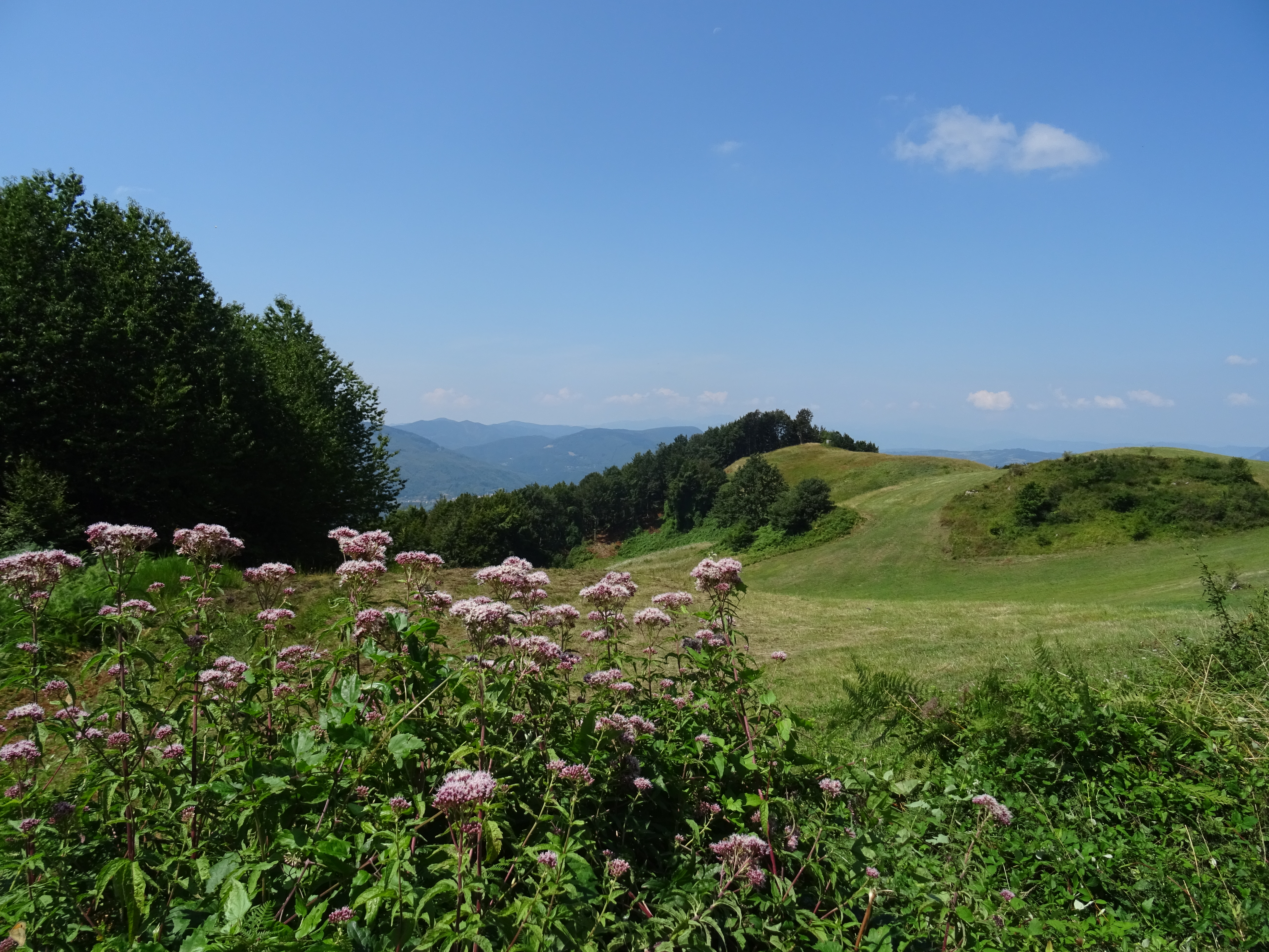 L’itinerario parte dall’incrocio con la poco trafficata Via Pian dei Torli che prendiamo in discesa (segnavia CAI 919) in direzione nord-est. Dopo 250 metri giriamo a destra e raggiungiamo la località Fontanabura con i suoi faggi secolari e manteniamo la sterrata (CAI 919) in discesa verso sud nel bosco. Dopo circa 1 chilometro, senza quasi accorgercene, la sterrata si trasforma in sentiero prima di raggiungere l’abitato di Cà dei Borelli; attenzione perché l’ultimo tratto quando lo abbiamo percorso risultava essere particolarmente invaso dalla vegetazione.
Cà dei Borelli è un piccolo e sonnacchioso paesino appenninico, lo attraversiamo seguendo le tracce bianco e rosse del CAI fino all’ultima casa; qui prendiamo a destra in mezzo a un campo e proseguiamo in discesa. Guadiamo un piccolo corso d’acqua che scende da Monte Bastione e proseguiamo sempre in discesa fino ad intersecare l’alveo del Torrente Savena.
Lo guadiamo camminando su una fila di ciotoli a pelo d’acqua e teniamo la destra in salita (CAI 917-Alta Via dei Parchi). Questo tratto è molto suggestivo, il sottobosco è solcato da innumerevoli avvallamenti che si intersecano gli uni con gli altri e che contribuiscono a raccogliere ed apportare acqua al Torrente Savena che nasce proprio da questo anfiteatro di monti costituito da Monte Bastione, Monte Luario, Passeggere, Sasso di Castro, Colle del Covigliaio e Monte Freddi.
Nei pressi del laghetto artificiale delle Passeggere il sentiero interseca la Via degli Dei (CAI019) che prendiamo in direzione Nord-ovest fino a raggiungere la Piana degli Ossi, una solitaria radura nella quale si trovano i resti delle fornaci dove gli antichi romani fabbricavano la calce.
Proseguiamo, e poco oltre, il bosco lascia spazio a verdi e panoramici pascoli di montagna.
Nei pressi di un antico edificio in pietra prendiamo la sterrata a destra in salita che costeggia la cima di Monte Luario e dopo un chilometro, sempre sulla destra, una deviazione segnalata con vecchi cartelli, ci conduce su un tratto ben conservato dell’antica strada romana Flaminia Militare.
Seguiamo per qualche decina di metri il basolato e ci ricongiungiamo al sentiero; costeggiamo l’antica cava di Pian di Balestra dalla quale i romani prelevarono la pietra per costruire la strada e successivamente entriamo nell’abitato di Pian di Balestra nostro punto di partenza.
https://www.trackguru.net/images/icone/hiking32.png
Dall'Eremo di Ronzano a Parco Cavaioni
A volte non si ha voglia di prendere l'auto e farsi decine di chilometri solo per arrivare alla partenza di un sentiero. Questo percorso ha un vantaggio indiscutibile: se abitate a Bologna, in cinque minuti siete pronti per inoltrarvi nei boschi!
Appena fuori porta San Mamolo, imboccate via dell'Osservanza e poi via di Gaibola per arrivare ad un comodo parcheggio ove lasciare l'auto. Imboccate il CAI 904 e seguite le indicazioni per l'Eremo di Ronzano; rapidamente arriverete all'edificio religioso attorniato da una vegetazione ricca e curata. Proseguite seguendo i segnavia rossi-bianchi del CAI verso Olmi-Gaibola-San Michele Arcangelo. Prendete quindi il CAI 900 prima e il CAI 906 poi, fino ad arrivare a Parco Cavaioni.
Se volete chiudere l'anello, senza tornare sui vostri passi, vi toccherà l'asfaltata oppure il bus; vi consigliamo però di organizzarvi in modo tale da passare qualche ora al Parco per un pic-nic o una visita ad uno dei tanti agriturismi nelle vicinanze, facendovi raggiungere da qualche amico e passare la giornata insieme.
La carta dei luoghi di cui parla l'articolo:
| |
Bologna
Valli dell'Idice, Zena, Savena, Navile, Reno e Lavino
Da Zola Predosa a Ozzano Emilia, da Bologna a Monte Sole
Aree Protette dei Gessi Bolognesi e Calanchi dell'Abbadessa, Colline di San Luca e Contrafforte Pliocenico
|
https://www.trackguru.net/images/icone/hiking32.png
Anello nel Parco Storico di Monte Sole
https://www.trackguru.net/images/icone/hiking32.png
Vado - Nuvoleto - Monte Sole
Attenzione: il tempo di percorrenza evidenziato non è corretto!
https://www.trackguru.net/images/icone/hiking32.png
Madonna dei Fornelli - Pian di Balestra
Partenza da Madonna dei Fornelli, in prossimità del Santuario di Madonna della Neve, proprio nel centro del piccolo paese. Esso sarà lambito dalla Mater Dei, una via in fase di realizzazione che tocca i luoghi di culto più importanti di questa parte di territorio.
Imbocchiamo la Via degli Dei (019-VD) e procediamo verso sud. Appena fuori dall'abitato, il sentiero ci porta in quota, salendo rapidamente fino a Le Scope e mantenendo una certa pendenza fino a Pian di Balestra. In fin dei conti, ci stiamo avvicinando al valico dell'Appennino tosco-emiliano e i dislivelli diventano più importanti, anche se privi di difficoltà tecniche. Arrivati alla piana di Pian di Balestra, tra qualche risorgiva e tratti infangati dopo il maggio più piovoso del secolo, prendiamo il 025, poi il 028 fino a chiudere l'anello.
In sostanza, si tratta di un itinerario adatto a chi non ha molto tempo e ottimo per allenarsi: 4 km di salita e 4 km di discesa fanno lavorare i distretti muscolari intensamente e in maniera circoscritta. Infine ricordiamoci che siamo sulla Via degli Dei e il meraviglioso panorama che ci circonda può essere descritto a tutti gli effetti come l'ambiente tipico del nostro Appennino.
La carta dei luoghi di cui parla l'articolo:
| |
Medie valli del Savena e del Reno e valli del Sambro e Setta
Terre degli Etruschi, Kainua, Rupe di Calvenzano e Tavernola
|
https://www.trackguru.net/images/icone/hiking32.png
Brasimone Wilderness
Un percorso di 10 chilometri e 500 metri di dislivello nella natura selvaggia del Parco Regionale dei Laghi di Suviana e Brasimone.
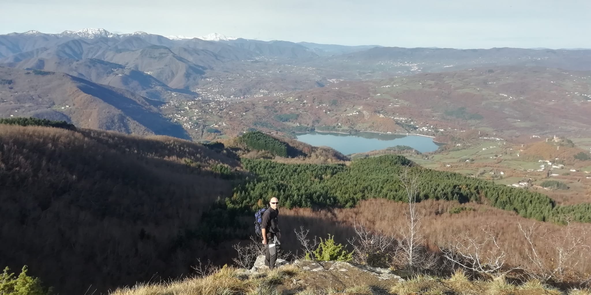 Raggiunto l’abitato de La Guardata sulla sponda settentrionale del Lago Brasimone accanto alla diga proseguiamo per la deliziosa stradina che costeggia lo specchio d’acqua.
Arrivati al termine del ramo occidentale, dove il torrente Brasimone si immette nel lago, la strada diventa ghiaiata. La percorriamo per circa 500 m e raggiunta la diramazione per Barbamozza, lasciamo l’auto nei pressi di un piccolo spiazzo sulla sinistra.Ci incamminiamo in salita verso Barbamozza che lasciamo alla nostra destra fino al bivio a sinistra con il sentiero CAI 009 – Alta Via dei Parchi. Imbocchiamo quest’ultimo ed entriamo nella faggeta; al successivo bivio teniamo la sinistra (segnavia CAI 009b) e dopo circa 1 km raggiungiamo il trivio del Balinello.
Una breve deviazione a destra ci conduce sulla cima piatta ed ariosa del Monte di Stagno (1214 m) dalla quale si apre un ampio panorama che domina il sottostante bacino di Suviana per spingersi fino ai rilievi del Corno alle Scale e del Monte Cimone. Tornati sui nostri passi, dal Balinello prendiamo il sentiero CAI 155 verso sud; qui ampi panorami si affacciano sulla valle del Torrente Brasimone.
Un ulteriore trivio, nei pressi di un edicola votiva ci indica la direzione degli ultimi metri da compiere per raggiungere il bivacco Eremo del Viandante:una vecchia costruzione in pietra, a disposizione degli escursionisti, che può risultare utile in caso di maltempo.
Da qui scendiamo per la mulattiera in direzione nord-est, passiamo accanto alla radura dove sorge l’agriturismo La Succhiata e mantenendoci sempre a sinistra del Torrente Brasimone in circa 40 minuti raggiungiamo il punto di partenza.
https://www.trackguru.net/images/icone/hiking32.png
Farneto anello Dolina di Gaibola
Dal Centro Visita "Casa Fantini" si percorre il sentiero CAI 804, che si snoda in direzione sud-est, fino ad incrociare il sentiero CAI 806, il vero anello che circonda le doline di Gaibola e Ronzana. Giunti sull'806, prendiamo a sinistra e percorriamo il crinale che divide la Dolina dell'Inferno e la Buca di Gaibola.
Da questo crinale si può godere di una bellissima vista sulle campagne circostanti.
Proseguendo sul sentiero si arriva al Casone di Gaibola, un edificio rurale in stato di abbandono. Qui troviamo un bel cipresso, che segna anche il punto più alto dell'itinerario, e un piccolo stagno. La vista è sulla Buca di Gaibola che presenta i caratteristici affioramenti gessosi e le bolle di scollamento. Queste ultime sono dei rigonfiamenti di forma pressappoco sferoidale che si formano nelle zone di roccia scoperta; il rigonfiamento della bolla cresce, anche a causa degli agenti atmosferici, fino al crollo della parte superiore, che prelude alla demolizione di tutta la struttura.
La pareti della dolina ospitano un bosco; le acque meteoriche lo attraversano scorrendo fino all'inghiottitoio posto sul fondo della depressione e, dopo un lungo percorso sotterraneo, raggiungono il Torrente Idice, situato più ad est.
Riprendiamo la nostra passeggiata fino ad arrivare alla asfaltata (CAI 817). Alla nostra destra possiamo ammirare la Buca di Ronzana, di caratteristiche simili a quella di Gaibola. Ne facciamo il periplo fino all'Eremo e poi oltre, quando ad un bivio teniamo la destra per riprendere il sentiero CAI 806 e chiudere l'anello ripercorrendo, nell'ultimo tratto, lo stesso percorso fatto in partenza.
Presso il Centro Visita Casa Fantini potrete trovare materiale informativo sui vari aspetti dell'area protetta e avere informazioni sulle attività del parco e le visite guidate naturalistiche e speleologiche organizzate per le scuole e i gruppi di visitatori.
Infine non possiamo non ricordare che a pochi passi dalla sede del Parco si trova la Grotta del Farneto, scoperta nel 1871 dal Fantini stesso. E' stata riaperta al pubblico nel 2008; è possibile organizzare le visite presso Casa Fantini.
https://www.trackguru.net/images/icone/hiking32.png
Anello di Labante
Le Grotte di San Cristoforo di Labante sono delle cavità che si sviluppano all’interno di una grande colata di travertino particolarmente scenografica che vede sulla sommità un’alta cascata fra muschi e rigogliose piante. Siamo a pochi chilometri da Vergato, nella valle del Torrente Aneva e da qui, dopo avere visitato ed ammirato questo incredibile sito naturalistico, zaino in spalla e ci incamminiamo verso valle.
Il sentiero CAI 162 ci conduce in breve sull’asfaltata nei pressi della chiesina di Santa Maria di Labante, la costeggiamo e prendiamo nuovamente il sentiero verso valle fino all’alveo del Torrente Aneva. Lo guadiamo in prossimità dei ruderi del Mulino di Santo Stefano e mantenendoci sempre sulla strada bianca raggiungiamo in breve un gruppetto di case, Abbazia di Labante.
Il sentiero CAI 162 prosegue sulla destra, attraversiamo un campo e dopo qualche minuto raggiungiamo Povolo con il suo bel mulino mantenuto in perfetto stato conservativo. Se la proprietaria è presente sarà ben lieta di mostrarvi l’interno della struttura nella quale è allestita una piccola esposizione di antichi arnesi e da una botola sul pavimento è possibile osservare le pale di comando delle macine ancora perfettamente funzionanti.
Ci rimettiamo in marcia, seguiamo il segnavia CAI 152a fino all’asfaltata in località La Torrazza che manteniamo fino a un tornante; qui il sentiero prosegue in marcata salita (Sentiero delle Tane) dove incontreremo varie cavità naturali scavate nella roccia.
La salita termina ai Serretti, ameno luogo dove possiamo osservare curiosi monoliti arenarici, alla cui base, su un soffice tappeto d’erba, possiamo riposarci.
Ci rimettiamo in cammino su strada bianca fino ai Serretti di Sopra, teniamo la sinistra (segnavia CAI 152) e successivamente ad un secondo bivio la destra.
Raggiungiamo la località Riola di Labante, costeggiando la colonia montana abbandonata Stella Mattutina, auspicando un prossimo ripristino della struttura prima che l’incuria possa danneggiarla ulteriormente.
Seguiamo l’asfaltata in discesa e dopo qualche metro prendiamo il sentiero a sinistra che ci riporterà velocemente al punto di partenza.
04 Monte Sole
02-05 Valli del Lavino
07 Corno alle Scale
03 Valli del Sillaro
https://www.trackguru.net/images/icone/hiking32.png
Da Portole a Punta Almana a Osteria Pastina
Percorso trekking interessante e suggestivo dal punto di vista paesaggistico. Richiede un buon allenamento. Sono presenti dei tratti scoscesi e non adatti a principianti. La traccia gpx è quella relativa alla variante che dalla Forcella di Sale si arrampica vertiginosamente verso la vetta di Punta Almana. Esiste una variante più soft ma non è quella riportata nella traccia gpx.
La maggior parte del percorso è fuori dal bosco e pertanto è sconsigliabile percorrerlo nei mesi più caldi in quanto privo di riparo dal sole.
https://www.trackguru.net/images/icone/hiking32.png
Da Riola a Montovolo
Percorso trekking che parte dal parcheggio della stazione ferroviaria di Riola fino al Montovolo.
https://www.trackguru.net/images/icone/hiking32.png
Calanchi di Monte San Giovanni
https://www.trackguru.net/images/icone/hiking32.png
Boschi, ruscelli e molini - Un percorso di 6 chilometri e 300 metri di dislivello tra Monte Venere e Monte del Galletto
 Avvicinamento:
da Monzuno seguiamo le indicazioni per Rioveggio, poco oltre il centro giriamo a sinistra per Monte Venere e proseguiamo su una piacevole stradina panoramica fino all’Oratorio Le Croci poco prima dell’omonima località (tot. km 5,5)
Lasciata l’auto nei pressi dell’antico oratorio, ci incamminiamo in direzione sud lungo la strada bianca (segnavia CAI 019 - Via degli Dei) ed attraversiamo l’abitato di Le Croci con i suoi pregevoli edifici in pietra. Subito oltre, a un trivio, teniamo la destra (segnavia CAI 059b) e prendiamo uno stradello, a tratti panoramico, in direzione di San Benedetto Val di Sambro.
Perdiamo dolcemente quota e nei pressi di un abetaia raggiungiamo un primo bivio, ignorando la deviazione a sinistra (segnavia CAI 059c) per La Gussella proseguiamo dritti e successivamente, al secondo bivio, teniamo la destra. Procediamo in discesa nel bosco, qua e là incontriamo radure panoramiche dove l’occhio può spaziare fino ai maggiori rilievi appenninici.
Raggiunto un quadrivio posto su una selletta giriamo a destra sempre in discesa, sfiliamo accanto ad un isolato rudere e poco oltre attraversiamo, in rapida successione, un paio di corsi d’acqua che scendono dal versante occidentale di Monte del Galletto.
Sulla sinistra, incastonato nella vallecola, troviamo l’antico mulino in località Molinello che sfruttava la corrente d’acqua del sottostante Rio Faiè.
Ora inizia la risalita su comoda carrareccia, al quadrivio teniamo la destra (segnavia CAI 059a) e passato un tornante attraversiamo un arioso pratone per poi rientrare nell'ultimo tratto boscoso. Ancora pochi passi e usciti dalla vegetazione si apre un meraviglioso panorama che ripaga della lunga salita che abbiamo effettuato. Raggiungiamo la strada bianca sommitale dove giriamo a destra e la manteniamo per qualche centinaio di metri fino a raggiungere l’oratorio, il nostro punto di partenza.
La carta dei luoghi di cui parla l'articolo:
| |
Medie valli del Savena e del Reno e valli del Sambro e Setta
Terre degli Etruschi, Kainua, Rupe di Calvenzano e Tavernola
|
04 Monte Sole 02-05 Valli del Lavino 07 Corno alle Scale 03 Valli del Sillaro
https://www.trackguru.net/images/icone/hiking32.png
San Martino - Il Poggiolo - Monte Sole
Breve anello nel cuore del Parco Storico di Monte Sole.
Si può lasciare l'auto al Centro visite "Il Poggiolo" oppure, come abbiamo fatto noi, subito dopo, all'incrocio di San Martino. Seguite il 100, arrivate sull'asfaltata e poco dopo prendete il 100a a sinistra. Quando incrociate nuovamente il 100, andate a destra e, in breve, arriverete in cima a Monte Sole, dove un semplice cippo ricorda i tragici eventi bellici del '44. Da qui si scende grazie ad una lunga teoria di scalette fino a chiudere l'anello.
https://www.trackguru.net/images/icone/hiking32.png
Anello Piamaggio - Balzo Arcigno - Piamaggio
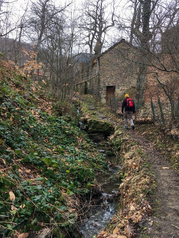
Dal piccolo centro di Piamaggio si prende il sentiero 909 verso sud. Si passa attraverso piccoli borghi semidisabitati e un vecchio mulino. Attenzione: subito prima di Caselina, seguire i segnali CAI ed evitare di andare nel prato (proprietà privata). Il sentiero è stato modificato da poco in modo da rispettare la privacy dei proprietari.
Dopo Caselina, c'è la salita in direzione Balzo Arcigno, non troppo impegnativa. Tutto il sentiero è ben segnalato, tranne, forse, un'indicazione che può trarre in inganno in corrispondenza dell'incrocio con il sentiero 8bMNG.
La cosa che sempre sorprende, di questi luoghi tra Monghidoro e Pian del Voglio, è la straordinaria quantità di fossi, rii, in generale corsi d'acqua che vanno poi a confluire nel Savena. Infatti, la discesa verso Piamaggio, dopo le piogge, può essere un po' difficoltosa.
La carta dei luoghi di cui parla l'articolo:
| |
Terre dei Celti
Contrafforte Pliocenico, Monte delle Formiche, Monte Bibele, Parco La Martina, Passo della Raticosa
|
https://www.trackguru.net/images/icone/hiking32.png
Anello intorno all'Alpe del Brasimone
Anello molto bello con partenza dal Bacino del Brasimone. L'itinerario è descritto in senso antiorario.
Si lascia l'auto in prossimità dell'incrocio del 155 con lo 011; proprio sulle sponde del lago, c'è un piccolo parcheggio con tre-quattro posti auto. Si imbocca lo 011; dopo 150-200 metri, trovate sulla sinistra il bivio che si inoltra nel bosco. In vista dell'agriturismo Barbamozza, c'è poca chiarezza con i segnavia CAI ma il concetto è quello di passare sotto la linea dell'alta tensione e raggiungere l'asfaltata nascosta dalla vegetazione. Prendete a destra e oltrepassate l'ingresso dell'agriturismo. In breve, si arriva all'incrocio con lo 009; da qui in poi si comincia a fare sul serio, nel senso che i panorami diventano davvero mozzafiato, specialmente se in una giornata limpida. E' anche il tratto più impegnativo, con maggiore dislivello fino circa a poco prima del Balinello, ma ne vale davvero la pena. Su questa tratta, infatti, si cammina perlopiù in una sorta di piccolo canyon (alto circa un metro, non siamo in Colorado!) scavato nella roccia. Poi si ha una bellissima vista sul Bacino di Suviana, alla nostra destra.
Dal Balinello in poi (ma anche da un po' prima, in verità) il sentiero comincia una lunga e morbida discesa fino al ritorno. Onnipresente il rumore dell'acqua dei numerosissimi rii e fossi che si immettono nel torrente Brasimone. Da Ca' Fontana del Boia in poi, si costeggia il torrente fino al bacino. Non sembra neppure di essere in Emilia Romagna! Il torrente possiede acque cristalline e disegna numerose anse e piccoli prati dove fermarsi per una sosta. La lunga discesa, oltretutto, è defatigante e fa tornare al punto di partenza freschi come rose, o quasi.
Da prendere in considerazione la possibilità di effettuare l'anello al contrario di come qui descritto, in modo da avere una salita lunga ma poco impegnativa e una discesa più ripida ma breve.

La carta dei luoghi di cui parla l'articolo:
| |
Alte valli del Savena, Setta e Limentra
Parco Regionale dei Laghi di Suviana e Brasimone, Alto Carigiola, Alta Valle del Santerno, Passo della Raticosa
Dal Lago di Suviana al Passo della Raticosa
Barberino di Mugello, Camugnano, Cantagallo, Castel di Casio, Castiglione dei Pepoli, Firenzuola, San Benedetto Val di Sambro, Vernio, Lago di Suviana, Lago Brasimone, Passo della Raticosa, Passo della Futa, Lago di Castel dell'Alpi
|
https://www.trackguru.net/images/icone/hiking32.png
Anello Montepiano - Monte della Scoperta

Lasciata l'auto nel parcheggio davanti all'Abbazia di Santa Maria, nella piccola frazione di Badia, si parte e dopo cinque minuti si imbocca il sentiero 27, costeggiando il Torrente Setta, fino all'incorcio con lo 001.
Purtroppo qui abbiamo sbagliato e, invece di proseguire sullo 001 verso NO, abbiamo imboccato la strada che si dirige a sud. Quando ci siamo accorti dell'errore, invece di tornare sui nostri passi, abbiamo preferito "tagliare" e seguire un vecchio sentiero CAI, oggi non più facente parte della sentieristica ufficiale, che parte in corrispondenza del "Rifugio Alpino". Abbiamo intercettato quindi lo 001 nei pressi di Sasso Bibbio. Da qui si sta interamente nel bosco, con uno splendido e ripido sottobosco sulla nostra destra e un sentiero di costa davvero suggestivo.
Poco dopo il Passo dell'Alpe di Cavarzano, per rimanere sul 23, uscite dalla strada battuta e imboccate un sentiero nel bosco, con indicazioni verso il campo scout. Il segnavia CAI è un po' nascosto e si rischia di non vederlo. Da questo momento in poi, è impossibile sbagliare e si chiude l'anello facilmente.
La carta dei luoghi di cui parla l'articolo:
| |
Alte valli del Savena, Setta e Limentra
Parco Regionale dei Laghi di Suviana e Brasimone, Alto Carigiola, Alta Valle del Santerno, Passo della Raticosa
Dal Lago di Suviana al Passo della Raticosa
Barberino di Mugello, Camugnano, Cantagallo, Castel di Casio, Castiglione dei Pepoli, Firenzuola, San Benedetto Val di Sambro, Vernio, Lago di Suviana, Lago Brasimone, Passo della Raticosa, Passo della Futa, Lago di Castel dell'Alpi
|
https://www.trackguru.net/images/icone/hiking32.png
Da Rasora verso Monte Gatta - Pian Colorè - Spinareccia
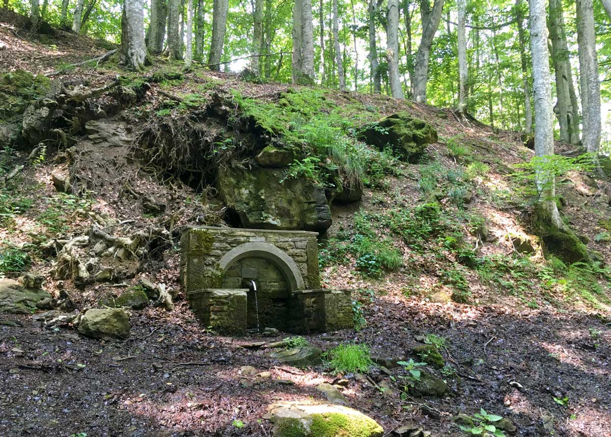
18 giugno 2023. Dal centro di Rasora procedete in direzione E, verso Case Berni, poi imboccate il sentiero 033. La salita si fa sentire, si arriva fino a quota 990 circa, poi spiana. Questo primo tratto è tutto boscoso, ottimo per le calde giornate estive. Al quadrivio, tenete la sinistra e imboccate il sentiero 035 fino all'incorcio con lo 003. Al traverso di Casa di Sopra, avete la scelta di andare a destra e incrociare lo 001; altrimenti proseguite rimanendo sullo 003, non cambia molto. Poco dopo arriverete ad un piccolo bivio che vi indica Pian Colorè, dove potrete fare una sosta all'ombra per mangiare e riempire le borracce.
Dopo il bivio di Pian Colorè proseguite sul sentiero 015 ma, poco dopo, fate attenzione perchè troverete che il sentiero, dalla strada, si "immerge" nuovamente nel bosco, alla vostra sinistra, e lo stacco non è molto visibile; ho messo apposta un waypoint sulla traccia che potete scaricare. Costeggiate il Fosso dei Carbonai fino all'asfaltata, in corrispondenza della Sorgente Docciole; qui prendete a destra fino a Spinareccia, poi, con un ultimo tratto di bosco, chiudete l'anello tornando a Rasora.
La carta dei luoghi di cui parla l'articolo:
| |
Alte valli del Savena, Setta e Limentra
Parco Regionale dei Laghi di Suviana e Brasimone, Alto Carigiola, Alta Valle del Santerno, Passo della Raticosa
Dal Lago di Suviana al Passo della Raticosa
Barberino di Mugello, Camugnano, Cantagallo, Castel di Casio, Castiglione dei Pepoli, Firenzuola, San Benedetto Val di Sambro, Vernio, Lago di Suviana, Lago Brasimone, Passo della Raticosa, Passo della Futa, Lago di Castel dell'Alpi
|
https://www.trackguru.net/images/icone/hiking32.png
Vidiciatico - Sboccata dei Bagnadori
Luglio 2023. Partenza dalla graziosa località di Vidiciatico, dove vi consigliamo di riempire le borracce presso la fontana in centro: pare che l'acqua abbia numerose proprietà benefiche! Con il percorso 127 si sale fino a Budiara, poi il sentiero si ammorbidisce con una lieve pendenza fino ai Bagnadori. potete proseguire altri 5 minuti per raggiungere la Sboccata dei Bagnadori, un'ampia radura ombreggiata, crocevia di diversi sentieri. Da qui, tornate all'incorcio con il 129. Dopo il Passo del Saltiolo, seguite per Vidiciatico con il 129a, per poi chiudere l'anello. Anello molto ben segnalato.
La carta di cui parla l'articolo:
| |
Alto Appennino bolognese e pistoiese
Parco Regionale Corno alle Scale, Parco Regionale dei Laghi di Suviana e Brasimone
Dal Corno alle Scale al Lago di Suviana
Porretta Terme, Lizzano in Belvedere, Granaglione, Castel di Casio
|
https://www.trackguru.net/images/icone/hiking32.png
Cavone - Passo della Porticciola - Briglia Malghe - Cavone (Corno alle Scale)
Luglio 2023. Partenza dal laghetto del Cavone, si imbocca il 335-337 in direzione SE. Subito dopo il Passo della Porticciola prestare attenzione perchè il bivio non è ben segnalato. L'intenzione era quella di arrivare al Lago Scaffaiolo ma un temporale improvviso ci ha costretti a desistere per cui, arrivati a Briglia Malghe, siamo dovuti tornare alla macchina. Prima parte dell'itinerario parzialmente in mezzo al bosco; dopo completamente scoperto.
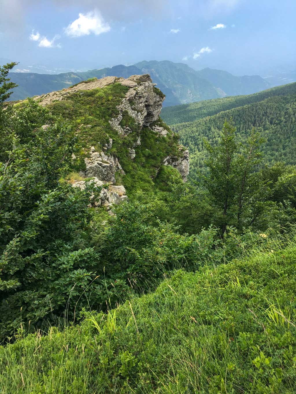
La carta di cui parla l'articolo:
| |
Alto Appennino bolognese e pistoiese
Parco Regionale Corno alle Scale, Parco Regionale dei Laghi di Suviana e Brasimone
Dal Corno alle Scale al Lago di Suviana
Porretta Terme, Lizzano in Belvedere, Granaglione, Castel di Casio
|
https://www.trackguru.net/images/icone/hiking32.png
Anello di Monte Spugi - Anello del Carnè
Questo anello si trova all’estremità orientale del Parco della Vena del Gesso Romagnola e forse non possiede il fascino delle pareti esposte di Monte Mauro; d’altra parte, è adatto a tutti gli escursionisti, anche bambini, e tocca il Rifugio Carnè, dove si possono fare soste gradevoli all’ombra del bosco. Lo si raggiunge da Brisighella o da un raccordo nei pressi di Zattaglia. Dal Rifugio Carnè, imboccate il 505 dirigendovi a sud. Siete nei pressi dei numerosi “abissi” di cui è possibile effettuare le visite guidate. Ben presto arriverete su un’asfaltata, fortunatamente breve; prendete a destra in direzione ENE. Dopo 800 metri circa troverete il bivio per il 511b sulla vostra destra: attenzione perchè non è molto evidente e potrebbe passare inosservato. Qui si cammina in mezzo ai vigneti che, in questa zona, insieme agli ulivi, è la coltura prevalente. Si arriva al bel casale di Ronchi e subito dopo alla piccola località di Vespignano. Qui incontriamo il 511 che ci permette di andare, a sinistra, verso il resto del Parco, ossia verso Monte Mauro, oppure proseguire dritto e chiudere il nostro anello. Da Vespignano in poi, per circa mezzo chilometro fino alla sella di Castelnuovo, possiamo ammirare le ampie messe a dimora dei vigneti con, sullo sfondo, gli affioramenti gessosi di Monte Mauro e Monte Incisa. Arrivati nei pressi della sella, alcuni interessanti pannelli informativi ci spiegano che siamo nuovamente entrati in una zona densa di inghiottitoi e abissi. Poco lontano da qui, infatti, si trova la cavità che appartiene ad uno dei più importanti e significativi sistemi carsici (un insieme di grotte idrologicamente collegate fra loro) dell’intera Vena del Gesso: la Grotta Risorgente del Rio Cavinale. Le esplorazioni speleologiche hanno accertato che l’intero settore di Monte Rontana e Castelnuovo è attraversato in profondità da un vero e proprio torrente che torna alla luce 270 m. più in basso e a quasi due chilometri di distanza, in corrispondenza della Grotta Risorgente, per poi confluire nel torrente Sintria. In questo tratto troviamo alcuni punti panoramici e aperture su dolci depressioni che formano prati molto gradevoli. La segnaletica è abbondante e chiara e, in breve, rimanendo sul 511, si arriva al punto di partenza, il Rifugio Carnè.
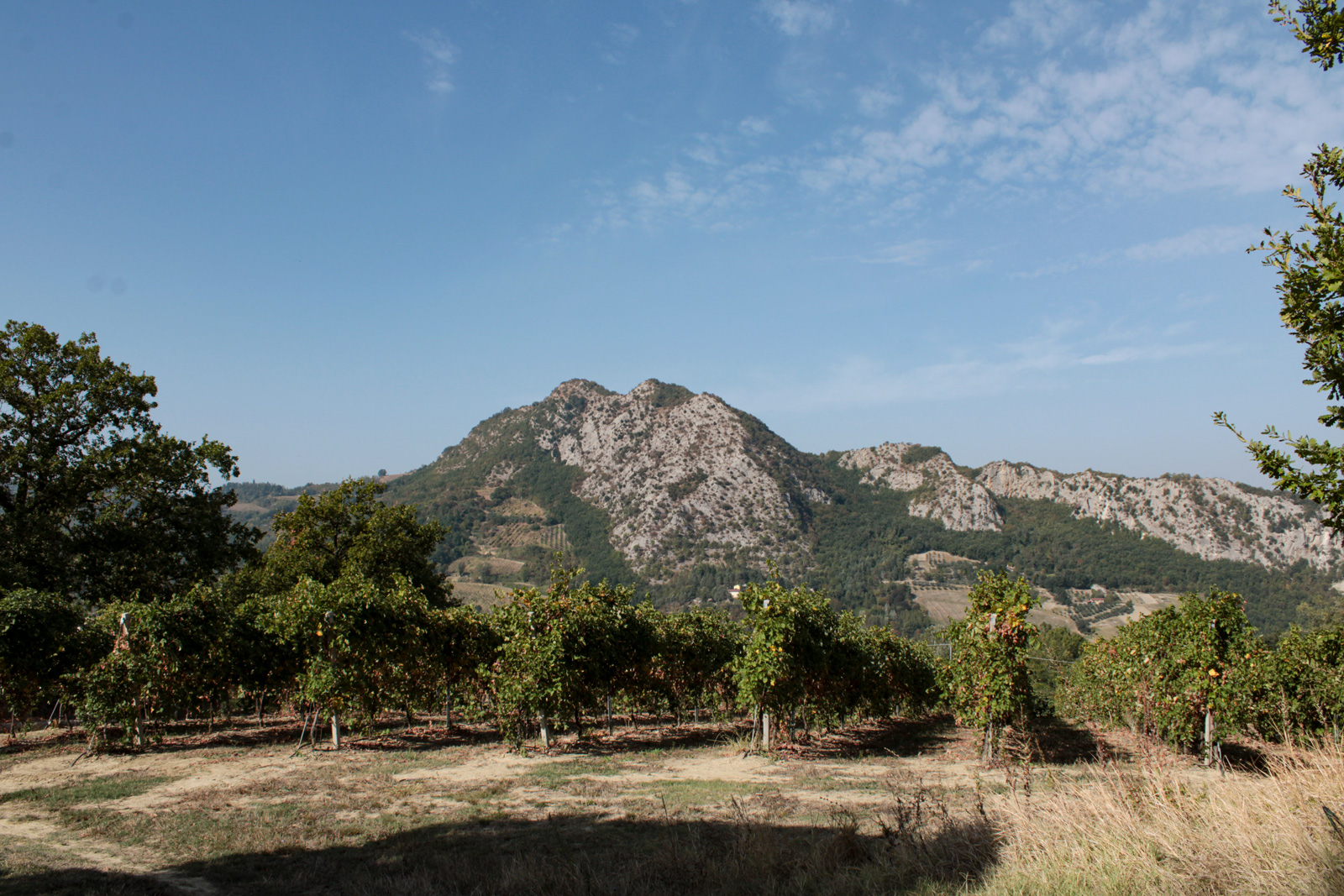
https://www.trackguru.net/images/icone/hiking32.png
Tossignano - Riva San Biagio - Cà Budrio - Tossignano. Nel Parco della Vena del Gesso Romagnola
17 ottobre 2023
Da Tossignano, si seguono le indicazioni per raggiungere la graziosa Rocca, proprio sopra il paese. Da lì, seguire le (uniche) indicazioni CAI per il sentiero 705. Il percorso ufficiale dell'Ente Parco prevede una bella sgambata di circa sei ore ma noi abbiamo fatto una variante da circa quattro ore. Dalla Rocca si scende fino ad incontrare il Rio Sgarba. Parte adesso una lunga e costante salita fino al Passo della Prè, un bel punto panoramico. Ignorate il 705b e prendete a destra, rimanendo quindi sul 705 (detto anche LG, Luca Ghini). ATTENZIONE! Il sentiero 705, da qui fino a Cà di Budrio, è segnato come di difficoltà EE (escursionisti esperti). In effetti c'è qualche punto esposto e può essere pericoloso dopo le piogge. Valutate voi se è nelle vostre corde affrontare questo sentiero: certo è che è il tratto in assoluto più bello di quest'area di Parco. Qui si cammina davvero sui gessi affioranti! E che panorama spettacolare!
Si rimane quindi sul 705 fino a Cà Budrio, dove incontriamo il Rifugio Speleologico. Da qui potete decidere se proseguire verso Sasso Letroso e, sostanzialmente, ricalcare l'anello dell'Ente Parco oppure, come abbiamo fatto noi, tagliare verso nord ed incocciare il 705-CSA (Cammino di Sant'Antonio). Stiamo andando verso NO: il percorso, qui, è decisamente meno interessante, essendo perlopiù in mezzo al bosco. Nulla da segnalare fino al ponticello che scavalca di nuovo il Rio Sgarba, molto più in basso (località Calvanetta, poco dopo Tramosasso). Subito dopo il ponte, prendete a sinistra, rimanendo sul CSA e tornerete in circa mezz'ora a Tossignano.
La carta di cui parla l'articolo:
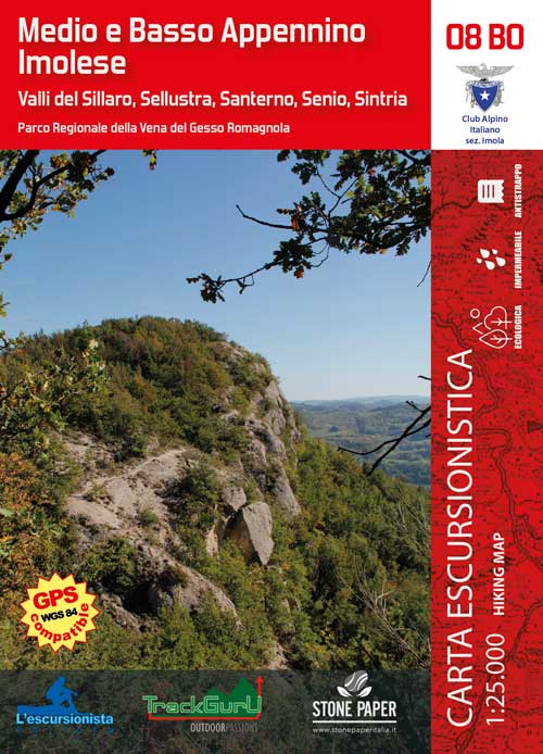 |
Valli del Sillaro, Sellustra, Santerno, Senio, Sintria
Parco Regionale della Vena del Gesso Romagnola
Dozza, Imola, Casalfiumanese, Borgo Tossignano, Fontanelice, Casola Valsenio, Castel del Rio
|
https://www.trackguru.net/images/icone/hiking32.png
Frassineta Monterenzio Via Flaminia Minore
Il percorso inizia a Frassineta ma è possibile iniziare a Monterenzio. C'è il pullman 916 che segui la Via Idice se vuoi tornare al punto dell inizia.
Da Frassineta il sentiero non è segnalato anche quando si attraversa Via Idice. Il salita è impegnativo fino alla Via Flaminia. Dopo pioggio ci sono tante pozzanghere grande e profondo sul sentiero, quindi sono consigliato i bastoni di trekking. Si passa dei serbatoi e sotto i eoliche. Un bel sentiero lungo con numerose viste panaromiche dei valli di entrambe lati.
https://www.trackguru.net/images/icone/hiking32.png
Anello Frassineta, Passo Raticosa, Piamaggio, Croci Alpi, Mongihdoro
Un sentiero molto bello ma molto impegnetivo! Inizia il percorso dove vuoi- io vivo a Frassineta quindi lo ho iniziato la ma Monghidoro e Passo Raticosa hanno ampio parcheggio. Ci sono numerose salite ripide. Il sentiro tro Frassineta e Monghidoro è stato restruturato e lo trovi ben segnalato ma il percorso segnalato col GPX è ancora valido.
https://www.trackguru.net/images/icone/hiking32.png
Monte Beni
Un percorso lungo e impegnativo raggiungendo la vetta di Monte Beni anche tre altre cime minore. Ci sono belle viste dal Monte Beni ma il sentiero dopo si trovi dei corde, quindi è adatto ai trekkisti esperti nonostante non è segnalato così. Il maggiore parte e sotto il bosco.
https://www.trackguru.net/images/icone/hiking32.png
Casola Valsenio - Monte Battagliola - Roncosole - Monte Fortino - Casola Valsenio
https://www.trackguru.net/images/icone/hiking32.png